Tuesday: Mostly cloudy skies continue with temps near normal
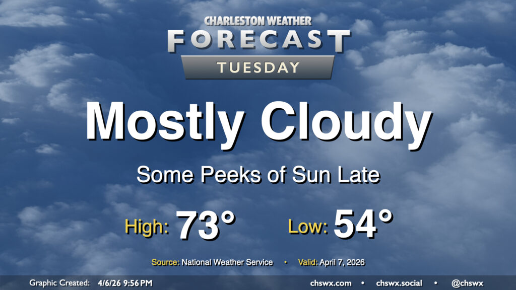
Cool high pressure remains the primary weather driver on Tuesday, though temperatures may tick up a degree or two compared to Monday’s high of 69°. We’ll keep the clouds around for a majority of the day, though some peeks of sun should start to filter through later in the day. Generally, expect to start the day in the mid-50s, warming to the low 70s in the afternoon. Northeasterly winds will kick up a little bit throughout the day, with gusts around 20-25 MPH possible.
Rest of the work week: Reinforcing shot of cool air comes through Wednesday; warming up for the weekend
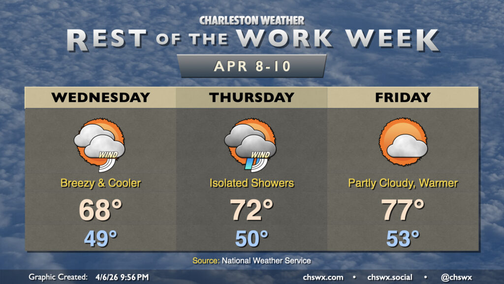
A front will drop in from the north early Wednesday morning, bringing with it a reinforcing shot of cooler air from the northeast and some breezy conditions. Expect winds generally in the 15-20 MPH range gusting to 30-35 MPH, especially near the coast and on Lake Moultrie, throughout the day. This could lead to increased fire danger, so please listen closely to local authorities regarding possible burn bans. Temperatures Wednesday will start in the upper 40s to around 50°, warming to the upper 60s in the afternoon. This is roughly 5° or so below normal for this point in the year.
We should see slightly warmer temperatures Thursday, but there will also be the risk for a few showers as a coastal trough moves inland. This should become less of an issue on Friday as the cold air damming scheme ushered in by Wednesday’s front continues to erode in concert with ridging starting to nudge in aloft, bringing about warmer temperatures and more in the way of sunshine as well. This trend continues into the weekend, which should be mostly sunny with low 80s each afternoon.
Follow my Charleston Weather updates on Mastodon, Bluesky, Instagram, Facebook, or directly in a feed reader. Do you like what you see here? Please consider supporting my independent, hype-averse weather journalism and become a supporter on Patreon for a broader look at all things #chswx!