Tuesday: Another pleasant day
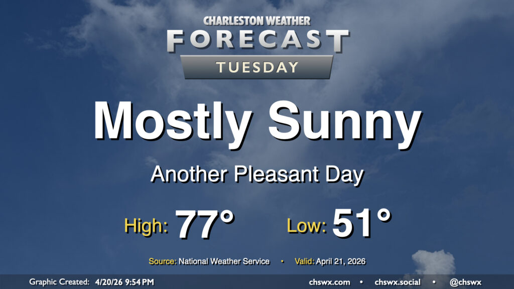
High pressure remains in control for Tuesday (and for the next few days), yielding plenty of sunshine and comfortably warm temperatures. We start the day in the low 50s and will head to the mid-to-upper 70s in the afternoon away from the locally cooler coastline. Overall, it should be a nice day to get out and about if you are able.
Rest of the work week: Warming back up
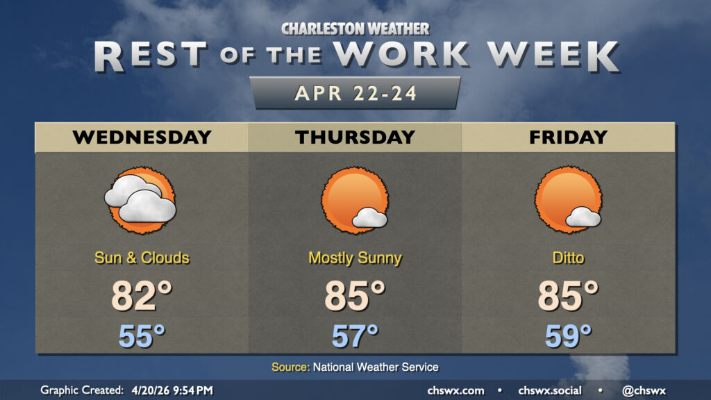
The 80s return by Wednesday as surface high pressure slips offshore and winds go more southerly, with the warming trend continuing into the latter half of the work week. We’ll continue to see mostly sunshine, though a few more clouds will be possible Wednesday. Otherwise, rain will remain tough to come by, and the drought may yet get even worse.
A statewide burn ban remains in effect due to very dry fuels. Heed this message! A three-acre brush fire of unkwown origin burned in North Charleston for a good part of the day, leading to an a arrest.
In the longer term, guidance continues to hint strongly at a pattern change beginning as early as this weekend. This shift in the pattern should help bring better rain chances to the area starting Saturday into Sunday, though it will still require quite a bit of rain to break the ongoing drought.
Follow my Charleston Weather updates on Mastodon, Bluesky, Instagram, Facebook, or directly in a feed reader. Do you like what you see here? Please consider supporting my independent, hype-averse weather journalism and become a supporter on Patreon for a broader look at all things #chswx!