Friday & the weekend: Turning cooler, still unsettled at times
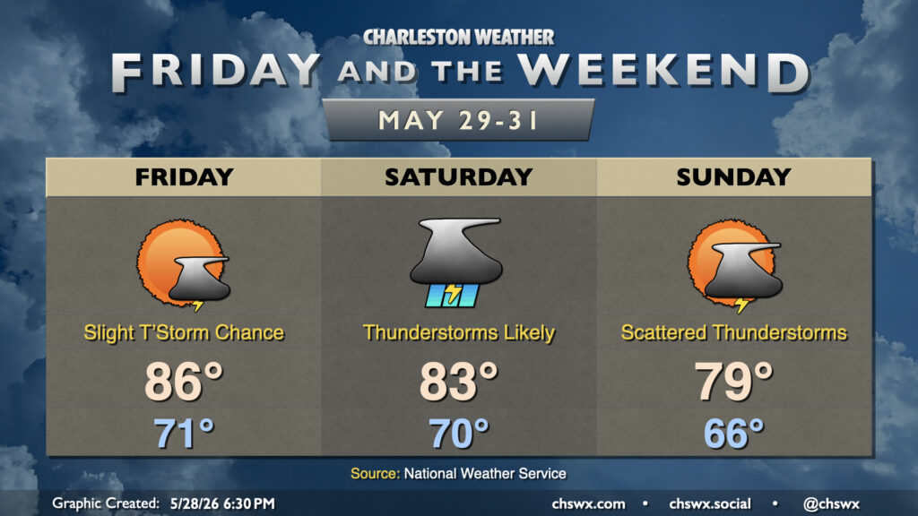
A cold front pushing southward overnight will stall out to our southwest, pushing some drier air into the area in the meantime and cooling things off a few degrees compared to the past few days. Friday still starts in the low 70s, but still a few degrees cooler than Thursday. Temperatures will head to the mid-80s in the afternoon with a few showers or storms possible midday, but otherwise, expect a quieter weather day compared to Thursday’s rambunctious thunderstorms which brought some much-needed rain to the Highway 17 corridor and points east.
The aforementioned front will wobble back northward on Saturday, and this will set up the potential for another round of significant rainfall across the area. Showers and thunderstorms should be fairly widespread especially toward midday through early evening. There is a risk for some minor flooding if storms should train, but otherwise, it’s much-needed rain with severe drought persisting across the Lowcountry. Temperatures will peak in the low to mid-80s after starting around 70°, owing to the rain-cooled environment.
The front will buckle back southward for Sunday, closing May on a cooler-than-normal note. Lows in the mid-60s warm to the upper 70s to around 80° in the afternoon. A few showers or thunderstorms will be possible during the day, though the push of drier air back into the area should keep that in check before the front buckles back northward overnight Sunday into Monday, bringing about more rainfall.
Follow my Charleston Weather updates on Mastodon, Bluesky, Instagram, Facebook, or directly in a feed reader. Do you like what you see here? Please consider supporting my independent, hype-averse weather journalism and become a supporter on Patreon for a broader look at all things #chswx!