Rest of the work week: Warm, then turning warmer
Generally normal summer weather continues for the rest of the work week, with a bit of an uptick in temperature as we head into Friday and the weekend.
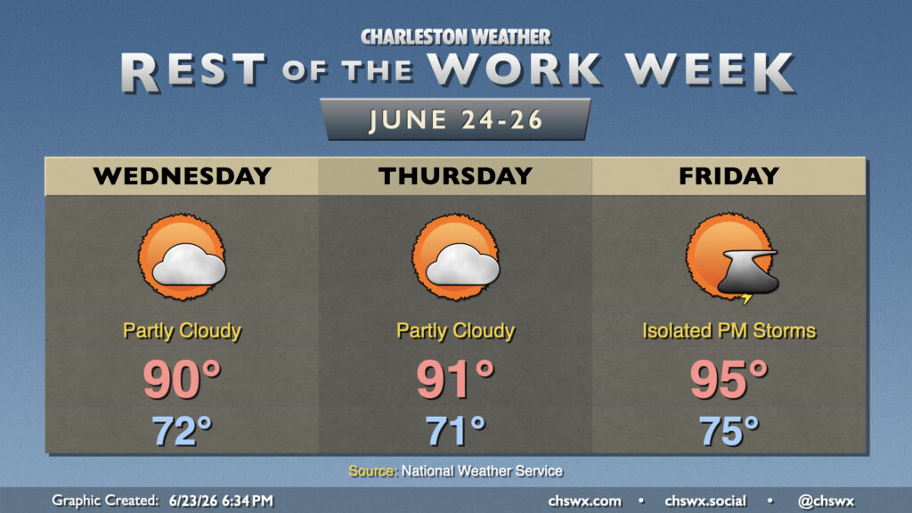
Drier air will be hanging around over the next couple days, taking some bite off the heat and keeping thunderstorm chances low. We’ll start Wednesday in the low 70s, warming to around 90° in the afternoon under partly cloudy to mostly sunny skies. Dewpoints in the 60s will keep the heat index in check, too. It’s a similar story Thursday, though we’ll see dewpoints rise a click or two. A decent cap on the atmosphere will stick around into Thursday, and so we shouldn’t see much, if any, thunderstorm development (though a very stray popup truly can never be completely ruled out this time of year). Warmer temperatures and higher dewpoints return for Friday, though, with mid-90s highs and low-to-mid-100s heat indices expected. There is a slightly better chance for an isolated thunderstorm with a little more instability, but don’t count on much relief from the heat.
Heat continues to build into the weekend, with forecast highs in the mid-90s on Saturday and upper 90s to near 100° on Sunday with little in the way of storms expected. Don’t be surprised if a heat advisory or two is needed at some point.
Follow my Charleston Weather updates on Mastodon, Bluesky, Instagram, Facebook, or directly in a feed reader. Do you like what you see here? Please consider supporting my independent, hype-averse weather journalism and become a supporter on Patreon for a broader look at all things #chswx!