Thursday: Another day of high heat
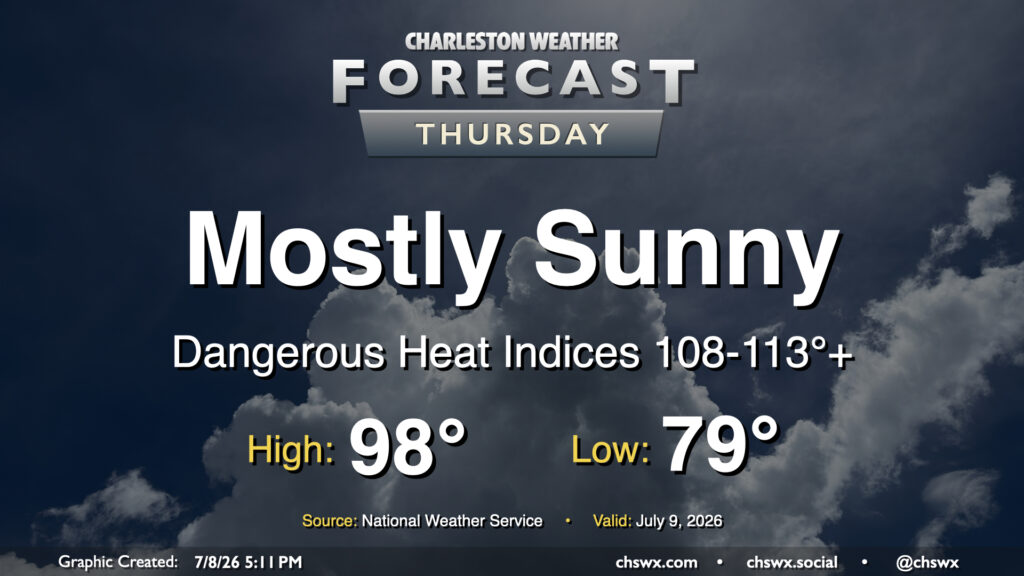
It was a stifling hot Wednesday in the Lowcountry, with highs reaching the upper 90s and heat indices peaking between 113-116° in parts of the metro area. Another round of high heat is in store for Thursday, as temperatures once again return to the upper 90s. Dewpoints near the coast and behind the seabreeze should surge well into the mid-to-upper 70s once again, sending heat indices between 108-113° (with locally higher readings possible) in the Highway 17 corridor. This has prompted another Extreme Heat Warning for Charleston County as well as the southern portion of Berkeley County that includes Hanahan and Daniel Island. Elsewhere, a Heat Advisory will be in effect for heat indices around 108-110°. Model guidance still suggests a few showers and thunderstorms will fire off along and ahead of the seabreeze, which will help cool some of us off. Coastward storm motions moving against the inland-moving seabreeze could cause some back-building of thunderstorms with some locally heavy rain. The strongest storms could produce damaging wind gusts, and a warning or two can’t be totally ruled out as a result.
Rest of the work week: Heat wave continues for a couple more days
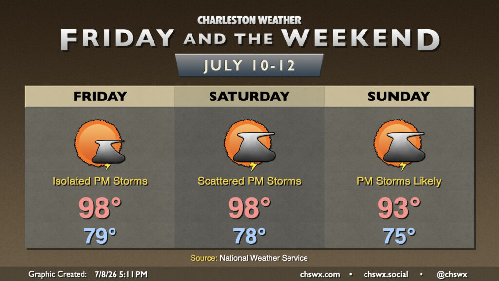
The heat wave will continue Friday and Saturday before finally backing off a little on Sunday as a front drops southward into the area. Until then, though, we’ve got what looks like a couple more days of boy band heat as air temperatures reach into the upper 90s away from the coast. While more westerly winds should bring dewpoints down a little, it certainly seems conceivable that we’ve got a day or two more of Heat Advisories. Isolated to scattered afternoon thunderstorms will still be possible to cool a few of us off on Friday and Saturday.
On Sunday, we should see a little more precipitation coverage as the aforementioned front slides south toward the area. Showers and thunderstorms become likely Sunday evening, and in general, we can expect more in the way of cloud cover to help keep highs capped to the low-to-mid-90s. Unsettled weather continues into the first part of next week, which will bring much-needed rain to the area and somewhat cooler temperatures as well.
Follow my Charleston Weather updates on Mastodon, Bluesky, Instagram, Facebook, or directly in a feed reader. Do you like what you see here? Please consider supporting my independent, hype-averse weather journalism and become a supporter on Patreon for a broader look at all things #chswx!