Friday & the weekend: Midsummer heat continues
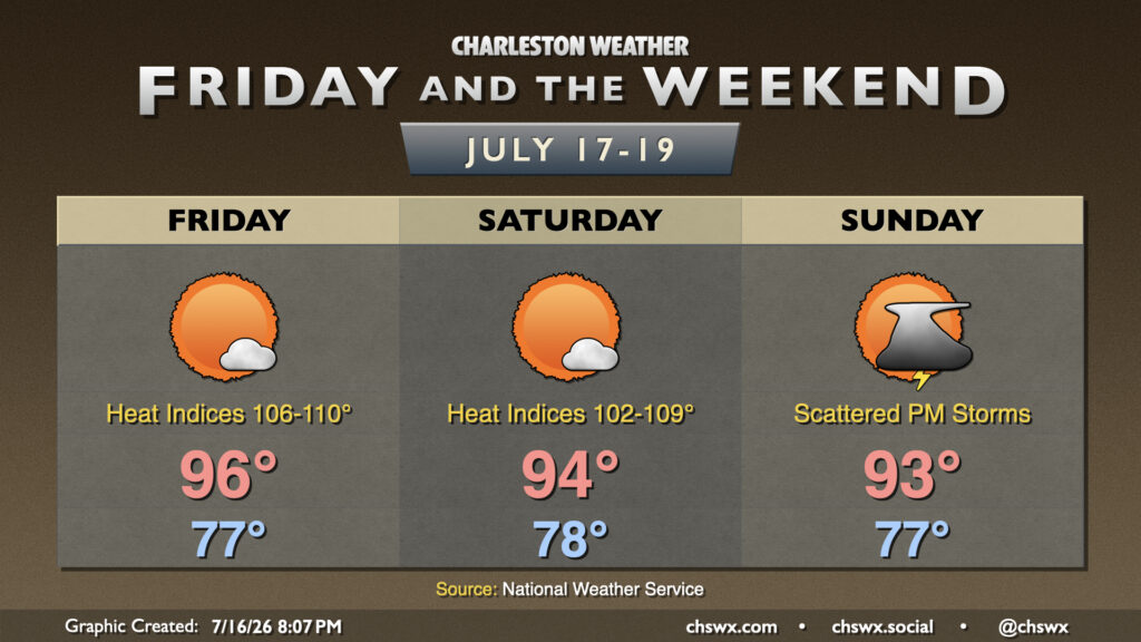
Heat and humidity continues for Friday and the weekend with high pressure aloft the main weather driver. Atlantic high pressure will continue to drive high dewpoints into the area, and that not only will drive heat indices well into the 100s, but it will keep us quite toasty at night, too. Expect lows in the upper 70s each day, perhaps not dropping below 80° closer to the coast and downtown.
It wouldn’t shock me to see a couple Heat Advisories over the next couple days. Highs will reach the mid-90s Friday and Saturday, while heat indices inland will peak in the mid-100s, while upper 100s to near 110° appear possible in the coastal corridor. Saturday’s air temperature looks to run a couple clicks cooler, but high dewpoints will keep heat indices elevated in Heat Advisory territory.
A stray shower or two can never be totally ruled out in July, but high pressure should keep a lid on any widespread rain or thunderstorm activity Friday and Saturday. Sunday looks a little more unsettled as the high begins to break down a bit and a front starts to nudge southward toward the area. It won’t rain all day; it’ll be more of the afternoon seabreeze storm variety.
Tropics: A low chance of development off the coast
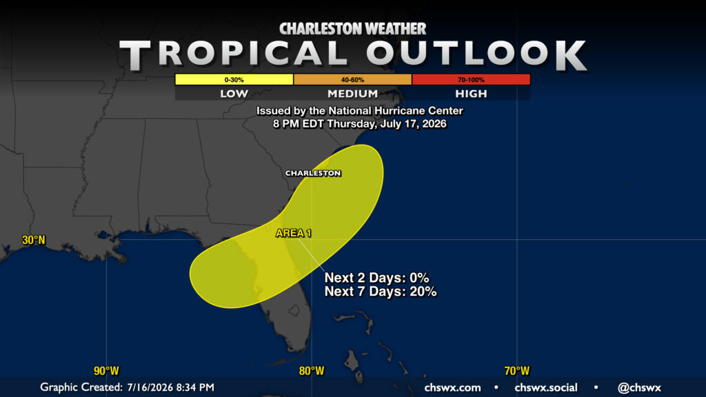
The National Hurricane Center is highlighting an area from the Gulf across northern Florida off the Carolina coast for possible development within the next week. Model support is very slim, though, and if something were going to try to get going, it would largely be a rain enhancer. Right now, though, there’s not much to be concerned about here.
Follow my Charleston Weather updates on Mastodon, Bluesky, Instagram, Facebook, or directly in a feed reader. Do you like what you see here? Please consider supporting my independent, hype-averse weather journalism and become a supporter on Patreon for a broader look at all things #chswx!