Weekend forecast: Rinse and repeat
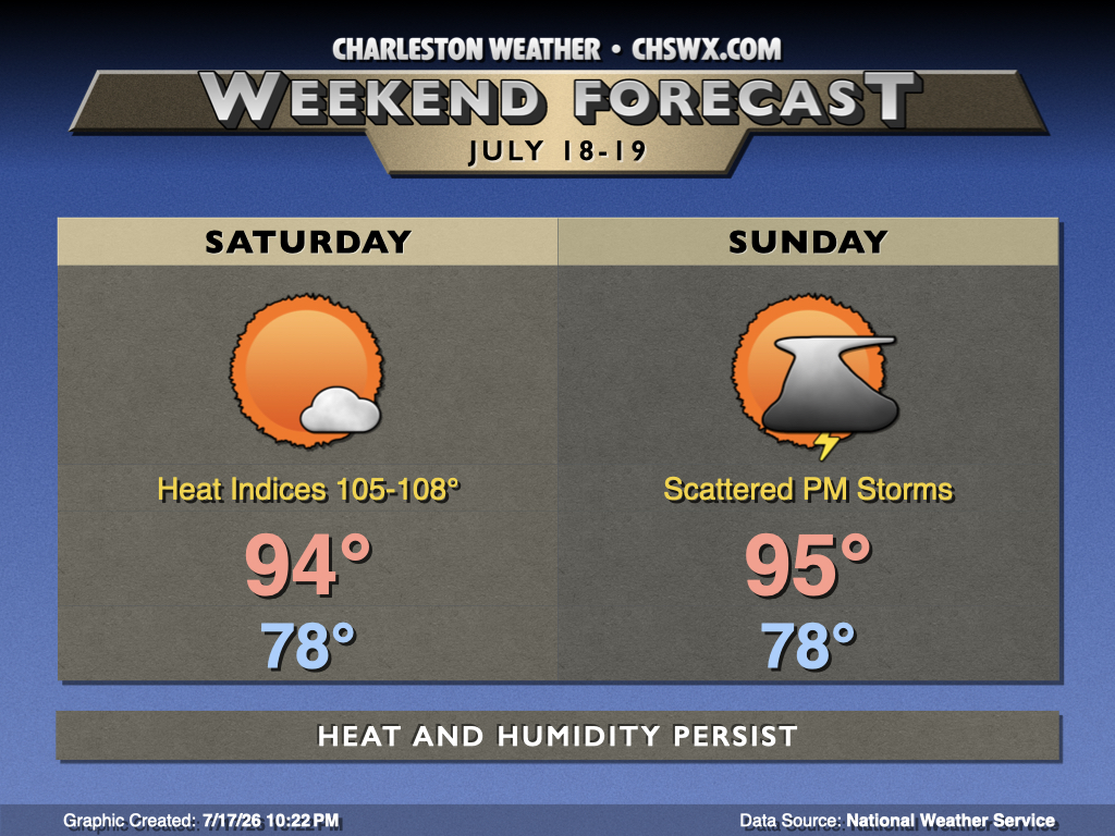
Midsummer heat and humidity will not relent this weekend with temperatures continuing to run above normal courtesy of Atlantic high pressure pumping warm and moist air into the area while high pressure remains resident aloft for a few more days.
Saturday starts in the upper 70s inland to around 80° near the coast, owing to the unrelenting warmth that continues to envelop the area this July. We’ll then warm into the mid-to-upper-90s in the afternoon, and with dewpoints continuing to run well into the 70s, heat indices could once again climb close to Heat Advisory criteria.
Expect a similar temperature profile on Sunday, but high pressure aloft relaxing a bit will allow a bit more in the way of showers and thunderstorms in the afternoon, but it’ll be no washout. As is often the case in July, a few of us may even be shut out. While widespread severe weather is not expected, cloud-to-ground lightning is certainly in play, and that’s always dangerous.
Tropics: Watching an area in the Gulf
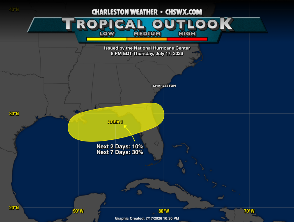
The National Hurricane Center continues to monitor an area of disturbed weather associated with an upper-level low just off the coast of Florida. This helped drive a damaging line of thunderstorms through the Florida panhandle earlier today. Models remain mixed about this storm’s chances to develop a surface circulation which could become tropical over the next week. Some of the convection-allowing models are going whole-hog (note for model watchers: the 3km NAM is way out of whack when deepening tropical cyclones and should be ignored) in developing a reasonably strong Tropical Storm Bertha, while global models are decidedly less convinced. However, while chances remain low, probabilities for development have been nudged up a bit, so we’ll continue to keep an eye on this one. For now, though, there’s no imminent concern for the Lowcountry. If that changes, we’ll let you know.
Follow my Charleston Weather updates on Mastodon, Bluesky, Instagram, Facebook, or directly in a feed reader. Do you like what you see here? Please consider supporting my independent, hype-averse weather journalism and become a supporter on Patreon for a broader look at all things #chswx!