The week ahead: Warm and muggy conditions continue; turning more unsettled
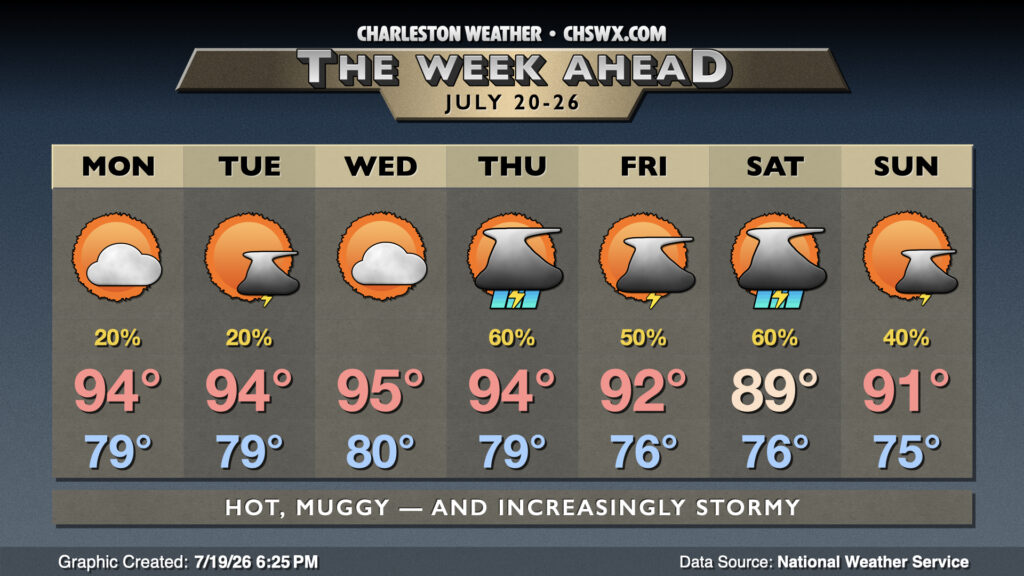
The week ahead will continue to feature warm and muggy conditions, with an uptick in rain chances as we get over the hump toward the weekend.
There’s a few mixed messages in models about the potential for a few showers to start Monday, but otherwise, things look relatively quiet — and quite warm. Lows inland will struggle below 80°, while low 80s will greet coastal areas on Monday. We’ll warm to the mid-90s in the afternoon, and while dewpoints won’t be quite as heinous as they could be, we’ll still see heat indices run 103-108° in the afternoon, with the highest values found in the wake of the seabreeze. Expect more of the same Tuesday and Wednesday, with highs in the mid-90s after lows in the upper 70s to low 80s and a stray storm or two mixed in. (Thoroughly gross).
A cold front will start pushing toward the area on Thursday, increasing the coverage of showers and thunderstorms as it approaches. Said front could make it as far as the coast before stalling out, helping to take a little edge off the heat, albeit with scattered to numerous showers and thunderstorms at times. Overall, expect highs in the mid-90s on Thursday to cool to the upper 80s to low 90s heading into Friday and the weekend.
Tropical Depression Two develops; not a concern for the Lowcountry
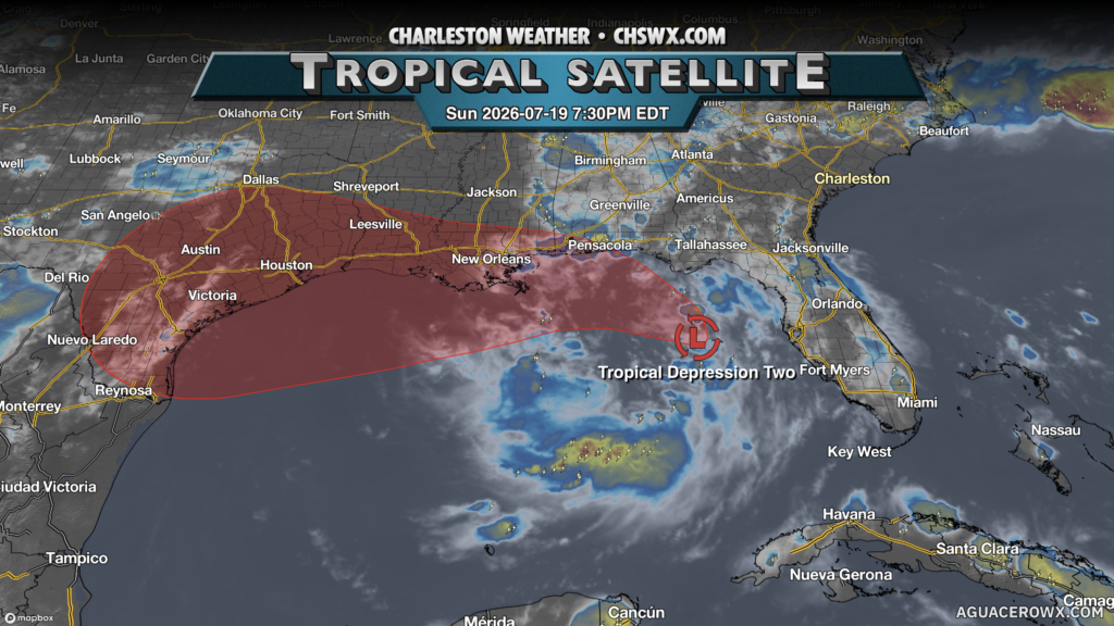
The second tropical depression of the season has formed in the Gulf today. It will generally track westward toward Louisiana and perhaps even Texas as Tropical Storm Bertha over the next week. It doesn’t pose a direct threat locally, but we’ll want to watch its moisture as it could become entrained into the area later this week, enhancing rainfall.
Follow my Charleston Weather updates on Mastodon, Bluesky, Instagram, Facebook, or directly in a feed reader. Do you like what you see here? Please consider supporting my independent, hype-averse weather journalism and become a supporter on Patreon for a broader look at all things #chswx!