Tuesday: Breezy, warm, with a stray storm
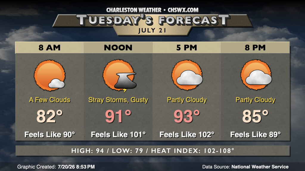
Tuesday looks similar to Monday, with temperatures warming into the low-to-mid-90s in the afternoon after another sultry start in the upper 70s to low 80s. Heat indices inland will run in the low 100s, but may push 108° as we get closer to the coast and the higher-dewpoint air. Southerly winds will continue to be breezy, with gusts pushing 30 MPH at times midday.
Rest of the work week: Turning more unsettled
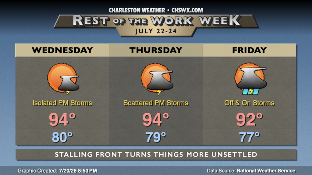
A southward-moving front will nudge into the area later this week, bringing some more unsettled weather into the picture especially Thursday and Friday. However, the revised forecast doesn’t bring the front quite as far south as mentioned yesterday, keeping us in the warm and muggy air with lows in the upper 70s to low 80s and highs in the mid-90s, particularly Wednesday and Thursday. As we get into Thursday afternoon and Friday, the risk for showers and thunderstorms will increase. A few of these could bring some heavy rain to some spots, with a risk for flooding if storms train over the same locations, so we’ll want to keep an eye on that.
Follow my Charleston Weather updates on Mastodon, Bluesky, Instagram, Facebook, or directly in a feed reader. Do you like what you see here? Please consider supporting my independent, hype-averse weather journalism and become a supporter on Patreon for a broader look at all things #chswx!