Friday & the weekend: Humidity and storms return
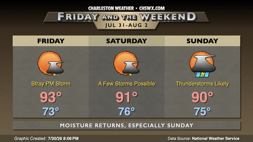
A brief interlude in midsummer humidity comes to a close as a stalled front that’s been hanging just south of the area lifts back northward on Friday. A stronger front approaches over the weekend, with deeper moisture and more widespread storms possible Sunday.
Friday will get off to another pleasant-by-July-standards start, with lows dipping into the low to mid-70s in the morning once more. A wave of low pressure along the front may nudge it north of the area late in the day, increasing the risk for perhaps a shower or thunderstorm Friday afternoon. Otherwise, temperatures Friday head into the low 90s with heat indices generally running in the mid-to-upper 90s, warmest near the coast.
Saturday could feature a few more showers and storms, especially as the seabreeze gets going, though some of the convection-allowing models have been indicating the potential for some showers in the morning. Temperatures will start a few degrees warmer with higher dewpoints beginning to move back in, generally in the mid-to-upper-70s. Highs should top out in the low 90s, with heat indices once again peaking in the mid-to-upper 90s.
Rain chances tick up late Saturday into Sunday as the stalled front degenerates into a trough ahead of a stronger front. Return flow from the south will turn the moisture pump back on in earnest, yielding more widespread showers and thunderstorms on Sunday. It shouldn’t rain all day, but some spots could see some heavy downpours. Lows in the mid-to-upper 70s warm to the low 90s in the afternoon.
Follow my Charleston Weather updates on Mastodon, Bluesky, Instagram, Facebook, or directly in a feed reader. Do you like what you see here? Please consider supporting my independent, hype-averse weather journalism and become a supporter on Patreon for a broader look at all things #chswx!