Thursday: More morning storms
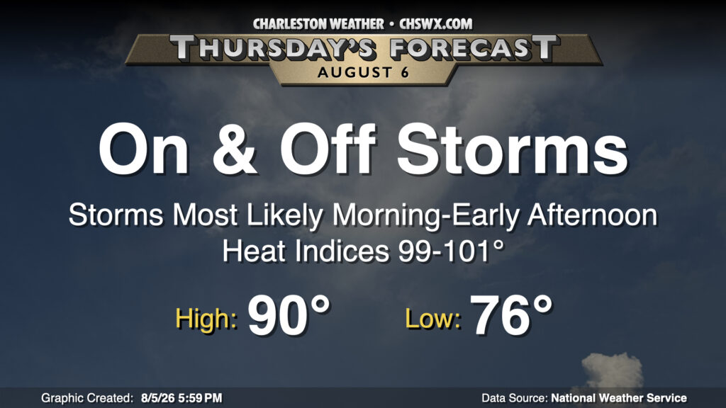
Like the past few days, we will be getting our storms out of the way during Thursday’s morning and early afternoon hours as storms developing over the Atlantic drift coastward. Expect a warm and muggy start in the mid-70s, warming to around 90° in the afternoon once the sun emerges from behind the clouds. Showers and thunderstorms will once again be capable of producing heavy rain, with a flood advisory or two not out of the question especially if storms begin to train. We may also see a waterspout or two as well; earlier today, a storm off Kiawah produced four waterspouts (none of which made it to shore, at least). Keep an eye out on the beaches or if you have some boating planned.
Friday & the weekend: Unsettled summertime weather continues
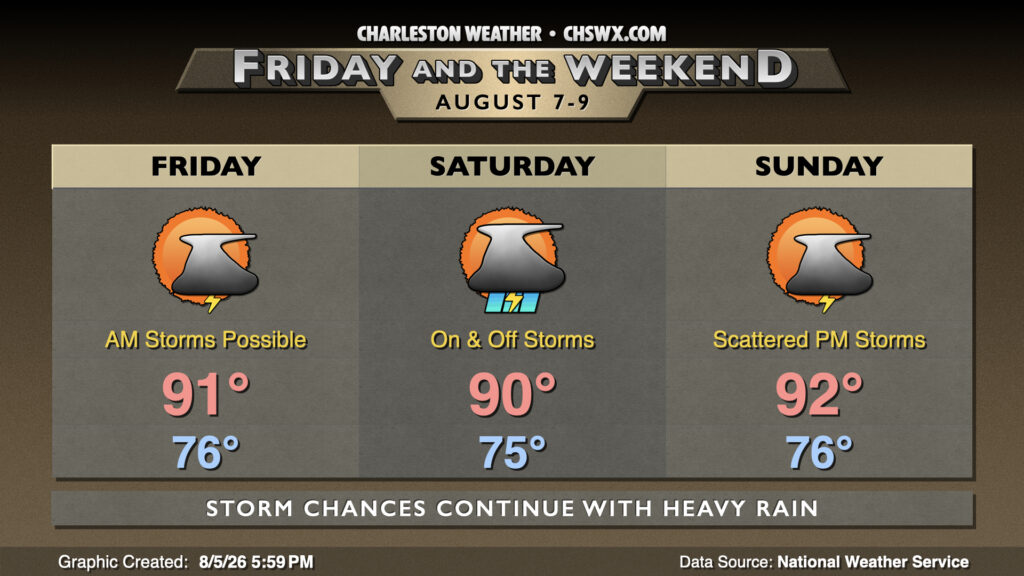
Expect periods of showers and thunderstorms each day heading through the weekend as we sit on the western periphery of Atlantic high pressure, keeping the hot and humid air pumping into the area from the south. Another round of morning storms is expected Friday, though a slug of drier air will push in and limit coverage and intensity (though could possibly contribute to a slightly higher severe threat). We should see coverage and the flooding rain threat tick back up for Saturday as more moisture moves back in from the Atlantic, with showers and thunderstorms becoming likely through the evening. From there, a bit more of a westerly component to the wind brings about more of a typical summertime pattern on Sunday with scattered afternoon storms. Temperatures generally run near or slightly above normal, with highs in the low 90s and lows in the mid-70s each day. Even warmer weather returns next week as the subtropical ridge nudges back in over the area.
Follow my Charleston Weather updates on Mastodon, Bluesky, Instagram, Facebook, or directly in a feed reader. Do you like what you see here? Please consider supporting my independent, hype-averse weather journalism and become a supporter on Patreon for a broader look at all things #chswx!