Friday & the weekend: Staying unsettled, particularly Saturday
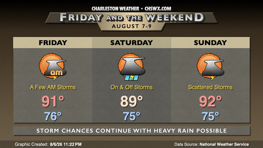
Showers and thunderstorms will remain in the forecast as we head into Friday and the weekend, with the best rain chances on Saturday as a slug of moisture moves ashore.
Friday starts in the mid-70s inland to upper 70s near the coast with a few showers and thunderstorms possible near the coast as the land breeze does its thing again. High pressure aloft and a pocket of drier air will be nudging in, though, and that should keep Friday relatively quiet (though not entirely rain-free for some). Temperatures will peak in the low 90s under generally partly cloudy skies, with heat indices running right around 100° owing to continued rich surface dewpoints in the mid-70s.
The wettest day of the set looks to be Saturday as a slug of moisture associated with a surface trough moves into the area. We can expect scattered to numerous thunderstorms starting perhaps as early as 8-9am and lasting into the afternoon across much of the metro area, though it won’t rain all day at any one location. Temperatures will still start in the mid-to-upper 70s, but the rain and cloud cover should limit highs to the upper 80s. Periods of heavy rain will be possible, and an isolated damaging wind gust can’t be counted out, either.
Shower and thunderstorm chances continue into Sunday, though they should run a little lower than previous days. Overall, be ready for outdoor plans to become indoor plans due to thunderstorms, but not everyone will see rainfall. Lows in the mid-to-upper 70s will warm back to the low 90s, with heat indices approaching 105° in the afternoon as dewpoints remain well into the upper 70s to near 80°.
Follow my Charleston Weather updates on Mastodon, Bluesky, Instagram, Facebook, or directly in a feed reader. Do you like what you see here? Please consider supporting my independent, hype-averse weather journalism and become a supporter on Patreon for a broader look at all things #chswx!