Thursday: Heat escalates; Extreme Heat Warning issued
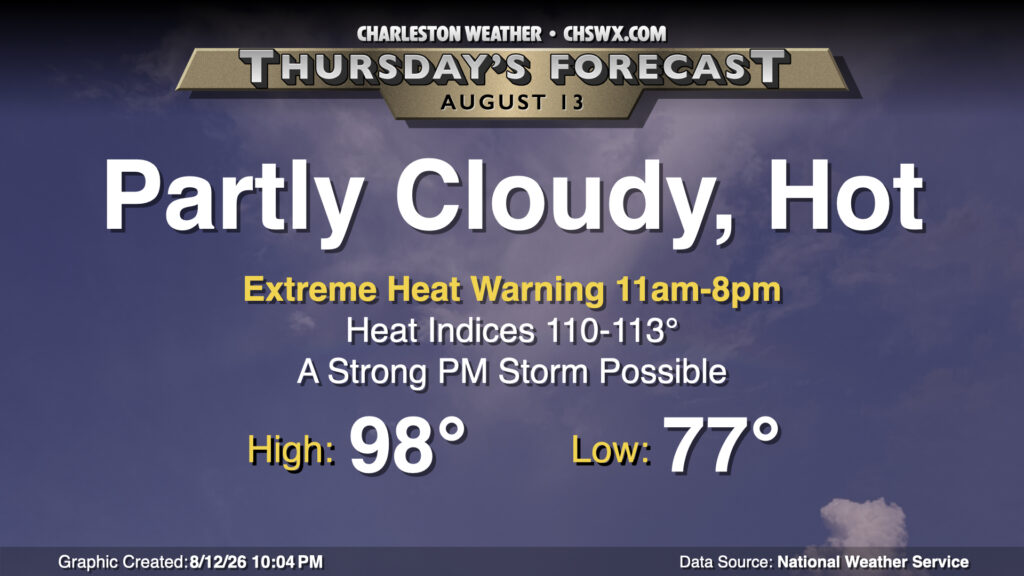
We’ll take the heat up a notch for Thursday as even hotter air temperatures in the upper 90s — perhaps approaching 100° in a few spots — combine with dewpoints in the mid-to-upper 70s to produce heat indices pushing 110-113°. This potential has prompted an Extreme Heat Warning for Charleston and tidal Berkeley counties (Daniel Island, Hanahan) from 11am-8pm. Elsewhere in Berkeley and Dorchester counties, a Heat Advisory will be in effect for the same time period. In these areas, heat indices should peak in the 108-110° range — still quite dangerous, but not nearly as intense as what folks will see closer to the coast, where the moisture-rich maritime air will make it that much harder for your body to cool down. If you must be outside during the advisory/warning period tomorrow, take frequent breaks in the shade with plenty of water.
There will be a risk for a few showers and thunderstorms in the afternoon as some energy ripples by aloft, riding around the periphery of a strong ridge of high pressure centered in the midsection of the continental US. If storms can get going, a stray strong storm or two won’t be out of the question given plenty of moisture to work with. However, don’t count on a thunderstorm to impart much, if any, relief from the extreme heat.
Friday & the weekend: Heat wave rolls on
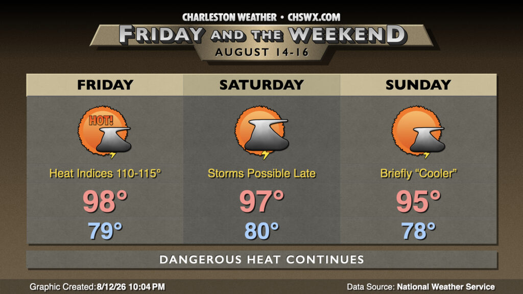
The heat wave will roll on for Friday and the weekend (and well into next week, for that matter). Air temperatures Friday should once again top out in the upper 90s to near 100° after starting out near 80° even away from the coast. This will represent the first peak in what looks to be a long-duration heat wave. Air temperatures Saturday and Sunday briefly trend back toward the mid-90s — hardly a consolation — courtesy of an ever-so-slight uptick in cloud cover and perhaps a little bit more in the way of thunderstorm activity. However, heat indices should continue to run at or above 105° each afternoon, and I’d be stunned if we didn’t see another Extreme Heat Warning for Friday and heat advisories over the weekend.
The one wildcard here is going to be the position of the ridge relative to the area; the further west it nudges, the better chance we have of thunderstorm complexes (or the remnants thereof) turning things slightly unsettled for some of us. There are thunderstorm chances in the forecast each afternoon and evening, but it can be tough to get a lot of lead time with these complexes running around the edge of the ridge in a “ring of fire” scenario. Thursday’s advice still applies, though: don’t count on a storm to cool you off.
Follow my Charleston Weather updates on Mastodon, Bluesky, Instagram, Facebook, or directly in a feed reader. Do you like what you see here? Please consider supporting my independent, hype-averse weather journalism and become a supporter on Patreon for a broader look at all things #chswx!