Thursday: Heat advisories continue ahead of a more unsettled weekend
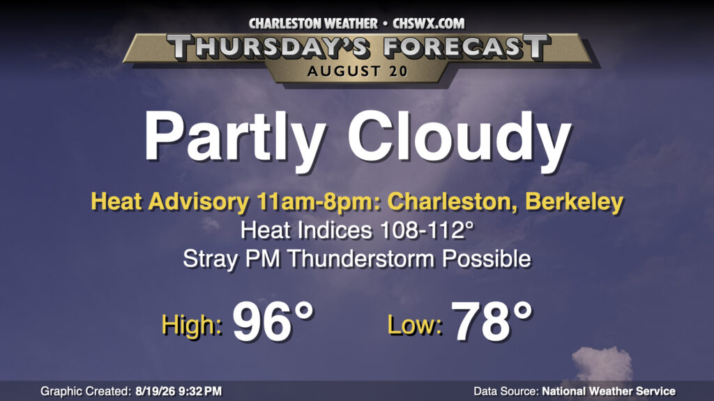
Another hot day lies ahead on Thursday, but we do have some changes coming that will turn conditions a little more unsettled, which in turn will start to take the edge off this heat some.
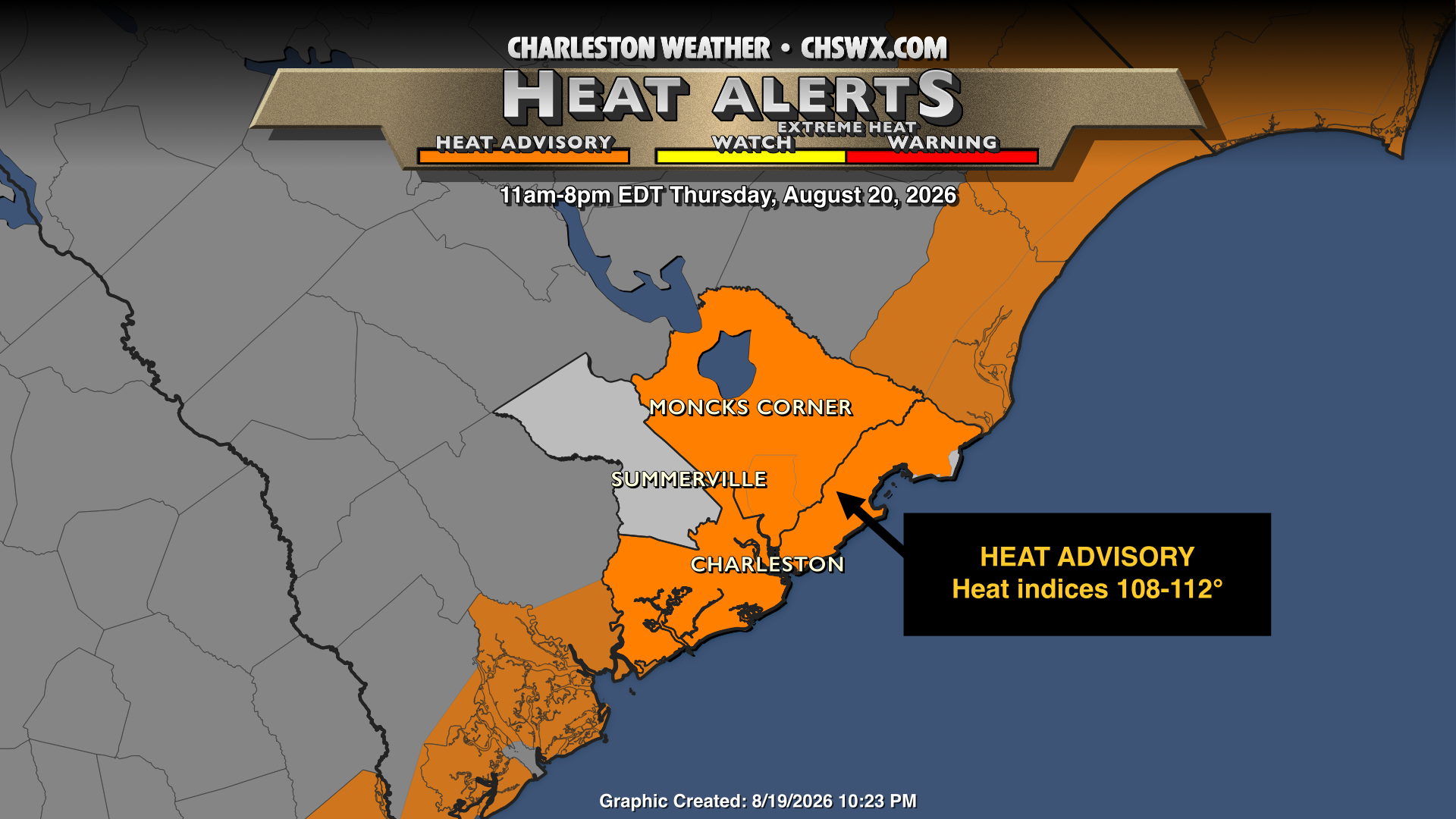
That being said, Thursday will mark the ninth consecutive day of heat headlines of some sort, whether it be a Heat Advisory or an Extreme Heat Warning, and it’s getting very difficult to find new ways to tell you it’s going to be hot. We start Thursday in the upper 70s to low 80s once again, with air temperatures in the afternoon peaking in the mid-90s. Heat indices will once again peak between 108-112° — not as bad as it has been, but still pretty gnarly — and that’s prompted the aforementioned heat advisory for Charleston and Berkeley counties. (Looks like we’ll fall short of heat advisory criteria in Dorchester County, but it will still be quite hot to the point where you’ll want to monitor for heat illness if outdoors for an extended period.) A few of us should see some isolated to scattered thunderstorms in the afternoon along and ahead of the seabreeze. There’s not much shear and storm motions will be slow, so heavy rain will continue to be a concern, and with plenty of instability available, storms could produce frequent lightning and gusty winds in downbursts. Be ready for conditions to change on a dime if out and about.
Friday & the weekend: Turning more unsettled
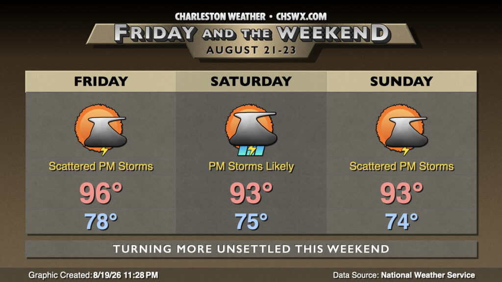
A trough to the north will start to dig more across the eastern US as we head into the weekend, nudging the strong ridge that has been baking us further west and increasing the risk for showers and thunderstorms, especially in the afternoons. Friday should be another hot day with heat indices potentially approaching advisory criteria again, though showers and thunderstorms should initiate a little earlier in the day. A few storms could be strong to severe given improving instability due to the cooling aloft, so we’ll want to keep an eye on that. Elevated thunderstorm chances continue into the weekend as a stalled surface front nearby helps provide an additional focus for shower and thunderstorm activity, enhanced by disturbances rippling through aloft. Temperatures do tick down a touch, though, with “only” low-to-mid-90s highs and lows in the mid-70s. We will take whatever we can get in the cooling department — it’s been a hot summer!
Follow my Charleston Weather updates on Mastodon, Bluesky, Instagram, Facebook, or directly in a feed reader. Do you like what you see here? Please consider supporting my independent, hype-averse weather journalism and become a supporter on Patreon for a broader look at all things #chswx!