The week ahead: Afternoon storms becoming plentiful, with heavy rain possible
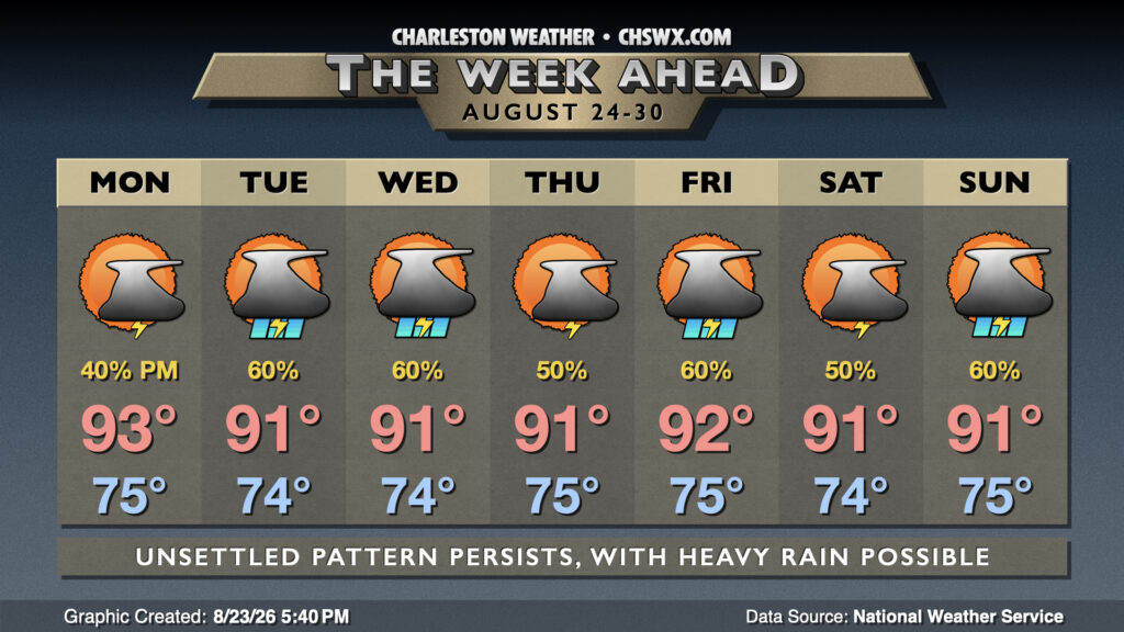
The week ahead will certainly not run as hot as the past two weeks have been, but that comes at the cost of afternoon thunderstorms each day, with a risk for heavy, flooding rain increasing as we get toward the second half of the week.
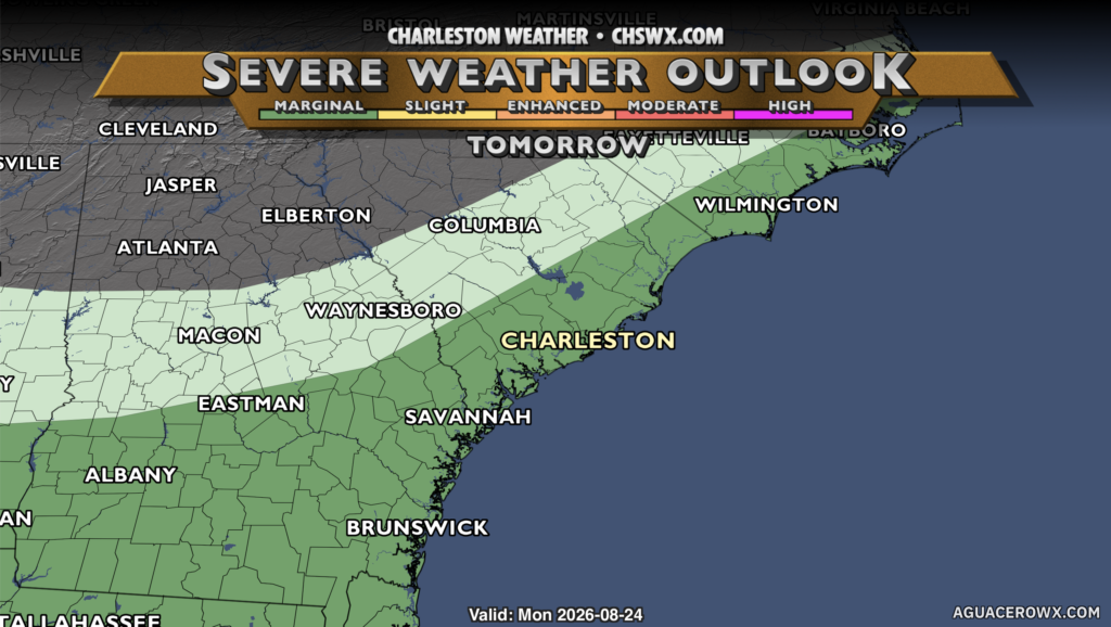
Monday starts in the mid-70s as the low levels remain humid with a stalled front just to the west, keeping the 60s dewpoints confined to the Midlands and points west. (Oh well.) We’ll see highs reach the low to mid-90s with a good bit of sunshine for much of the day as dry air continues to reside aloft, though a little more moisture than Sunday should allow for a bit more in the way of afternoon thunderstorm development along the seabreeze and in the vicinity of the front. The drier air will elevate the risk for any storms that do form to bring some strong, damaging winds to the surface, so we’ll want to monitor for that as we get into the late afternoon through the commute. The Storm Prediction Center has a level 1 of 5 risk (marginal) outlined across the Lowcountry as a result. Not everyone will see a storm, though.
Moisture will continue to tick back up as the week goes on, though, increasing the risk for afternoon and evening thunderstorms each day into the weekend. As that moisture continues to become richer, the risk for heavy and even excessive rainfall will increase, which we’ll want to watch for flooding concerns. On the flip side, the rain will keep temperatures from getting too out of hand, with upper 80s to low 90s expected each afternoon before storms kick in. While hot, it’s nowhere near where we’ve been, that’s for sure.
Tropics: A couple areas of interest, but no immediate concerns
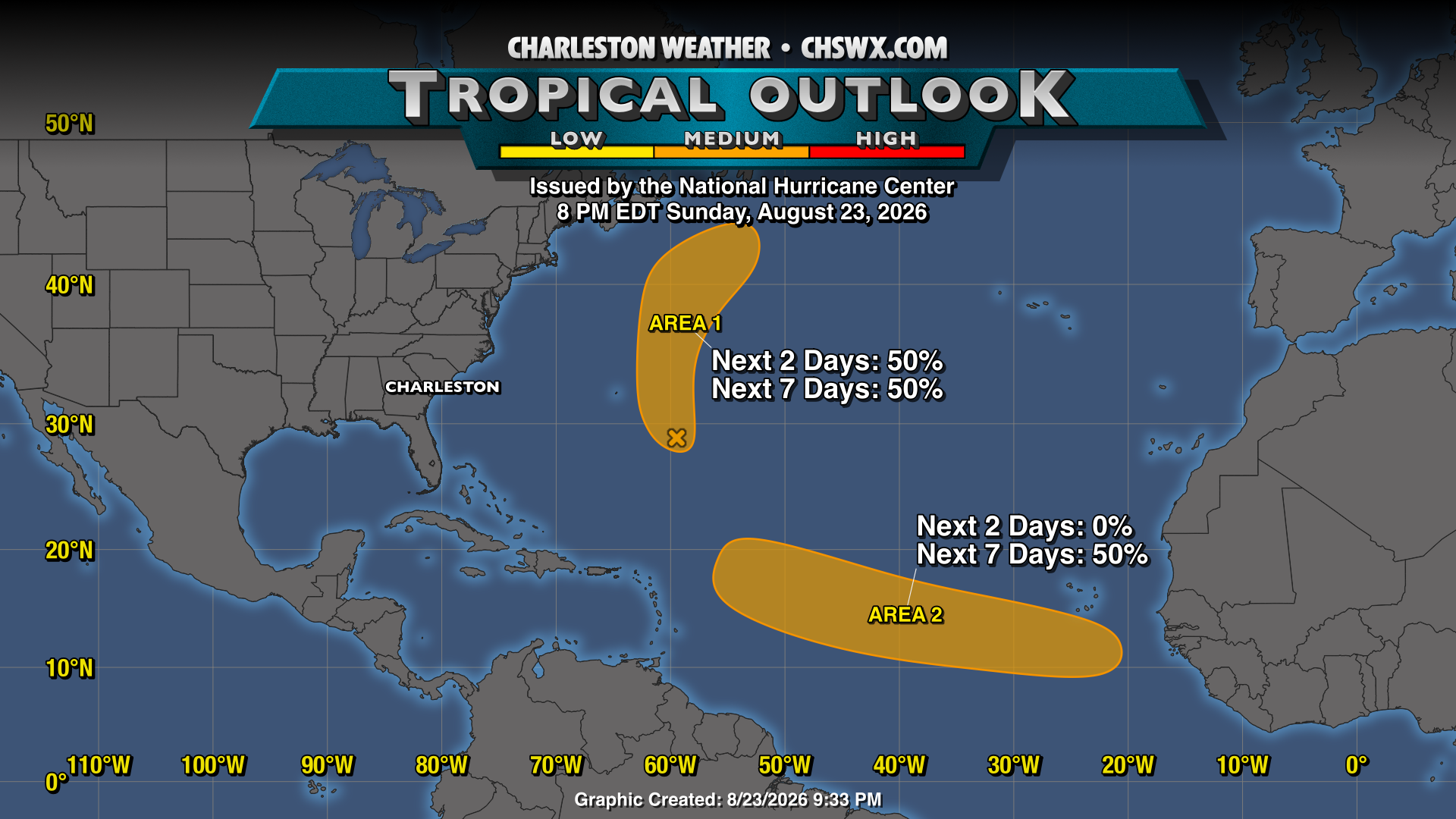
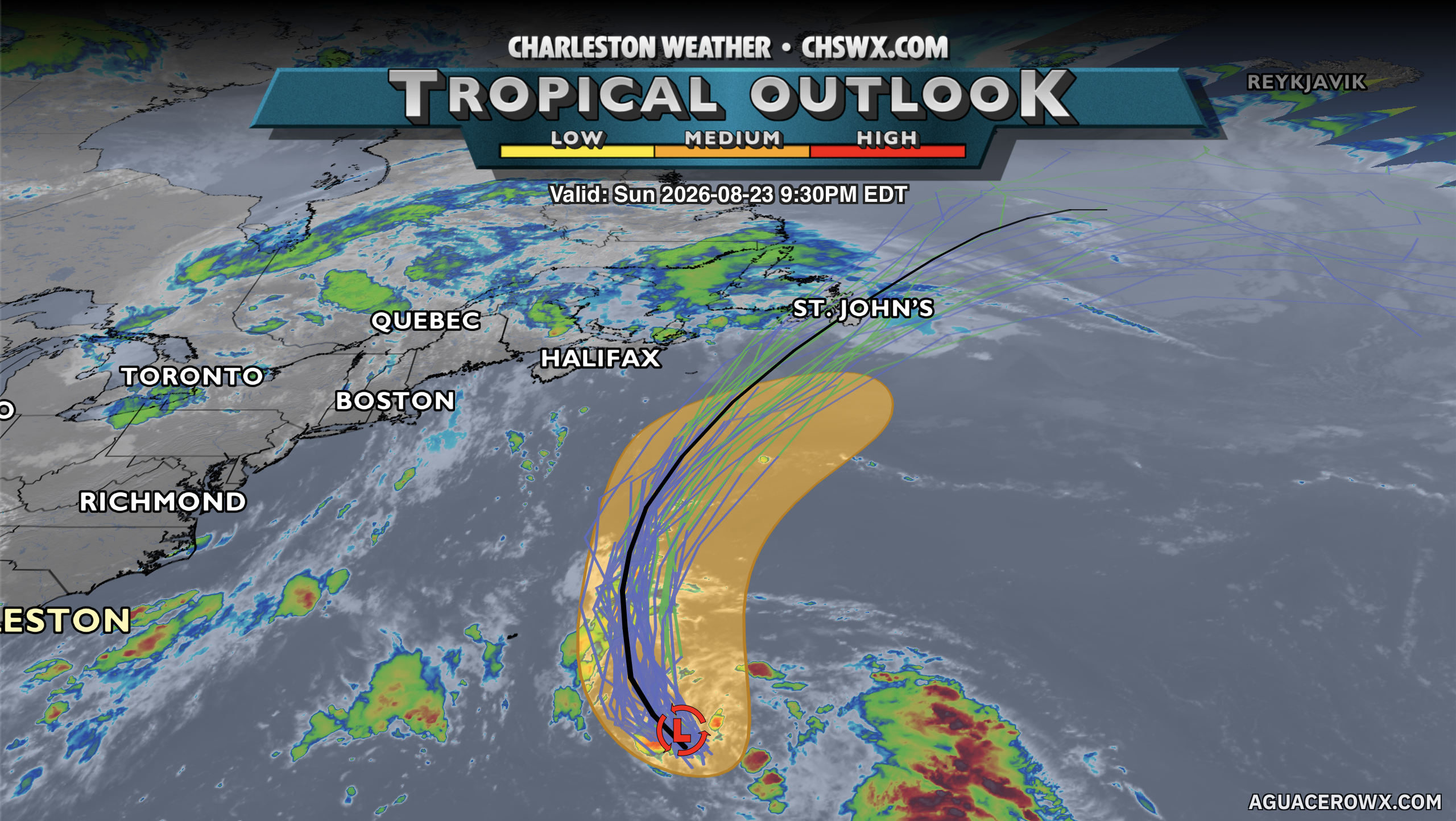
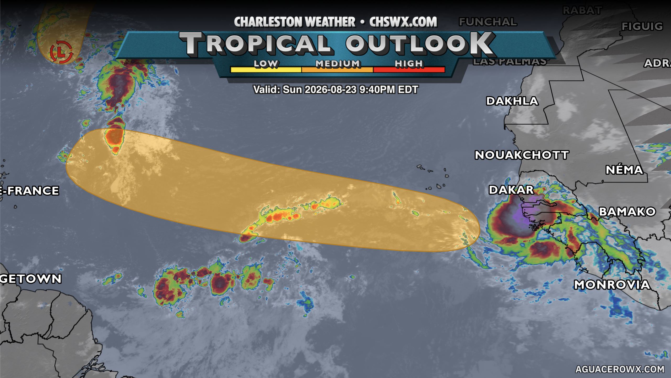
The National Hurricane Center is watching a couple spots in the Atlantic for possible development as we continue to head toward the climatological peak of the season in mid-September. The first area is a wave (designated as Invest 95L) that’s southeast of Bermuda and heading northward. It looks to stay safely east of Bermuda as it goes, with a 50% chance to become a tropical cyclone this week.
The second area has yet to emerge off the coast of Africa, but once it does, there’s a corridor between 20°W and 55°W where conditions could become favorable for development. NHC gives this disturbance 50% odds to become a tropical cyclone this week. It’s got a long way to go, and we’ll keep an eye on it. For now, though, there are no imminent tropical threats to us at home.
Follow my Charleston Weather updates on Mastodon, Bluesky, Instagram, Facebook, or directly in a feed reader. Do you like what you see here? Please consider supporting my independent, hype-averse weather journalism and become a supporter on Patreon for a broader look at all things #chswx!