Rest of the work week: Turning more unsettled
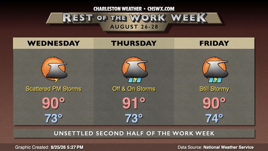
Afternoon shower and thunderstorm coverage will gradually increase over the next few days as a trough of low pressure remains draped over the eastern third of the country and moisture return continues to improve.
Wednesday starts in the low-to-mid-70s as we continue to see a front draped just to our west. Temperatures will warm to around 90° in the afternoon before showers and thunderstorms start to kick off and spread across the area along the seabreeze and outflow boundaries. Heavy rain and frequent lightning will be the main concerns, though a storm or two could be strong with gusty winds.
We’ll rinse and repeat this forecast for the next couple days as well with the trough still in place across the area. The existing front will wash out as another front will approach from the west, turning up shower and thunderstorm chances a little bit more for Thursday and Friday afternoons. It won’t rain all day in any one location, and some spots may yet be shut out — so it goes with summer storms. The trough plus the rain chances will keep temperatures around 90° each afternoon, with heat indices peaking in the mid-to-upper 90s.
Tropics: Next depression soon?
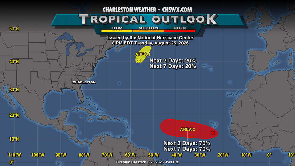
The National Hurricane Center continues to watch two areas for development. The first area over the North Atlantic is seeing its chances diminish quickly and poses no threat. The second area, south of the Cabo Verde Islands, is increasingly likely to become a depression (and maybe more) over the next couple days before it encounters more hostile conditions as it heads further west. Long-range guidance is mixed over whether it recurves in the middle of the Atlantic or keeps going west as a weak storm — if it survives at all. We’ll keep an eye on it, but for now, there’s no imminent tropical threat to the Lowcountry. If that changes, we’ll let you know.
Follow my Charleston Weather updates on Mastodon, Bluesky, Instagram, Facebook, or directly in a feed reader. Do you like what you see here? Please consider supporting my independent, hype-averse weather journalism and become a supporter on Patreon for a broader look at all things #chswx!