Rest of the work week: Warming trend continues; rain chances follow
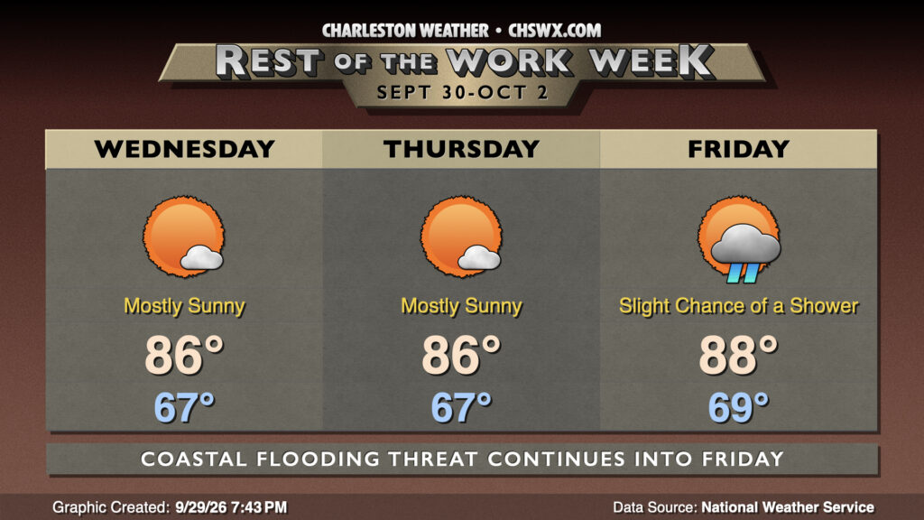
Warmer-than-normal temperatures will continue for the rest of the work week, with rain chances starting to tick up as we get toward Friday and the weekend.
Until then, high pressure aloft will keep mostly sunny skies in place for a couple more days, while surface high pressure shifting into the Atlantic will drive in warmer and more humid air from the south. Wednesday starts noticeably warmer than we’ve seen in the past few days, with lows in the mid-to-upper 60s expected. We’ll warm to the mid-80s in the afternoon with that aforementioned sunshine. Expect a similar day on Thursday before we start to see some shower activity begin to enter the picture on Friday as a coastal trough takes shape.
A residual risk of coastal flooding will continue with each morning high tide through Friday, though the risk will be gradually diminishing as we get further from the full moon and marine effects from the nor’easter continue to subside. Still, be alert to Coastal Flood Advisories over the next few mornings due to the risk for minor coastal flooding.
Looking ahead: Turning more unsettled and cooler
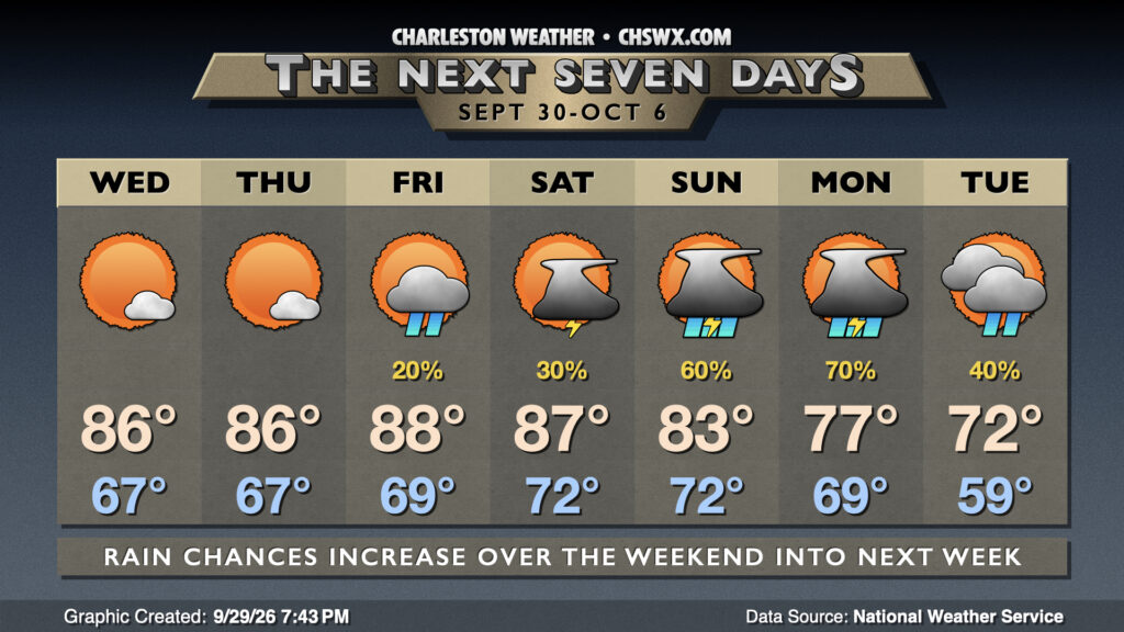
Shower and thunderstorm chances will tick up heading into the weekend and especially early next week as a cold front moves into the area. The front should get through by Monday, and that will drive much cooler air back into the Lowcountry with some lingering shower chances into Tuesday. Highs could struggle into the low 70s Tuesday as breezy northeast winds associated with a wedge of high pressure really start to kick in.
Follow my Charleston Weather updates on Mastodon, Bluesky, Instagram, Facebook, or directly in a feed reader. Do you like what you see here? Please consider supporting my independent, hype-averse weather journalism and become a supporter on Patreon for a broader look at all things #chswx!