Rest of the week: Turning much cooler

A cold front will come through Wednesday, knocking temperatures down for Thanksgiving and Black Friday.
Read more »A cold front will come through Wednesday, knocking temperatures down for Thanksgiving and Black Friday.
Read more »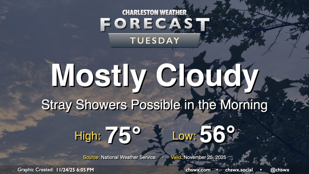
High pressure to our north will be shifting offshore as Tuesday goes on ahead of a storm system moving through the Ohio Valley, allowing a warm front to push northward into the area during the day. Some of us may see a few showers as this warm front moves northward, especially later in the morning and closer to the coast. They’ll be relatively short-lived, clearing the area during the afternoon, and won’t amount to too terribly much rain for those who see any of it at all. It’ll be a mild day once again, with lows in the mid-50s warming to the mid-70s in the afternoon in the wake of the warm front.
Read more »
We’ll start Thanksgiving week out on an unseasonably warm note, but a temperature correction is incoming starting Thanksgiving Day as a strong cold front moves by. We’ll have a couple more slight rain chances, but overall, we’ll be largely dry as drought conditions continue to creep further into the Lowcountry.
Read more »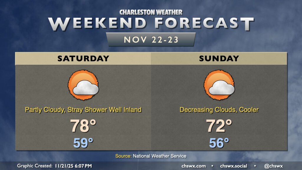
Another warmer-than-normal weekend lies ahead, though a front will restore at least a little order to temperatures for Sunday. First, though, a very mild Saturday lies ahead, with temperatures starting in the upper 50s, warming to the upper 70s to around 80° in the afternoon. A stray shower will be possible well inland, but the front will be generally making a dry passage overnight into early Sunday morning. It’s not a particularly potent front; temperatures will only drop a few degrees, but it will be a bit more seasonable regardless. Clouds will be on the decrease throughout the day, so sunshine will increasingly factor in.
Read more »
After a slightly cooler and more cloudy day courtesy of a backdoor cold front, temperatures will head back into the upper 70s on Friday as the aforementioned front washes out with high pressure moving offshore. We start the day in the mid-50s and perhaps with some fog. Cloud cover will gradually diminish as the day goes on, and we should have a pleasant close to the day as we head into the weekend.
Read more »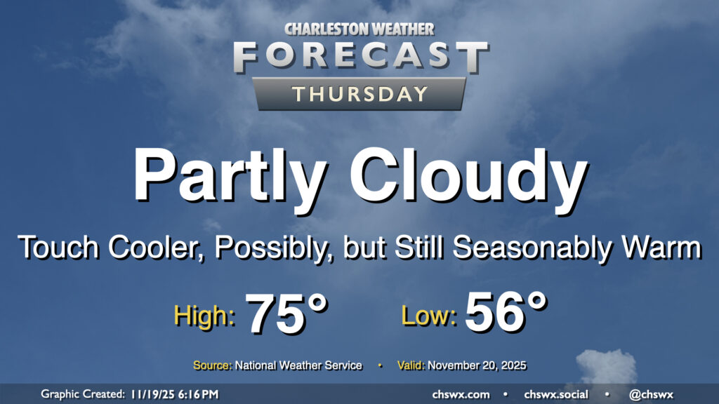
Warm temperatures continue for Thursday, though a nearby front and some more cloud cover will likely preclude temperatures from getting too out of hand. Wednesday’s highs were close to records for the date: 82° at the airport was just a degree shy of the record of 83° set in 1942, while 80° downtown missed the record of 82° set there in 1958. Depending on where the front hangs up, we may yet make another run at records, but the preponderance of the evidence suggests that we’re going to stay in the mid-to-upper 70s on Thursday. The front won’t come with much moisture, so an uptick in cloud cover is about it.
Read more »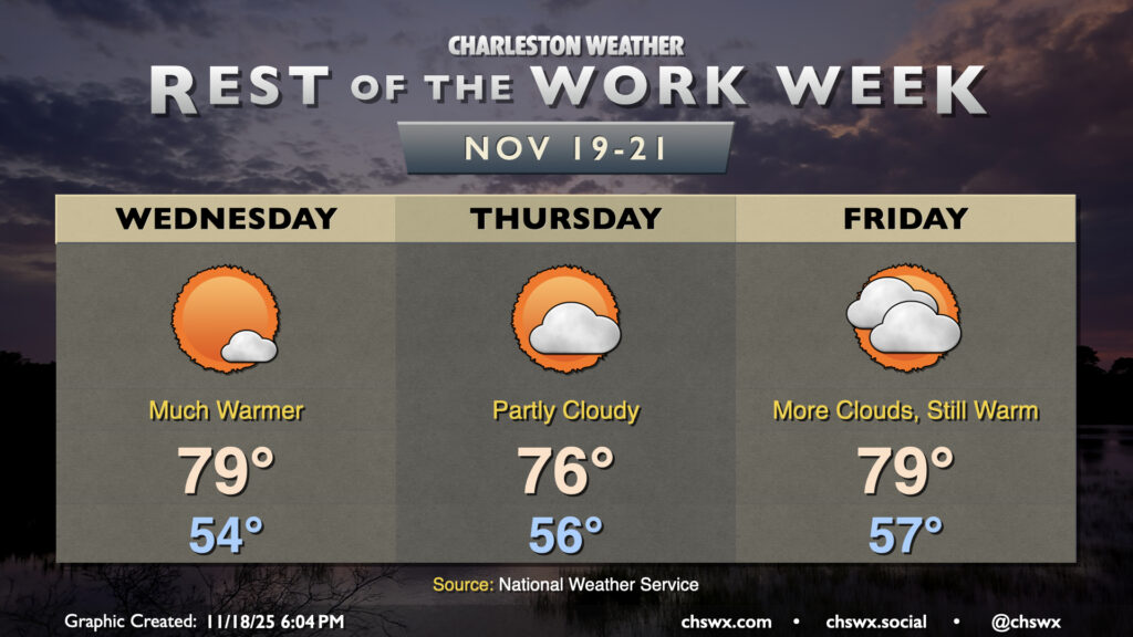
The main weather story for the rest of the work week will be unseasonable warmth courtesy of a ridge building in aloft. Temperatures will run well above normal, with highs approaching 80° particularly Wednesday and Friday (and maybe Thursday, depending on the position of a cold front to the north).
Read more »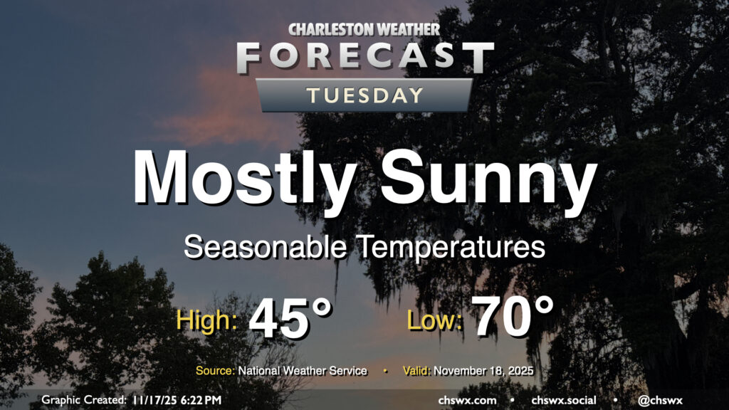
After a near-normal day of temperatures on Monday, we’ll look for a similar performance on Tuesday. Temperatures will start in the mid-40s across much of the area (a little warmer near the coast, a little cooler further inland), and highs will peak around 70° in the afternoon with mostly sunny skies remaining the rule. Winds will be going more southerly during the day as surface high pressure begins to shift offshore. This will set us up for a few days of rather warm temperatures starting Wednesday.
Read more »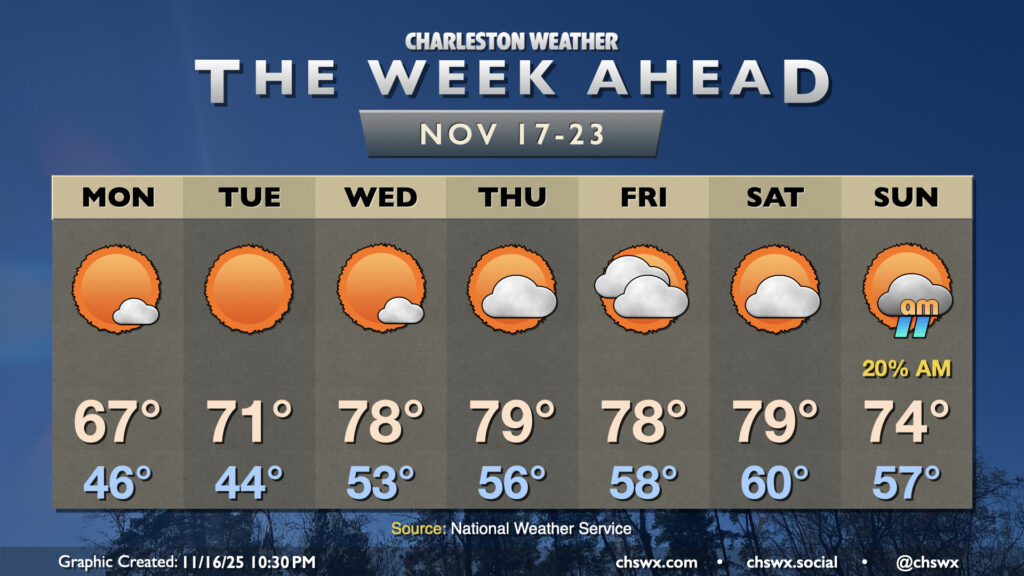
After a cold front brings a brief cooldown to the area on Monday, temperatures return to the 70s on Tuesday before heading well above normal for the balance of the week ahead with little rain in sight.
Read more »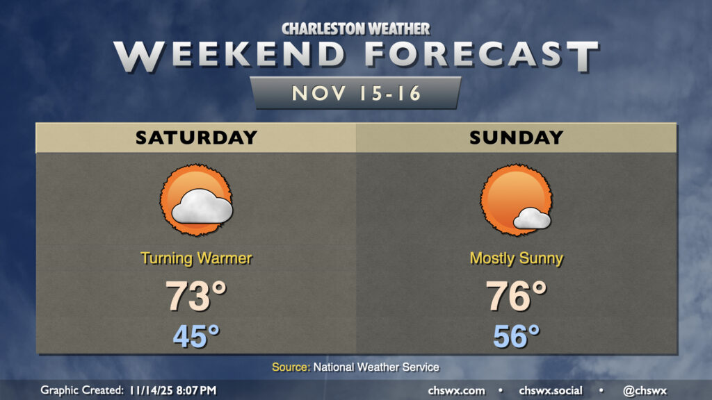
After a brief cooldown on Friday, temperatures head back above normal for the weekend as high pressure remains the dominant weather feature across the area. We’ll see the high that’s overhead as of Friday evening slip southward, sending wind directions a little more westerly to southwesterly, kicking temperatures back into the low-to-mid-70s on Saturday. Compressional heating ahead of an advancing cold front will send highs on Sunday solidly into the mid-70s after a warmer start in the mid-50s. This frontal passage once again looks dry thanks to a dearth of moisture; in fact, rain chances remain slim well into next week.
Read more »