Weekend forecast: Turning up the heat
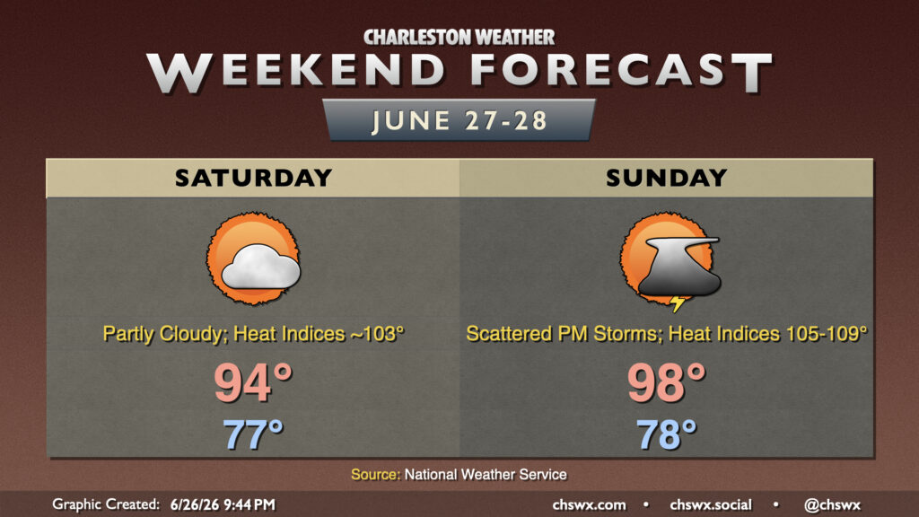
A hot weekend is ahead, especially on Sunday, as high pressure builds in aloft. A few of us could get some relief from a few thunderstorms, but that’s not a guarantee for everyone.
Read more »A hot weekend is ahead, especially on Sunday, as high pressure builds in aloft. A few of us could get some relief from a few thunderstorms, but that’s not a guarantee for everyone.
Read more »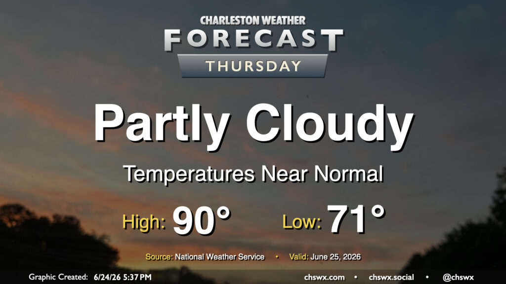
Another quiet day is on tap for Thursday with high pressure in control. Lows bottom out in the low 70s, warming to around 90° in the afternoon. Dry air (for this time of year, anyway) will hang on for one more day, though it will be a bit more humid than it was on Wednesday. High pressure and warm air aloft should keep a lid on thunderstorms for one more day as well.
Read more »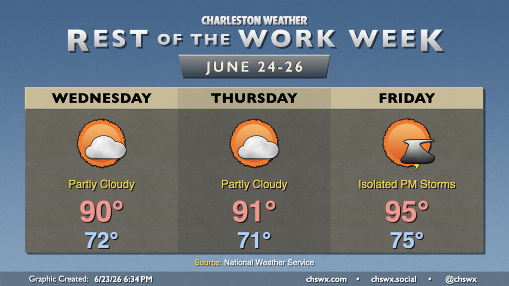
Generally normal summer weather continues for the rest of the work week, with a bit of an uptick in temperature as we head into Friday and the weekend.
Read more »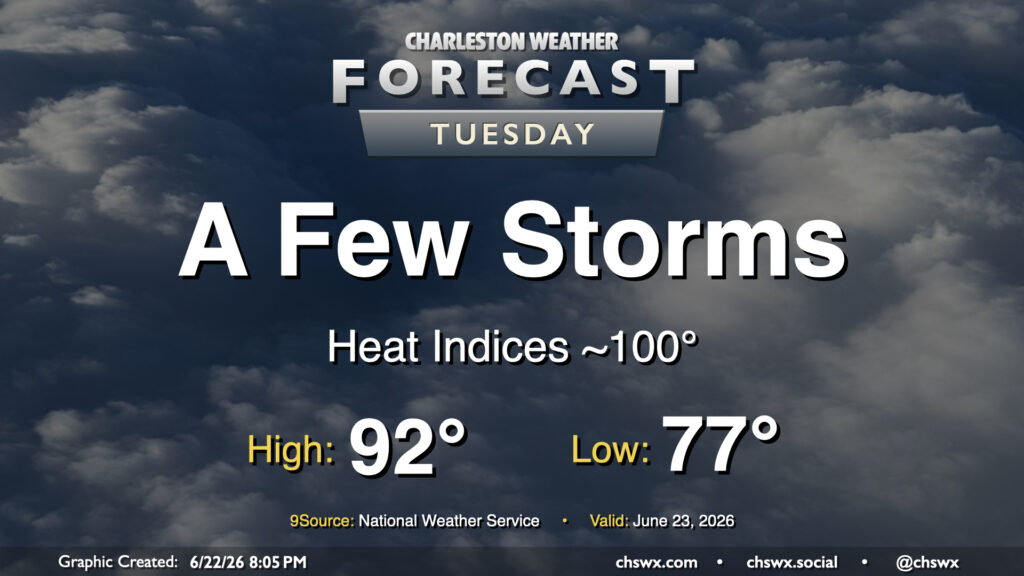
Standard summertime fare continues in the forecast for Tuesday with seasonably warm temperatures and a few afternoon thunderstorms. We’ll start the day on the warm side of normal ahead of a stalling cold front, with lows in the mid-to-upper 70s. The record warm low temperature at the airport for June 23 is 78°, set in 2024, and we may get close to that. From there, we’ll warm into the low 90s, but dewpoints in the low 70s will drive heat indices to around 100° at peak heating. We should see a few storms fire along and head of the seabreeze in the afternoon, though the convection-allowing models are rather sparse with coverage. If storms get going, there are some indications that a pocket of dry air in the mid-levels could help produce some gusty winds in addition to the usual heavy rain and lightning threat, so be alert for possible special weather statements or even warnings.
Read more »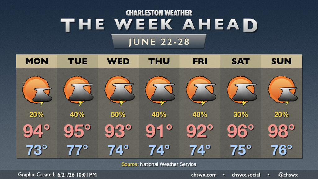
Weather worthy of the summer solstice will continue this week with highs in the 90s and a shot at afternoon thunderstorms each day.
Read more »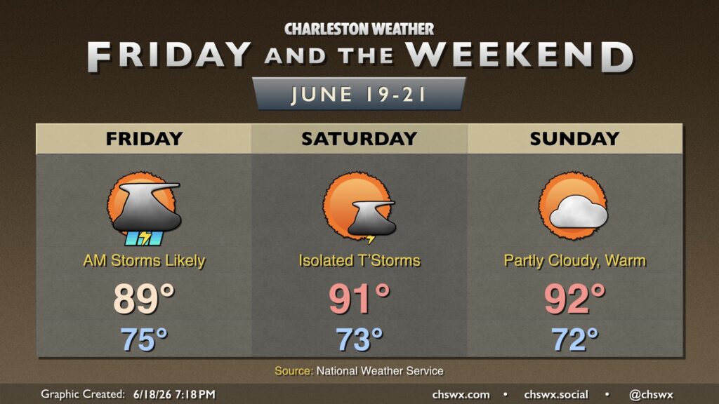
Unsettled weather continues as the remnants of short-lived Tropical Storm Arthur move across GA and South Carolina late tonight into early Friday. From there, more typical summertime weather sets in.
Read more »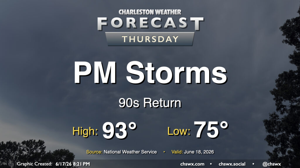
We’re back in the 90s on Thursday as we get a brief lull in between disturbances, but showers and thunderstorms will return in the afternoon and evening as a slug of moisture from what we expect will be the remnants of Tropical Storm Arthur, which was christened earlier today, There will be a risk for a storm or two to produce some damaging wind gusts, but the overall severe weather threat this far to the east is fairly marginal. Will keep an eye out, though.
Read more »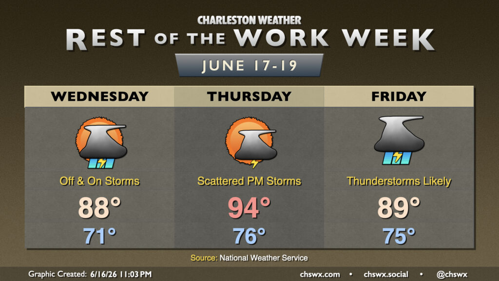
Unsettled weather sticks around for the rest of the work week as disturbances continue to move across the area, with a shot of tropical moisture enhancing rainfall heading into the weekend.
Read more »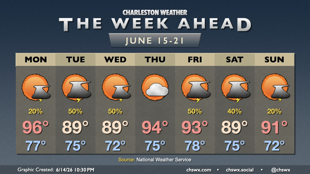
Fairly standard summertime weather continues for the week ahead, though we shouldn’t run quite as hot as we did this past weekend, with no record highs in jeopardy of being toppled this go-around.
Read more »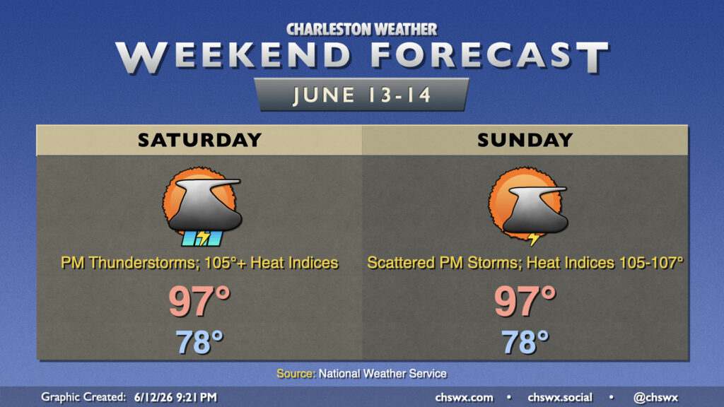
Heat, humidity, and chances for afternoon thunderstorms continue into the weekend, with the potential for not only record high temperatures but also record warm low temperatures each day.
Read more »