Jared Smith founded @chswx on Twitter in 2008 as an experiment in disseminating weather data through social media. In the ensuing decade-and-a-half, @chswx has provided live coverage of tropical cyclones, tornadoes, severe weather, and even a couple bouts of winter weather to the good people of Charleston, SC.
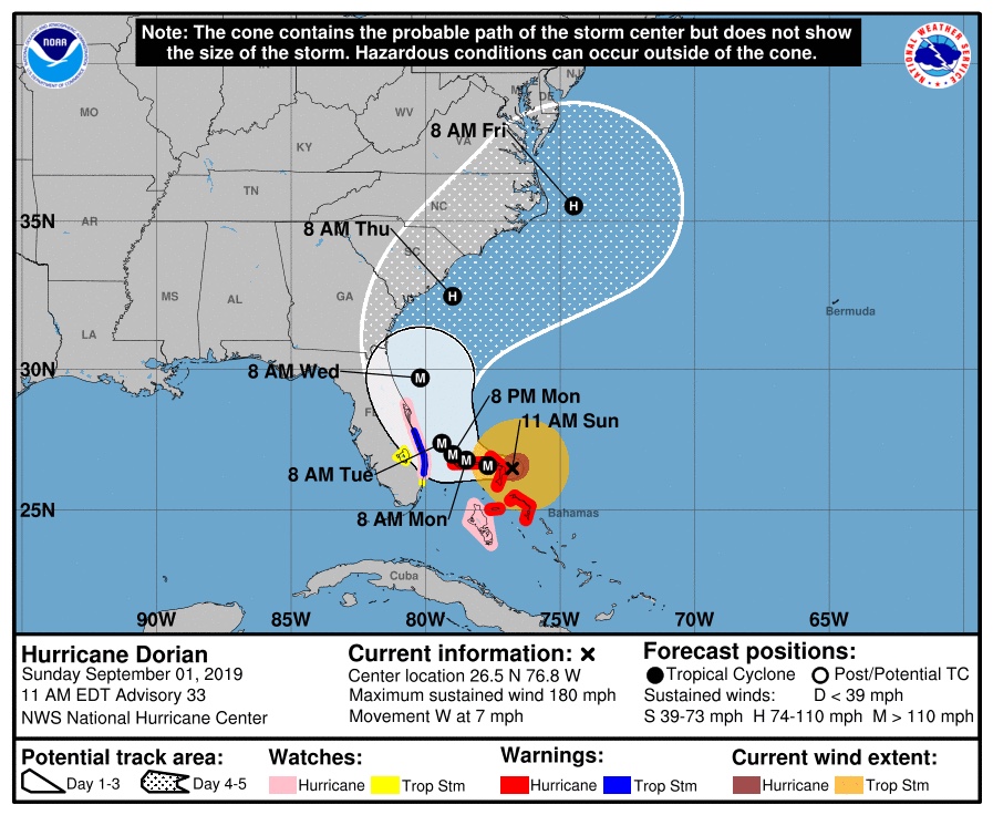
At 4 PM, Hurricane Dorian tied the third-strongest hurricane on record, the 1924 “Cuba” hurricane, in the Atlantic basin by pressure with a barometer reading of 910 millibars. Max winds are estimated at 185 MPH with gusts to 220 MPH. It is lashing the Bahamas with extreme wind and storm surge as it continues to slow down. We are watching intently to see when the storm will turn north. (The sooner, the better.)
The storm continues to pose a threat to the Southeast coast, including Charleston, for the middle of next week. Preparations for hurricane conditions should continue in the Charleston area, with the risk for greatest impacts Wednesday afternoon into Thursday.
The next full track and intensity forecast will be out at 5PM.
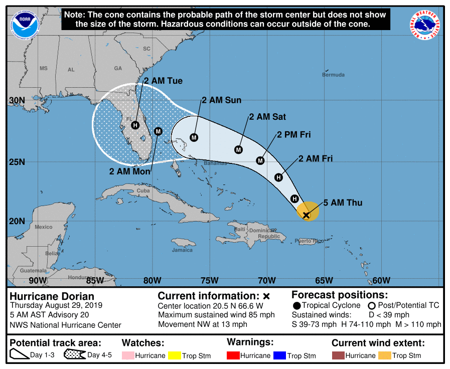
We in #chswx continue to monitor Hurricane Dorian’s progress in the southwest Atlantic. As of 5am, Dorian had maximum sustained winds of 85 MPH and was moving NW at 13 MPH. On the forecast track, it makes landfall somewhere along the east coast of Florida as a major hurricane on Labor Day.
Tropical Storm Dorian formed over the weekend, fighting dry air as it approaches the Lesser Antilles. It has a highly uncertain road ahead of it, but it may be something to watch as we get into next week.
The second half of 2019 will get off to a fairly hot start, with heat indices running in the low 100s each afternoon. Scattered thunderstorms will provide relief, particularly later in the week. (Must be July in Charleston.)
Welcome to the 2019 Atlantic hurricane season, which begins today (June 1) and lasts through November 30. This is the climatologically favored time for tropical systems to develop in the Atlantic basin (though we have had our fair share of May storms, including Subtropical Storm Andrea a few weeks ago). A fact of life of living in the Lowcountry — which is a really wonderful place! — is that we are susceptible to tropical cyclones, and as such, must be prepared for the possibility that one may approach the area.
It’s been a while since I’ve been able to say this, but here goes:
The record high of 98°, set in 1953, is safe today.
Temperatures will only top out in the mid-90s before thunderstorms — yes, thunderstorms with actual rain — start to develop by mid-afternoon. A few of these thunderstorms may be on the strong side, though.
We continue to rewrite the record books as a strong ridge of high pressure remains firmly entrenched over the Charleston area, with three straight days of 100° temperatures and counting. The streak may continue for one more day, followed by a gradual falloff of temperatures (and a small increase in shower and thunderstorm chances) as we get into the weekend.
After a record-breaking Memorial Day weekend, the heat wave continues as stifling high pressure remains in force over the Charleston metro area. Temperatures approaching the century mark away from the immediate coast are once again expected. While heat indices will not pose a major issue, low humidity will instead elevate the wildfire risk. Changes are coming later this week, though.
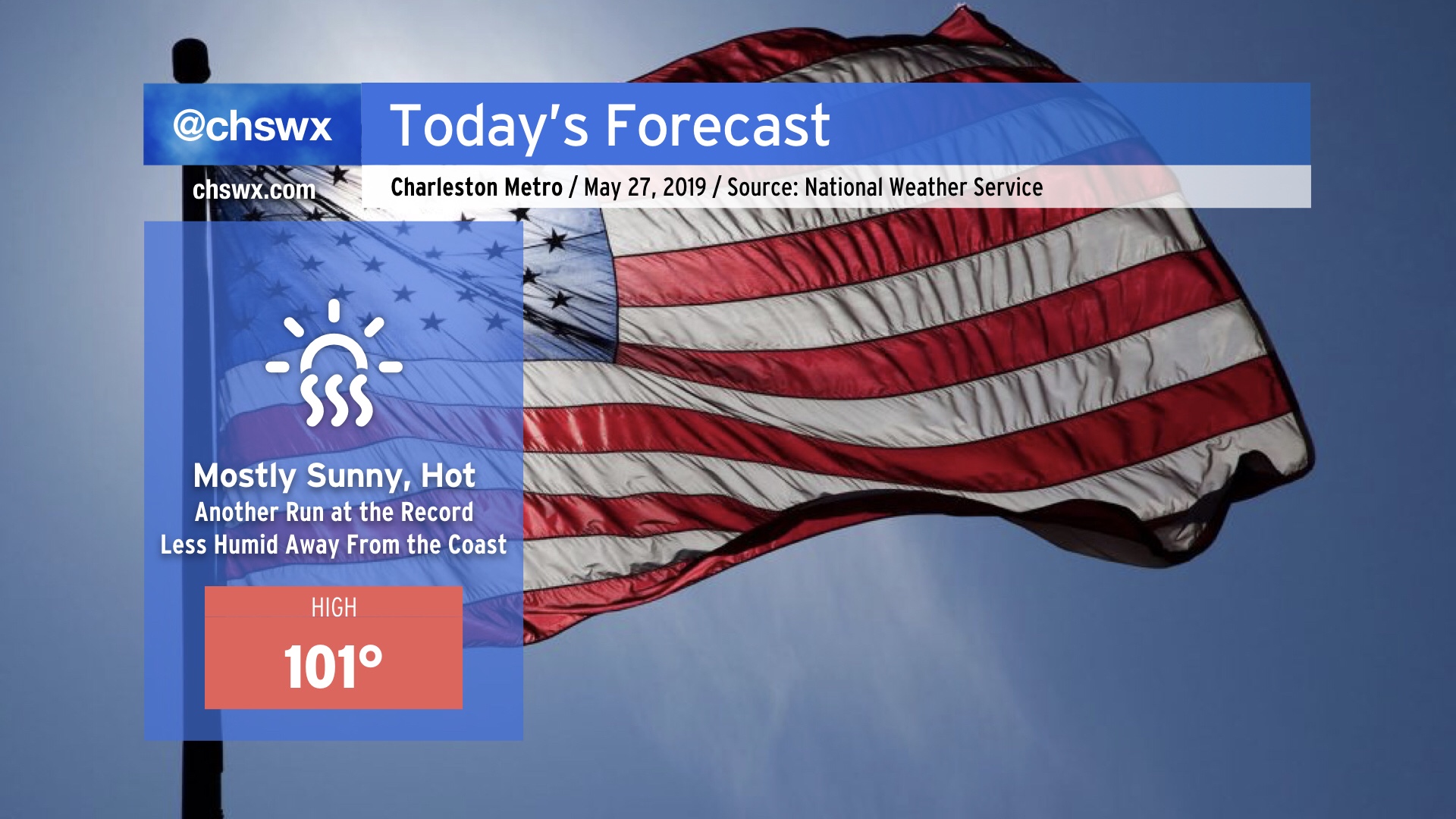
We will make another run at the century mark today, with a decent chance of at least tying the all-time May high temperature record set yesterday (100°). In fact, this morning’s NWS forecast has the airport breaking that record once again today. While there is no Heat Advisory today as heat indices will remain below 105° (pre-July 1 threshold), it will still be plenty hot (even at the beaches, where low 90s are possible) and you should still keep heat safety precautions in mind when observing Memorial Day today.
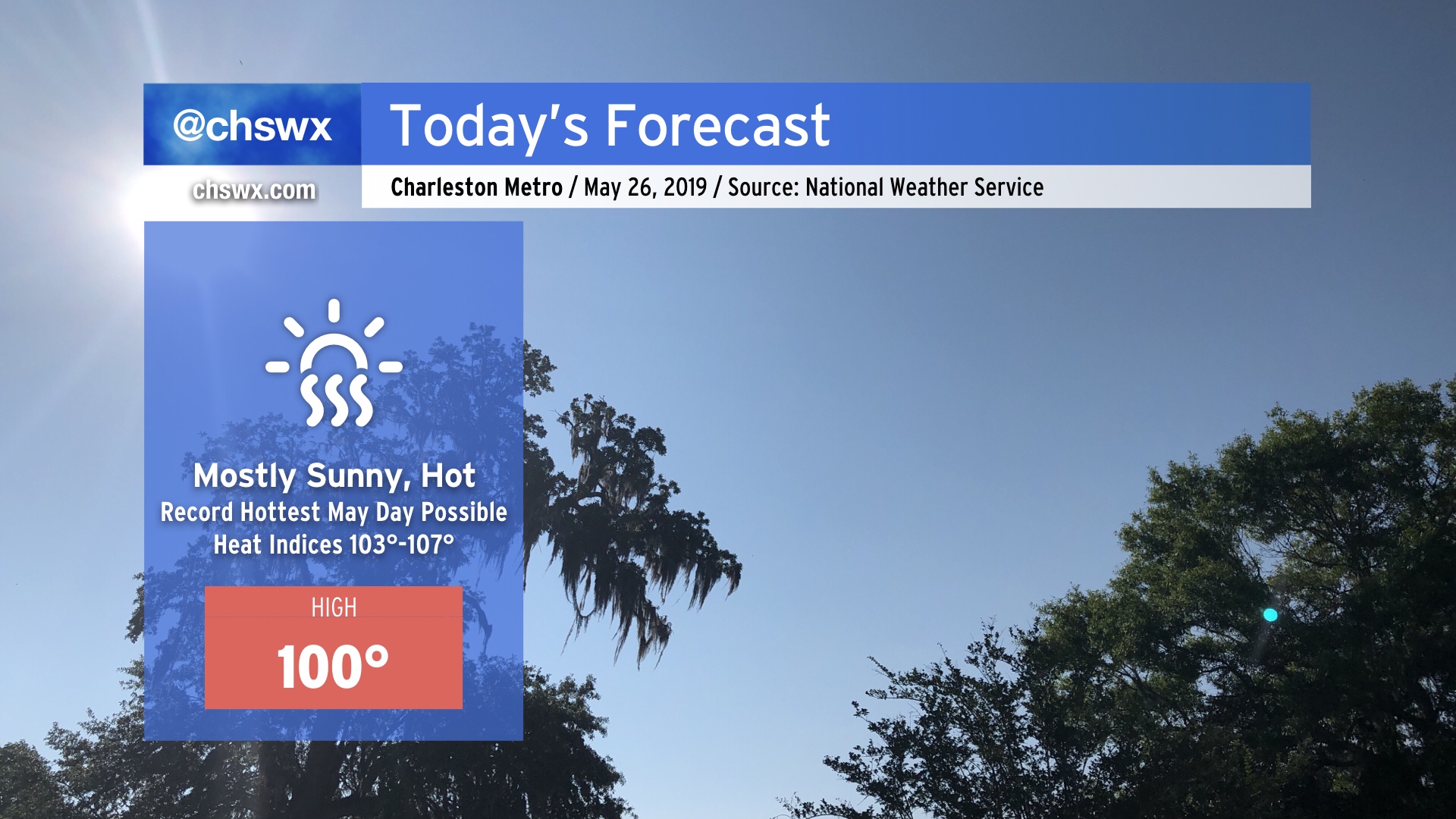
Temperatures are expected to hit 100° away from the coast this afternoon. If this forecast verifies, it would be the earliest a 100° temperature has been recorded at the North Charleston climate site since records began in 1938. Combined with humidity, this will feel more like 103°-107°. Heat Advisory will be in effect from 11am-8pm. Heat safety is a must today — fluids, shade, rest! More on the heat wave later today.