Jared Smith founded @chswx on Twitter in 2008 as an experiment in disseminating weather data through social media. In the ensuing decade-and-a-half, @chswx has provided live coverage of tropical cyclones, tornadoes, severe weather, and even a couple bouts of winter weather to the good people of Charleston, SC.
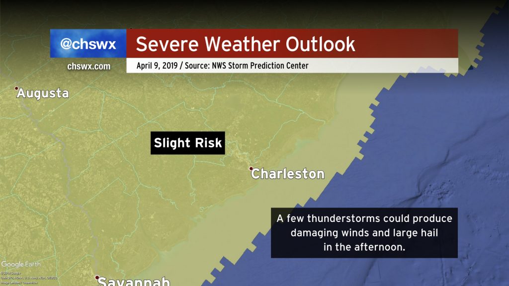
Be weather-aware today as a few thunderstorms could produce damaging winds and large hail this afternoon. A stacked low pressure system will continue its approach to the Charleston area this morning. As it gets closer, some drier air may filter in and break up the cloud cover we’re seeing, improving instability. The forcing from the low and some upper-level energy will allow for thunderstorms to develop this afternoon (think 1-2 PM). The strongest storms could bring some trees down and produce hail the size of quarters.
Thunderstorms will be possible well into the evening, but the window for severe weather appears to be 2PM to 8PM.
Be sure you can hear weather warnings this afternoon. NOAA Weather Radio and smartphone apps from local television stations are a great way to go about this.
More drought relief is on the way for Monday as energy from a storm system makes its approach to the Lowcountry. This beneficial rain may come with a few strong wind gusts, though.
A period of unsettled weather begins today and will last through the weekend. No washouts in store, but be ready for scattered showers and even some thunderstorms. With a lot going on outside this weekend, you’ll want to stay weather-aware.
High pressure will stay in control of our weather for one more day ahead of an upper disturbance and cold front. Highs will moderate to the mid-70s under southerly flow on the western edge of the high pressure system. Rain chances look to hold off until early Friday morning. Enjoy the day! Look for more details on Bridge Run and Flowertown weekend later today.
Tuesday may be one of the busier weather days we’ve had so far in 2019 as low pressure is expected to brush the coast with strong, gusty winds and a bout of heavy (yet much-needed) rainfall. This may have impacts on the morning commute.
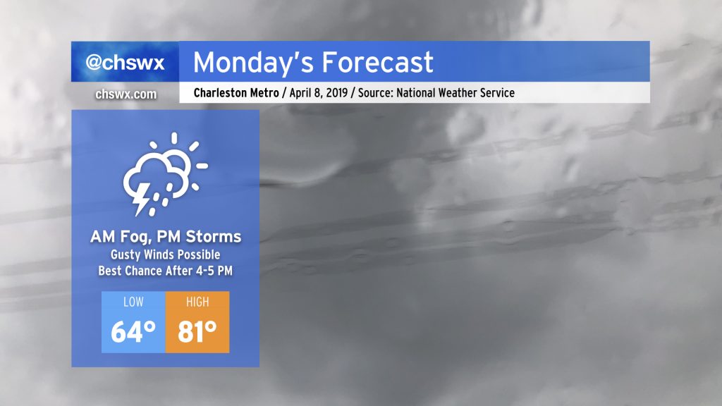
No fooling: It’s not going to get out of the 50s on Monday. (Nor will it on Tuesday.) The good news is that we may actually see something resembling substantial rainfall across much of the area for the first time all year. Will it be enough to bust the drought?
A nearly flawless Spring Break week (weather-wise, anyway…) will close with a nice warmup as temperatures surge into the upper 70s and perhaps the 80s to end March. Changes are coming, though — the transitional season of Spring is not through with us yet.
Weather-wise, we have a pretty tranquil week ahead (save for maybe a shower or two overnight Wednesday into Thursday morning). We’ll just need to keep an eye on tides with a full moon in perigee (“Supermoon!”) this week.