Jared Smith founded @chswx on Twitter in 2008 as an experiment in disseminating weather data through social media. In the ensuing decade-and-a-half, @chswx has provided live coverage of tropical cyclones, tornadoes, severe weather, and even a couple bouts of winter weather to the good people of Charleston, SC.
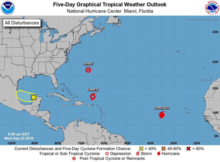
The tropical Atlantic basin remains fairly active: While Jerry is no longer a tropical cyclone, it continues to spread strong winds and heavy rain across Bermuda. Lorenzo, well out in the Atlantic, has strengthened to a hurricane and is no threat to any land at this time.
By the time some of you read this, the autumnal equinox will likely have passed (3:09 am), ushering in astronomical Fall. (It’s been meteorological fall since September 1.) Don’t tell that to Ma Nature, though. High pressure aloft is re-establishing itself, ushering us back into what is effectively a very summer-like pattern for the upcoming week.
We have a really nice weekend of weather coming up as high pressure remains firmly in control across the area. Cool starts will give way to comfortably warm afternoons with highs in the mid-80s and low humidity. Rain chances are nil, and we should see plentiful sunshine throughout the weekend.
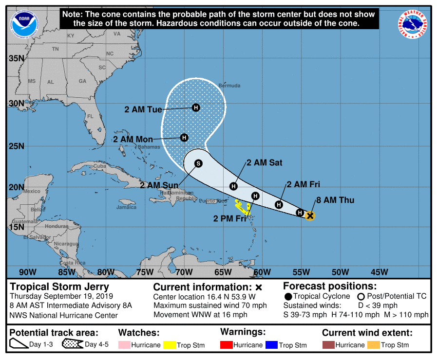
So let’s start with the good stuff: Model agreement has continued to improve regarding Tropical Storm Jerry’s future path, and that path is toward recurvature way from the US East Coast this weekend. (Bermuda, which just took a pretty good whooping from Humberto, will want to watch Jerry with wary eyes.) But, for Charleston, Jerry increasingly looks like a storm about nothing. It is forecast to become a hurricane later today, but will encounter hostile upper-air conditions that will limit its further development, according to the Hurricane Center. This should preclude the stronger solutions and a more southerly track as seen in a few of the global guidance members that we discussed yesterday.
Tropical Depression Ten strengthened overnight, having reached Tropical Storm status and the threshold to receive a name. The name most of us thought this system would get was Imelda, but a tropical depression formed quickly near the Gulf Coast yesterday and was named within an hour’s time. Imelda is already inland, so we are now watching Tropical Storm Jerry as it churns in the Atlantic, 960 miles east of the Leeward Islands (and a lot farther than that from Charleston!)
A warm start to the work week will give way to a taste of fall to close it out. (I mean, my goodness, 82° and fair skies on Thursday? Pinch me!) Plus, no worries about the tropics for the foreseeable future, either. Here’s a look at the week ahead…
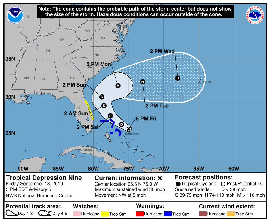
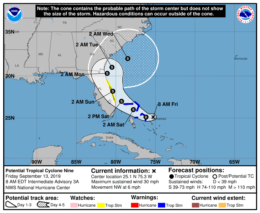
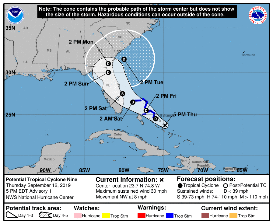
We now have Tropical Depression Nine in the Atlantic after a closed circulation was found. It has maximum sustained winds of 30 MPH and it moving NW at 8 MPH. It is expected to become Tropical Storm Humberto tomorrow as it moves very near the Abaco Islands.
Potential Tropical Cyclone Nine, which is forecast to develop into Tropical Storm Humberto by tomorrow, continues to bring breezy conditions and rain to the Bahamas, who totally need such a thing right now. We continue to monitor this storm for potential impacts to our weather next week, but there is still serious uncertainty that has not yet been resolved in the models. So, we watch and wait.
The National Hurricane Center has started advisories on Potential Tropical Cyclone Nine. This is a wave that has not yet become a tropical cyclone, but the probability of it becoming one is high enough for NHC to issue Tropical Storm Warnings for the Abaco Islands and Grand Bahama — exactly where they are not needed. If named, PTC 9 would be Humberto.
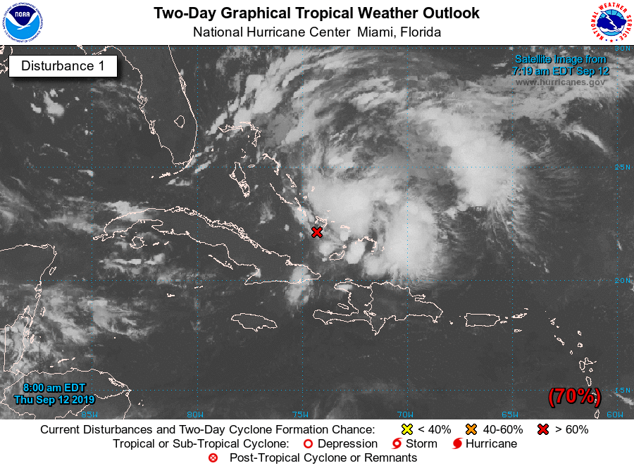
The National Hurricane Center is watching an area of disturbed weather affecting the Bahamas for potential tropical cyclone development. This wave has been watched closely for the last few days, and probabilities for development have been rising. It now appears likely that we will see a tropical depression form in the next couple days. If it becomes named, it would be named Humberto.