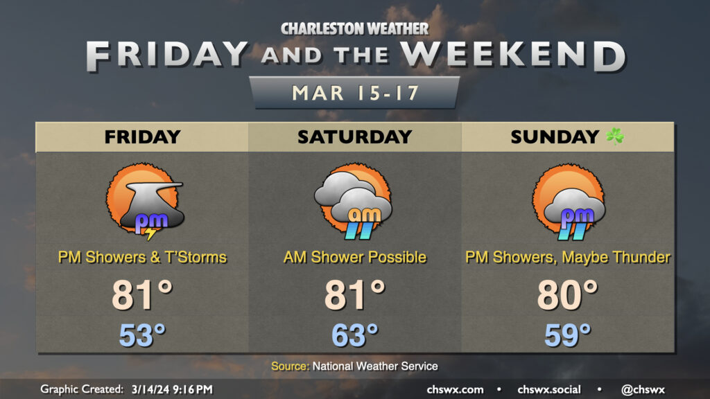
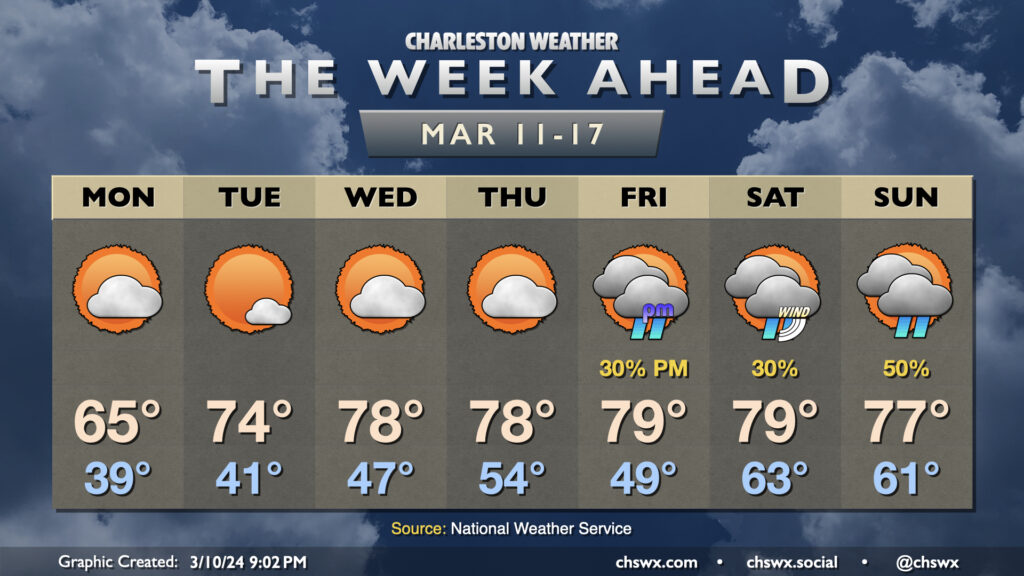
High pressure will lose its grip on the area for Friday and the weekend, allowing some periods of unsettled weather to move in — but don’t fret as we’ll have plenty of rain-free time as well. It’ll stay quite warm, too, with 80s expected each afternoon.
We’ll at least get Friday morning in rain-free ahead of a disturbance that’ll push a cold front into the area Friday afternoon and evening. Showers and a few thunderstorms will be possible by mid-afternoon leading into the commute, but not before we warm back into the 80s once again. A strong storm may not be totally out of the question west of 17-A, but high-res guidance generally shows storms in a weakening trend as they push eastward toward much cooler shelf waters.
Shower and thunderstorm chances persist overnight Friday into Saturday morning before what looks like a break in the action for much of the day. Temperatures start quite mild — think low to mid-60s — and warm back to the low 80s in the afternoon under a mix of sun and clouds. Shower chances should hold off Saturday night and into a good bit of Sunday before returning later in the afternoon and into the evening as another front approaches the area. This front shakes us out of our run of 80s and back below normal for Monday and Tuesday of next week.
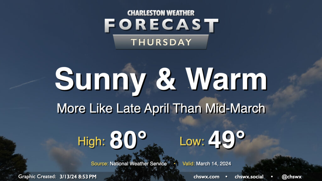
Thursday looks like an excellent weather day across the Lowcountry, something out of the late-April playbook but in mid-March. We’ll start the day around 50° once again, warming to the low 80s in the afternoon with maybe a few clouds amongst otherwise clear skies as ridging aloft strengthens briefly for the day. Expect winds generally in the 5-10 MPH range, picking up a little in the afternoon in the wake of a sea breeze. Enjoy!
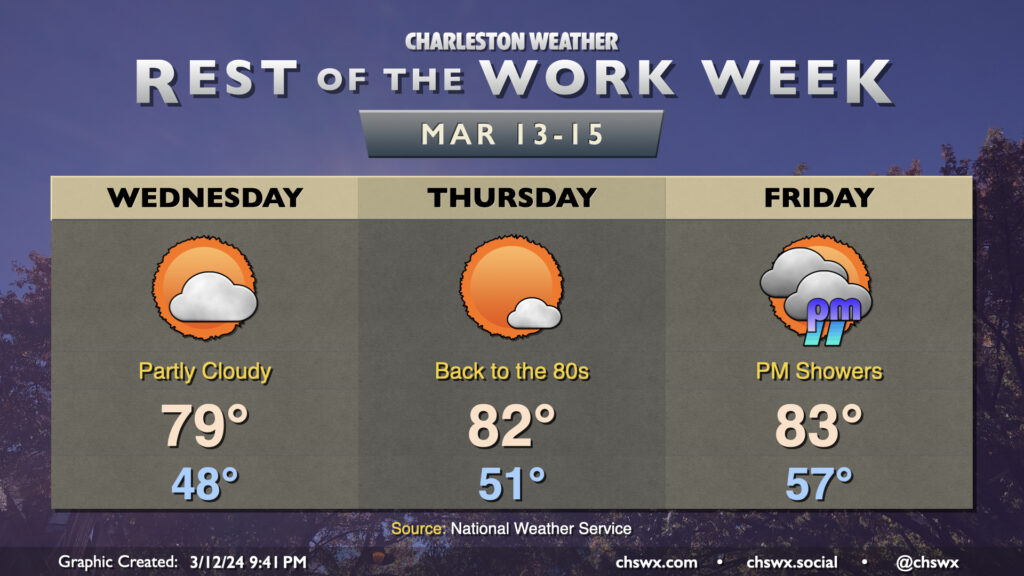
The rest of the work week will be much warmer than mid-March normals as high pressure ridges across the area at the surface and aloft. Temperatures on Wednesday will start in the upper 40s, warming to near 80° in the afternoon under partly cloudy skies as a weak disturbance ripples across the area, bringing only an uptick in cloud cover and little else given such a dry atmosphere at the surface. Thursday will see us solidly back in the 80s once again with just a cloud or two at times as high pressure will be strongest that day. We’ll start to see cloud cover come back up for Friday as high pressure gets shunted offshore by the next storm system, though it’ll still be a very warm day by mid-March standards as lows bottom out in the mid-50s with highs warming to the low 80s in the afternoon. We should get much of the day in rain-free, though a shower or two will be possible as we get into the late afternoon and evening hours.
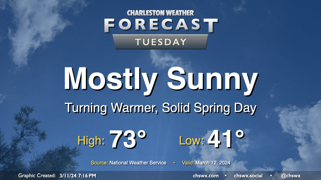
After one more somewhat chilly night — expect low 40s across much of the metro, with mid-to-upper 30s possible further inland — we start a warming trend that’ll get us into the 80s by the end of the week. Tuesday looks rather delightful: expect highs to top out in the low 70s away from the locally cooler coastline. Comfortably dry air will be in place with relative humidity bottoming out around 30% in the afternoon, and we’ll keep a solid amount of sunshine throughout the day. Winds will start to swing more southwesterly in the afternoon and kick up to around 5-10 MPH. Not bad!
The week ahead will be largely marked by high pressure before the next storm system starts to affect the area just in time for St. Patrick’s weekend. (Sorry.)
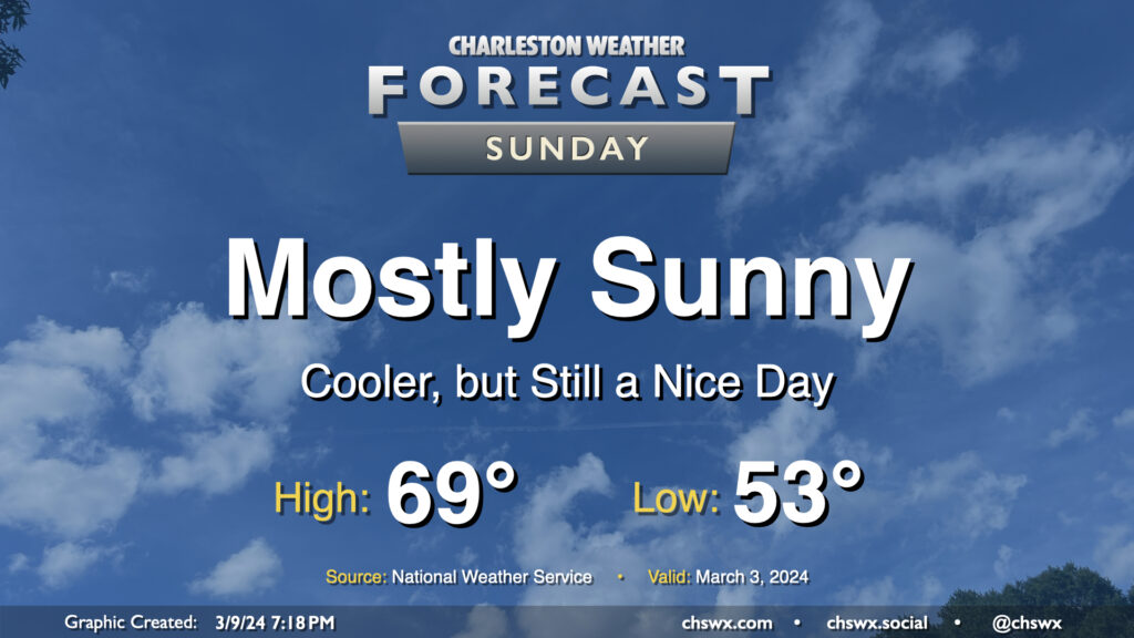
After the cold front that helped instigate quite a busy morning of weather gets offshore, we end up with a rather nice Sunday as cloud cover clears out, leaving mostly sunny skies in its wake. Temperatures will start in the low 50s and warm to the upper 60s to around 70° in the afternoon. The only fly in the ointment will be the breeze: expect gusty conditions throughout the day as high pressure builds in, with winds 10-15 MPH perhaps gusting to 25-30 MPH at times.