Rest of the work week: A couple days of quiet, then a stormy Friday
After a day of weather that went more or less as advertised, we get a couple days to dry out before another round of showers and thunderstorms — and maybe some more severe weather — arrives on Friday.
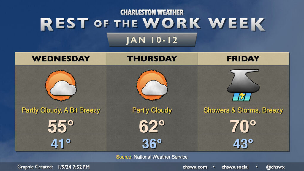
We will stay breezy Wednesday, particularly in the morning, as cooler and drier air blows into the area behind a cold front. We start the day in the low 40s and warm to the mid-50s in the afternoon. A few clouds will be around, but overall it’ll be much sunnier than Tuesday. (Not hard to do!)
Thursday will feature calmer winds and a chillier start. We’ll begin the day in the mid-30s before warming to the low 60s in the afternoon under partly cloudy skies. It should be a fairly quiet, nice day of weather overall.
The quiet doesn’t last, though, as another storm system affects the area on Friday. While it won’t be as windy of a system as Tuesday’s was, it will still bring with it a fairly well-sheared environment which, if paired with enough instability, could yield another round of severe weather. The Storm Prediction Center has the area outlined in a 15% severe weather risk in the Day 4 outlook; we’ll see how this evolves as the rest of the week wears on. For now, though, don’t let the weather radio stray too far…we might need it again later this week.
Read more »