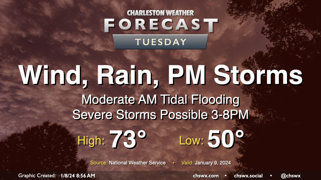
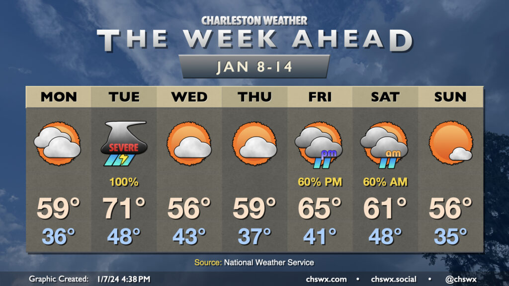
An unusually potent storm system will affect the area on Tuesday, bringing strong, gusty non-thunderstorm winds, some tidal flooding in the morning, and a squall line in the afternoon and early evening that could bring a swath of damaging winds and maybe a few tornadoes on its leading edge.
The active weather pattern we’ve found ourselves in for the start of the year continues this week as we’ll see at least two storm systems visit the area, with quiet and generally cool weather days interspersed between them.
Monday will feature increasing clouds and a steady east to northeast breeze as high pressure wedges southward. We start the day in the mid-30s and warm to around 60° in the afternoon with clouds steadily increasing ahead of Tuesday’s storm system. Late Monday, a warm front will lift north of the area, which may bring some scattered showers along with it, but we should get much of the daylight hours, if not all of them, in rain-free.
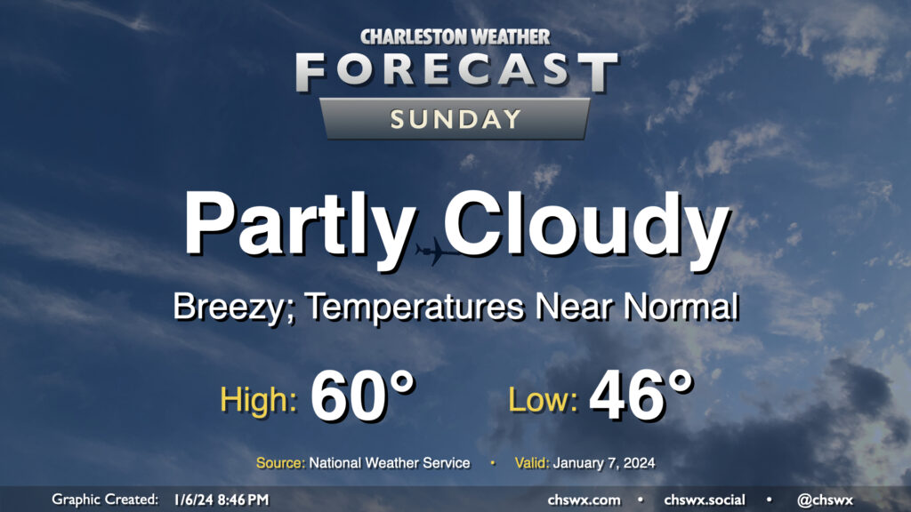
After a rather warm Saturday — the warmest day of the young year so far with a high of 75° — temperatures return to normal on Sunday as cooler and drier air blows in behind a cold front. We start the day in the mid-40s, but the ongoing cool air advection will hold highs to around 60° in the afternoon despite partly cloudy to mostly sunny skies. It’ll be another breezy day; expect winds generally 10-15 MPH out of the west with gusts approaching 25-30 MPH once again.