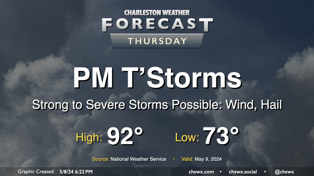
We get off to a warm start on Thursday — expect lows to only bottom out in the low to perhaps mid-70s with highs topping out in the low 90s and humidity making it feel closer to the upper 90s. The main weather story, though, will be the risk for some strong to severe thunderstorms moving through Thursday afternoon and into the evening. These could pack strong and potentially damaging wind gusts along with large hail. Exact timing is still unclear, but there is a risk these could coincide with the commute, so we’ll want to watch them closely. Stay close to reliable weather sources throughout the day for updates.
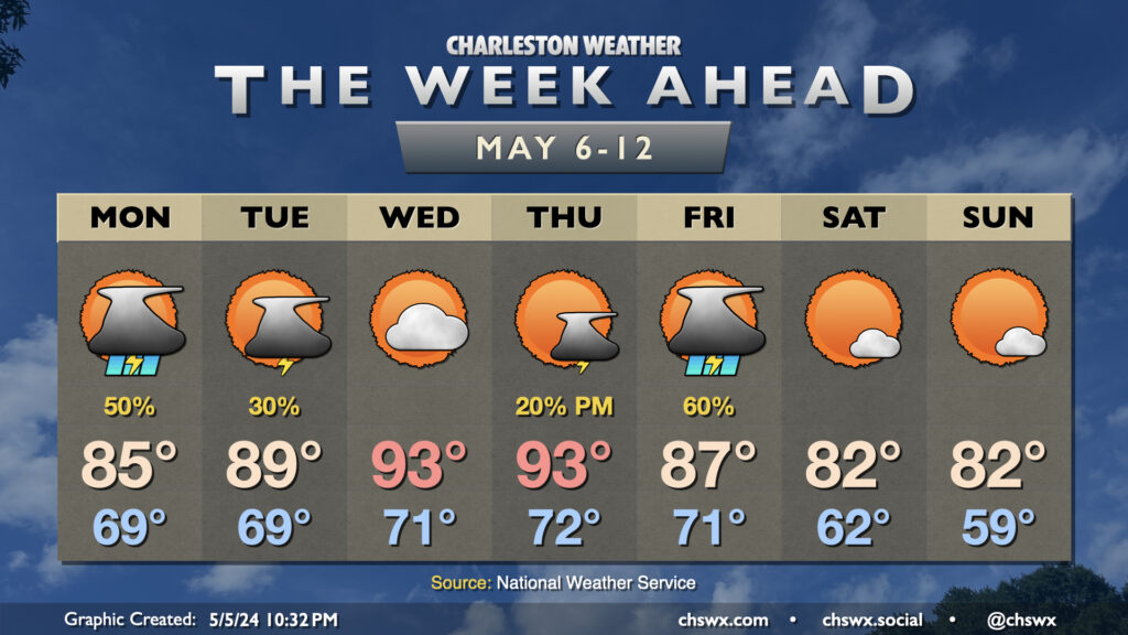
We reached 90° on Tuesday, the third 90° high of the year and the first time since April 20, when we reached 91°. We turn even warmer for Wednesday and Thursday as high pressure ridges over the area. Wednesday will feature highs in the low-to-mid-90s under mostly sunny skies. Heat indices won’t get too out of bounds, but it’ll still feel a touch warmer than the air temperature will indicate.
High pressure remains in control to start Thursday, sending us to the mid-90s in the afternoon with heat indices in the mid-to-upper 90s possible. A storm system will approach the area, though, and this will help ignite showers and thunderstorms later in the afternoon and evening. Given the moist, unstable, and decently sheared environment, a few of those storms could turn strong or severe. We’ll keep an eye on how things evolve further to our west Wednesday as they’ll inform the situation locally on Thursday. Stay tuned.
Showers and thunderstorms feature prominently in the forecast on Friday as a cold front moves through. A couple stronger storms still can’t be totally discounted in this scenario, though the risk looks lower than Thursday at this point. Temperatures will be governed by clouds and rain, topping out in the mid-80s. Once the front gets through late Friday/early Saturday, cooler and drier air moves in for what should be a rather nice weekend!
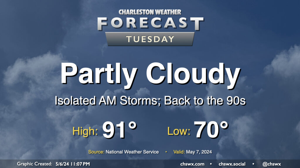
We may contend with a storm or two in the morning, but the weather story for Tuesday will be the return of the 90s in the afternoon. It’ll be a warm start with lows around 70°, but as the ridge aloft builds in, highs top out in the low 90s. If there’s one bit of good news here, it’s that it’s not summer-humid just yet, and dewpoints should run in the mid-60s, keeping heat indices reasonably in check. Cloud cover will be diminishing throughout the day as well, so expect plenty of sunshine as we get into the afternoon and evening hours.
The upcoming week will be on the warm side as ridging aloft builds in, sending mid-week temperatures well into the 90s and perhaps into record territory.
First, though, we deal with another round of scattered showers and thunderstorms for Monday. Temperatures on Monday start once again in the upper 60s to near 70°, warming to the mid-80s as one last upper disturbance makes its way through. We should see thunderstorms fire up around or a little after midday and generally remain scattered in nature. A few heavy downpours will be possible, and a strong storm can never be totally discounted near where boundaries collide — and on the flip side, some of y’all might not see any rain at all. (That time of year!)