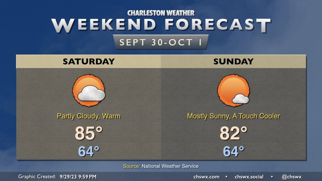
Overall, the weekend forecast is looking solid for doing stuff outside. Expect comfortable starts in the mid-60s (warmer at the beaches), more than ample sunshine (especially Sunday), and warm afternoons with high pressure in control. Saturday looks to be the warmest day of the set with highs topping out around 85° in the afternoon. A reinforcing round of slightly cooler air moves in for Sunday, and that will help cap highs in the low 80s.
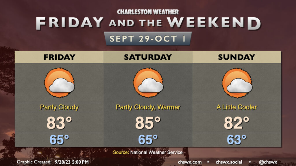
After a fairly cool and cloudy day on Thursday, cloud cover breaks up a bit for Friday into the weekend, and this will allow temperatures to return to the low to mid-80s each afternoon. Temperatures will peak Saturday before a little cooler air works into the area Sunday. Overall, it looks pretty good to get out and do stuff, especially with the northeasterly winds backing off a bit more as the pressure gradient relaxes.
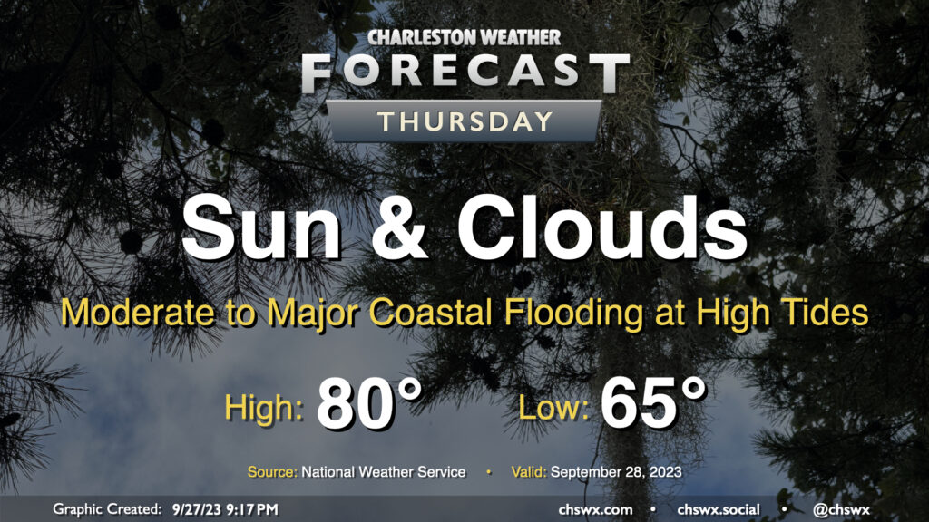
Rain will generally be a non-factor in our weather starting Thursday (except for maybe some brushes near the coast) heading into Friday and the rest of the weekend. We start the day around 65° with some cloud cover in the area. A northeasterly breeze courtesy of high pressure wedging into the area from the northeast will continue to keep temperatures down to about 80° at warmest in the afternoon with cloud cover hanging around. We should see some sun break through at times as well, though.
The main weather concern will be coastal flooding at times of high tide, and it could be somewhat disruptive to the morning commute in particular. High tide around 7:30am will top out around 7.9′, which is the high end of moderate flood stage in Charleston Harbor. The evening high tide should reach even higher, with water levels around 8.1′ expected around 8pm. Watch for road closures as you commute Thursday morning and then again a little later Thursday evening, particularly if downtown is in your plans.