Friday and the weekend will feature another round of warm temperatures, with heat indices running 105-110° by the weekend, and a solid chance of thunderstorms each afternoon and evening. We’ll start each day in the upper 70s — perhaps not getting below 80° downtown and at the beaches — before warming to the mid-90s each afternoon. Surface dewpoints running solidly in the mid-70s will yield heat indices approaching 105° on Friday. The weekend should peak even hotter, with heat indices approaching 105-110° each afternoon. Stay tuned for the potential for Heat Advisories from the National Weather Service.
From there, showers and thunderstorms will fire each afternoon along and ahead of the seabreeze. Heavy rain and frequent lightning will be the main concerns, though the stronger updrafts found where outflow boundaries collide could be capable of producing a marginally severe storm or two with damaging wind gusts the main concern. As is often the case in July, it will not rain all day, and some of you may not see rain every day. Just be ready to bring outdoor activities inside in case thunderstorms approach. Severe or not, lightning makes every thunderstorm dangerous. “When thunder roars, go indoors!”
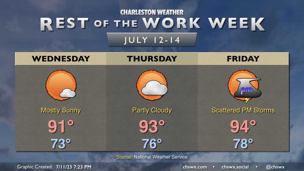
Expect one more generally quiet weather day on Thursday (though a shower or storm can’t be ruled out in the afternoon, especially further inland) before things turn more unsettled as a trough digs in for Friday and the weekend.
Another day or two of quiet weather is expected as deep-layer dry air remains in place over our part of the world, suppressing thunderstorm development and keeping temperatures a little more in check. Wednesday looks pretty good by July standards, with mostly sunny skies and highs in the low 90s expected. Surface dewpoints in the low 70s should yield a peak heat index around 99°, generally after the seabreeze moves by. Thursday will run a degree or two warmer with a little bit more in the way of cloud cover as moisture starts to tick up somewhat. Peak heat indices should run around 100° during the mid-afternoon hours.
We get back to a more traditional July pattern of afternoon thunderstorms on Friday as more humid air begins to work back into the area. We start the day in the upper 70s and top out in the mid-90s before scattered thunderstorms develop in the afternoon and evening hours along the seabreeze. Heat indices could top out above 105°. We’ll keep this going into the weekend, too, with the potential for advisory-level warmth (heat index 110°+ for two hours) and scattered thunderstorms as the main weather concerns for outdoor activities.
Somewhat drier air (aloft, anyway) moving into the area Tuesday will put an end to the soggy weather for a few days, though an isolated afternoon thunderstorm does remain possible. We start the day in the low 70s — the coolest start to a day since June 28 — before warming into the low 90s in the afternoon. While the drier air will provide for generally partly cloudy skies amidst a somewhat brilliant blue sky, it’ll still be fairly humid at the surface; expect heat indices to peak around 100° in the afternoon as the seabreeze moves by. All in all, though, we should have plenty of sun to help sop up this latest round of heavy rain.