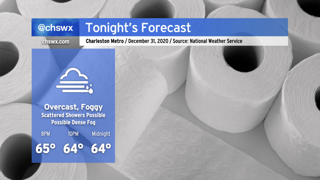
It’ll be a warm but overcast night across the area as we flush 2020 and try again in 2021. Temperatures will hold in the mid-60s as the clock turns midnight, owing to the muggy airmass in place. Said muggy airmass will allow fog to develop later this evening as well; some patches of it may become dense, and NWS notes in its discussion that a Dense Fog Advisory could be required.
Watch out for a few scattered showers coming in from off the ocean this evening as well, but the bulk of the activity looks to remain northwest of here as rain continues to fall into the remnants of the cold air damming regime. Depending on where the front ultimately ends up, we could see that enhanced rain risk come a little closer to 17-A, but we’ll keep an eye on it.
Overall, it’s not the worst weather to end 2020 with, especially considering how this year has gone. I wish you all a very Happy New Year!
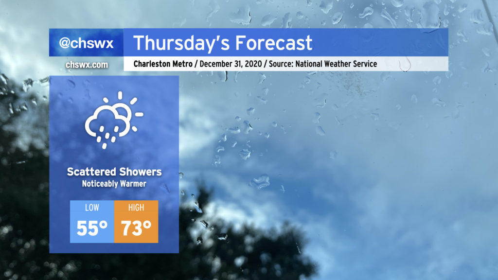
We’ll say goodbye to 2020 with quite a few choice words, warm temperatures, and perhaps a few showers mixed in at times. Showers will be possible at any point during the day Thursday, including up to midnight, so keep rain gear close if you are out and about.
Temperatures will turn noticeably warmer, with highs recovering into the 70s as we enter the warm sector ahead of our next storm system, which will hang around for a few days before clearing the area Sunday.
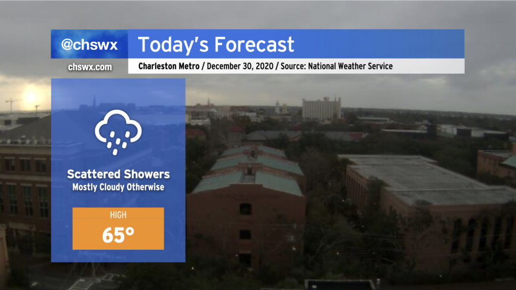
High pressure wedged in from the northeast combined with moisture overrunning a nearby coastal trough will keep clouds and scattered showers in the forecast today. This trough will eventually lift inland later today into tonight, swinging winds back around to the southeast and perhaps warming things up a touch. Generally speaking, plan for highs in the low to mid-60s across the area, and keep rain gear nearby. Rainfall amounts should generally remain light.
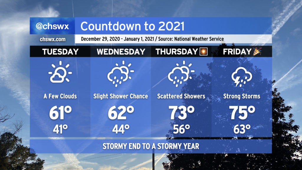
2020 looks to hand off to 2021 in the fashion we would expect from this year — a bit on the warm and stormy side — as a cold front approaches the area from the west.
The last few days of the year will get progressively warmer, with 70s back in the picture for New Year’s Eve. Rain chances also return beginning Wednesday, with a shower or two possible as a coastal trough moves inland in response to high pressure to the northeast breaking down and moving out. Rain chances improve for Thursday along with a noticeable jump in temperatures (70s!) as warm and moist air overspreads the area ahead of our next storm system.
Overall, if you’ve got things to do outdoors, Tuesday’s your best day to for-sure avoid rainfall. As for New Year’s Eve, I’m not expecting a washout for fireworks displays as of now, but the devil is in the details. Stay tuned.
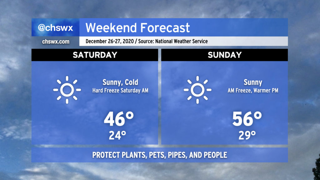
Get ready for a hard freeze tonight as temperatures plummet into the low-to-mid-20s pretty much everywhere inland of the immediate coast, where temperatures will still likely reach freezing. While winds will die down a little, there will still be enough to send wind chills into the upper teens for Saturday morning. Protect plants, pets, pipes, and people tonight.
Saturday will be another day where temperatures struggle into the mid-40s despite full sunshine. After another freeze Sunday morning, temperatures will begin to moderate, topping out in the mid-50s in the afternoon with plenty of sunshine to continue.