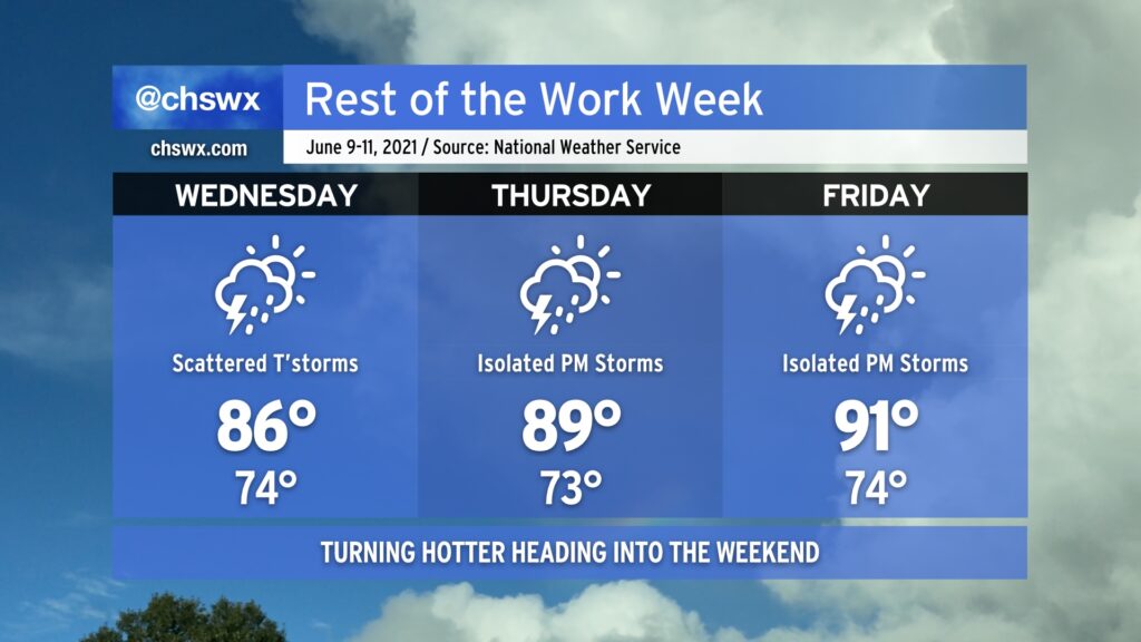
We’ve got one more day of scattered to numerous storms inland (we can’t seem to catch a raindrop here toward the coast) before ridging and drier air begins to put a bit of a lid on more widespread thunderstorm activity heading into Thursday and Friday. As storm coverage decreases, temperatures will increase, and we look in line for our first 100° heat indices of the year come Friday. A storm or two will still be possible, which may bring some brief relief, but be ready to pay a little more attention to hydration and time outside later this week.
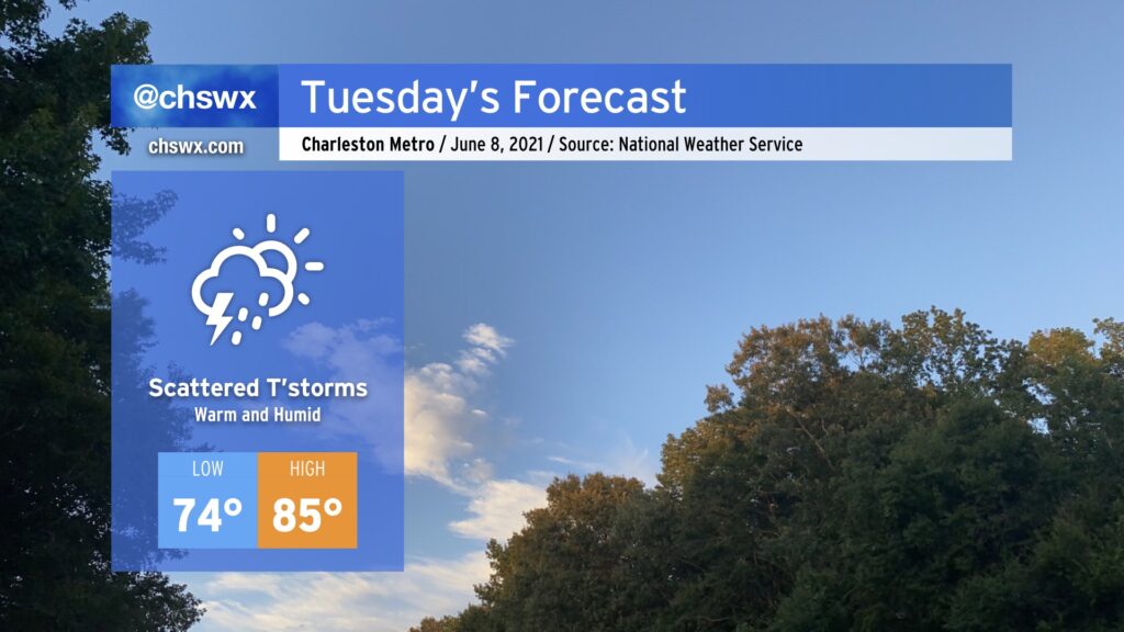
We’ll continue our risk for isolated to scattered showers and thunderstorms overnight Monday into much of Tuesday. Like today, we could see some showers swinging through early in the morning. More scattered showers and storms should pop as daytime heating builds across the area. We’ll see this risk shift inland with the seabreeze by evening. Severe weather is unlikely, but this time of year we always have to be wary of outflow boundaries and their intersection helping to briefly intensify thunderstorm updrafts.
Temperatures will top out in the mid-80s thanks to cloud cover and the presence of scattered showers and storms. The humidity will make it feel more like the low 90s. A warming trend continues throughout the week; we’re in the 90s by Friday.
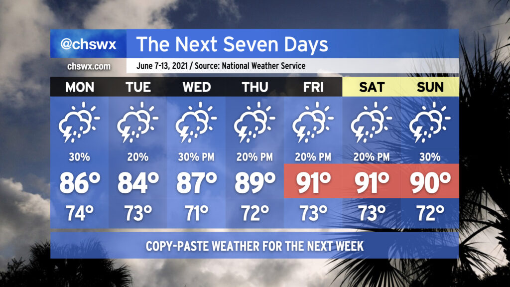
We’re getting into “copy-paste season,” when the summertime weather pattern is such that you’ll be pretty much on point with upper 80s to low 90s and a 20% chance of storms each afternoon. Of course, much more science goes into the forecast than that, but it goes to show just how static the pattern looks to be for the next few days. As is customary in summer, showers and thunderstorms will be isolated to scattered in nature. It will not rain everywhere, and it will not rain all day. It will be impossible to say with much certainty where storms will form, and if we are lucky to get clues as to where thunderstorms may initiate, we won’t have a lot of lead time.
Temperatures will start around normal before creeping up into the 90s by the weekend. Combined with humidity, that may yield our first 100°+ heat indices of the season, so that’s something you’ll want to plan for if you have outdoor activities scheduled.
Welcome to summer, folks. (Meteorological summer started on June 1; the summer solstice will take place on June 20.)
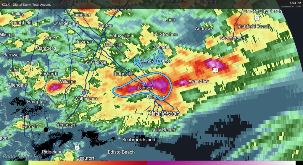
It’s been another rough day of precipitation. Last night, McClellanville and then Downtown Charleston took the brunt of it, and today it was the Goose Creek area. Rain gauges in the Crowfield Plantation/College Park area recorded 4-6″ of rain in just about two hours as strong to severe thunderstorms (which dropped quarter-size hail on Goose Creek) essentially parked themselves until they gusted out.
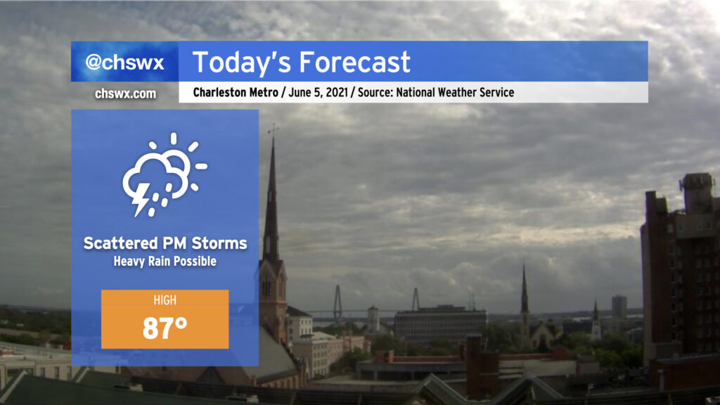
It must be June: Scattered showers and thunderstorms return to today’s forecast with temperatures topping out in the mid-to-upper 80s. Today’s storms look to kick off along the seabreeze perhaps as early as 1-2 PM, with the likeliest corridor of heavy rain to remain between I-95 and US-17. A couple storms could briefly turn severe with wet microbursts the primary concern, particularly where outflow boundaries intersect. So far, overnight model data do not favor a repeat of last night’s deluge in Downtown Charleston, but we will need to see how things ultimately evolve this afternoon. Keep rain gear handy and be ready to move outdoor activities indoors — in other words, pretty much standard for this time of year.
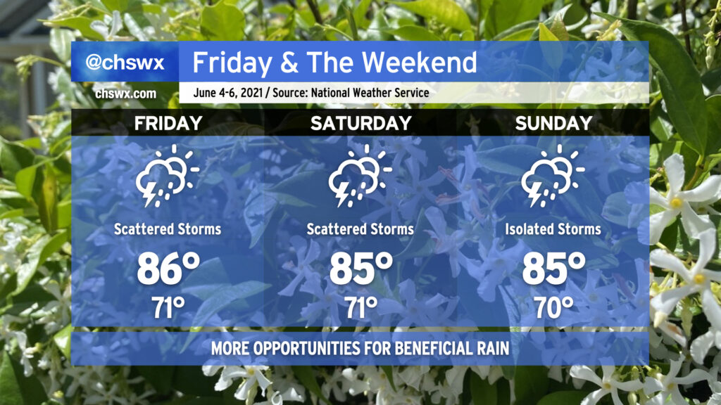
Scattered showers and thunderstorms will continue to factor in prominently in the forecast over the next few days, with periods of heavy rain possible especially Friday and Saturday. A storm or two may be able to produce a wet microburst, but other than that, no severe weather is expected. Storm motions will be watched closely for any training of heavy rain, and we’ll also keep an eye on tides in case radar trends show heavy rain approaching downtown. We’ll begin to see a downtick in storm coverage as we get into Sunday, when high pressure nudges back in a little bit, but we’ll still see more typical-for-June afternoon shower and storm chances along the seabreeze. It won’t rain all day, and it won’t rain all the time — just ensure you have a backup plan for your outdoor activities if and when it does rain.
The one benefit to these storms is that it’ll help keep temperatures down to around normal values for early June, with highs in the mid-80s. Even still, dewpoints around 70-72° will keep these highs feeling closer to the low to mid-90s, but at least it won’t be hotter with the same humidity.
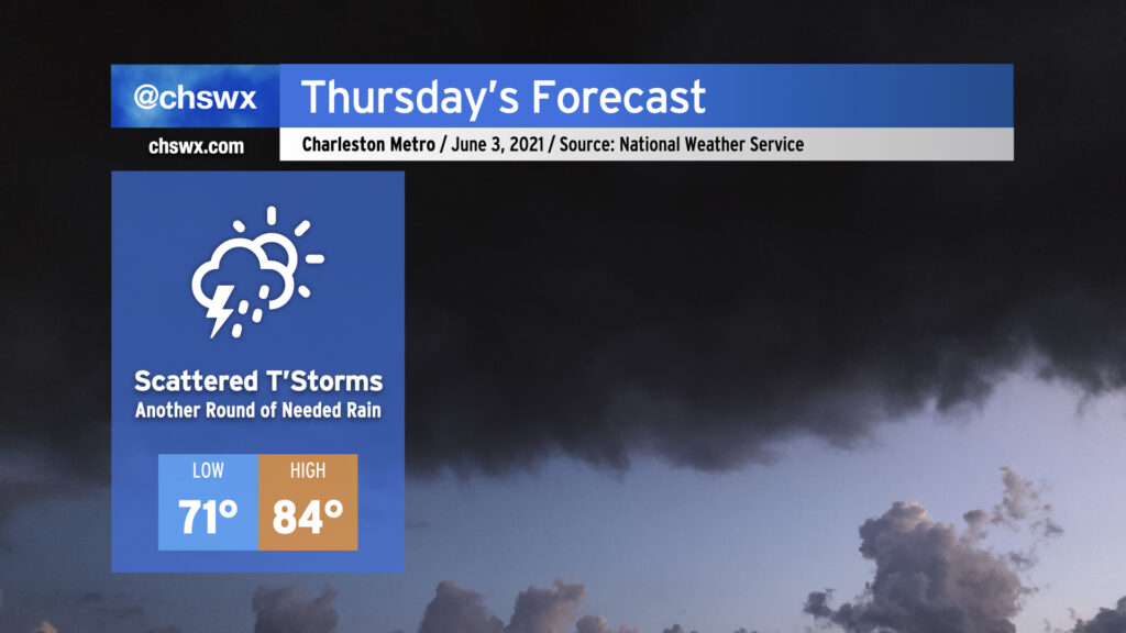
Scattered showers and thunderstorms return to the weather picture on Thursday. We should see a little greater coverage of storms than we saw today given weakening high pressure at the surface and even more robust moisture in place. Temperatures once again will only top out in the mid-80s with showers and storms in the area after a mild start in the 70s. Convective temperatures look fairly low — model soundings generally suggest around 80° — so we should see showers begin to initiate within 2-3 hours of sunrise. Storm motions will be inland, and we should see a break in the rain closer to the coast in the late afternoon/early evening hours as the seabreeze makes its westward progression. With any luck, we’ll get more much-needed rainfall across even more of the area than we saw today.
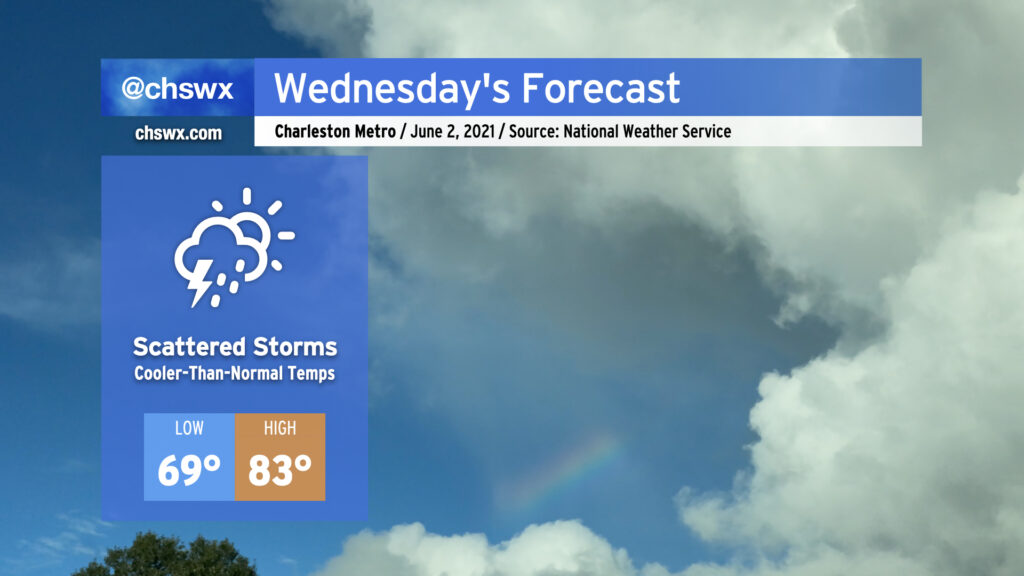
We’ll have more chances for beneficial rainfall tomorrow across the Lowcountry as scattered showers and even a few thunderstorms will be possible for much of the day. Onshore flow and storms in the area will keep high temperatures down into the low 80s. No severe weather is expected, just more much-needed rain. Not everyone will see rain, and it won’t rain all the time. If you miss out tomorrow, rain chances continue to head up as we get into Thursday and Friday, so chances are good you’ll see something as the pattern turns wetter across the area.
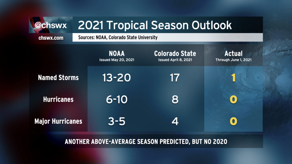
Well, friends, it’s that time of year again: The Atlantic hurricane season begins today and runs through November 30. Seasonal forecasters from Colorado State University and NOAA are calling for another above-average season when considering continued warm sea surface temperatures and ENSO-neutral conditions (read: no La Niña nor El Niño is expected). While a repeat of the sheer volume of the 2020 hurricane season is unlikely, it still looks to be busy out there.
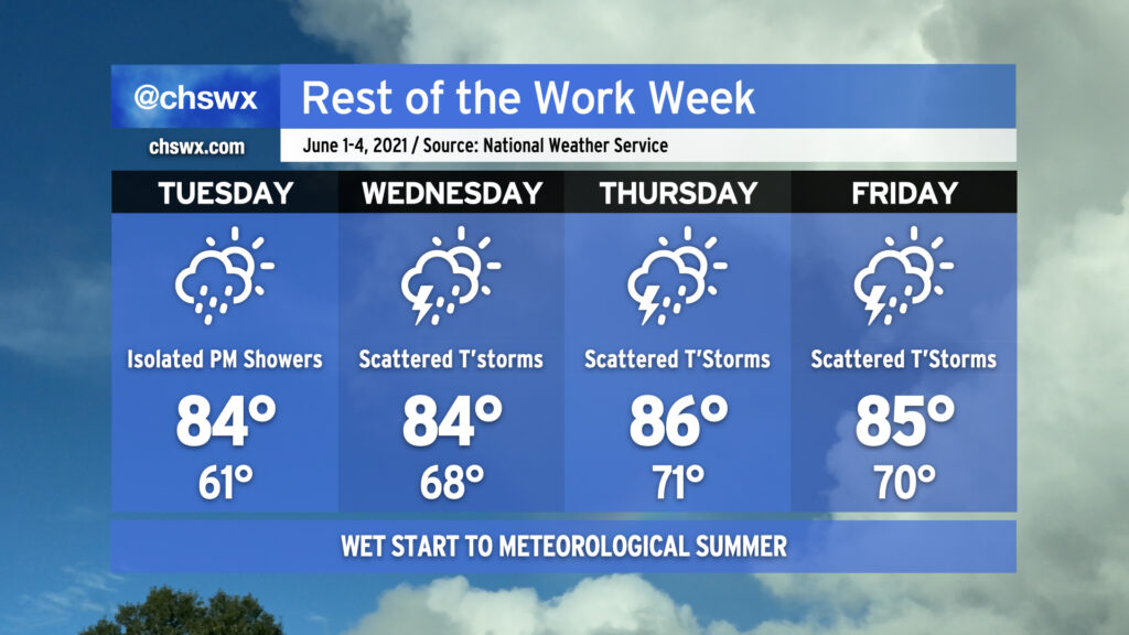
We’ll get June off to an increasingly rainy start as the dry high pressure which brought us two incredible days this weekend begins to break down. Expect to get much of Tuesday in rain-free, but a few showers will be possible in the afternoon and evening hours as a coastal trough begins to sharpen nearby and moisture begins to peek ashore. As we get into Wednesday, more moisture will overspread the area and shower and storm coverage will kick up a little bit. We’ll see this pattern persist into Thursday and Friday, with afternoon showers and storms becoming more likely each day, bringing some more much-needed rainfall to the area. If you didn’t get much with Saturday evening’s activity, you’ll more likely than not have some measurable rainfall by the end of the week.
High temperatures will remain at or ever-so-slightly below normal through the work week thanks to onshore flow and expected afternoon showers and thunderstorms. Lows will be creeping back toward 70° with the increasingly humid airmass in place. With June 1 marking the beginning of meteorological summer, it will be as if the humidity will be right on cue.