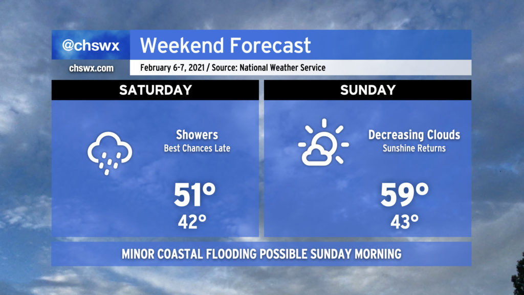
Showers, overcast, and chilly temperatures will continue on Saturday. The best rain chances will come in the afternoon into Saturday night as some upper-level energy and a surface low pressure system traverse the area. The weather improves Sunday as low pressure moves away from the area, yielding to high pressure building back into the area from the northwest. Cloud cover will scour out, allowing temperatures to rise into the mid-to-upper 50s across the area with ample sunshine throughout the day, giving you a great excuse to skip the 12 hours of Super Bowl pregame shows and get outside for a bit.
There will be an outside shot at some minor coastal flooding very early Sunday morning (high tide ~4:01am) as low pressure deepens off the coast. The current tide forecast peaks around 6.9’, which could be just enough to put some salt water on Hagood Ave. at Fishburne. Given the early hour on a weekend, it should not have major impacts on travel. We remain at five total coastal flooding events (tide levels at or above 7.0’ mean lower low water) so far in 2021.
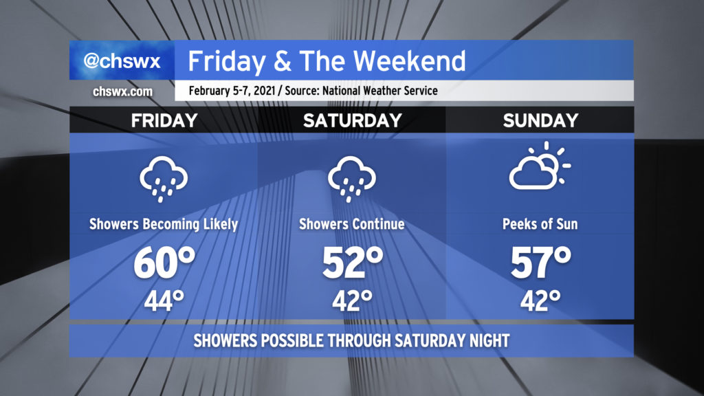
After a few chilly but dry days, the rain’s back in the weather picture for Friday ahead of a cold front. It’ll be a little warmer with highs around 60° mid-afternoon before the front gets through. Rain chances decrease some for Saturday morning, but then ramp back up as more upper-level energy and surface low pressure approach the area. Saturday will be on the chilly side with highs just topping out in the low 50s. High pressure returns for Sunday. Clouds will hang around but there should be some peeks of sun as well, and that will help us warm a little into the mid-50s.
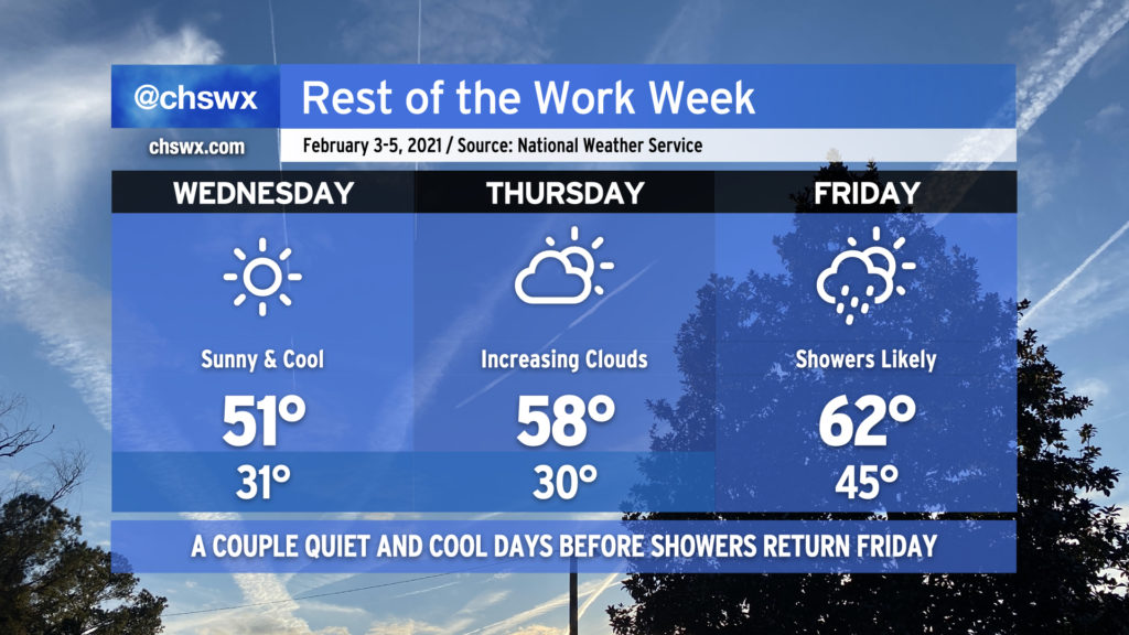
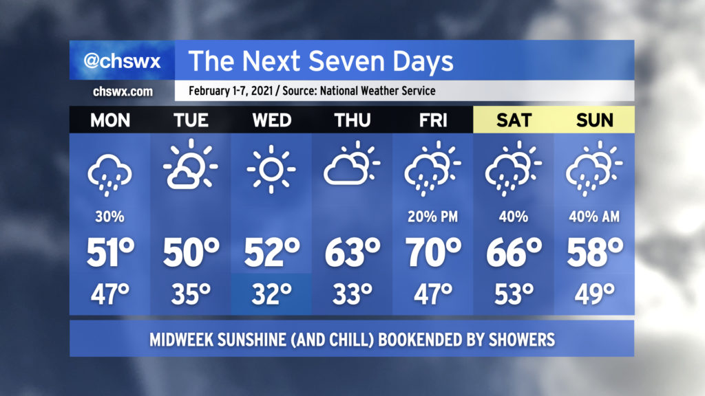
Chilly temperatures will define the next couple days as Arctic air continues to spill into the area. We’ll start Wednesday below freezing in most locations away from the immediate coast; despite full sunshine, temperatures will struggle to reach the low 50s. Another freezing cold night is ahead for Thursday, but the afternoon will be a little warmer as winds swing around to the south ahead of the next cold front. Cloud cover will increase and help keep us warmer for Friday morning, with lows in the mid-40s. By Friday afternoon, we’ll see highs return to the low 60s — and a pre-frontal band of showers will roll through the area as well.
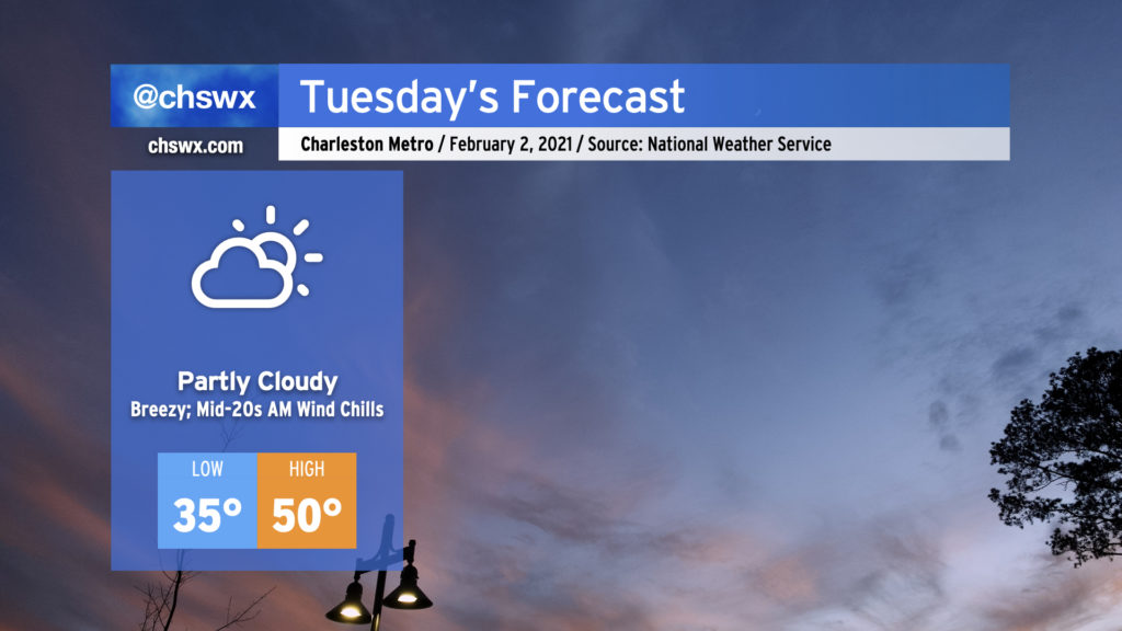
Cooler and drier air will rush into the area tonight into Tuesday, helping to break up the cloud cover but keeping us rather chilly. Breezy northwest winds will make tomorrow morning’s mid-30s feel more like the 20s, so if you’re headed out in the morning, make sure you’ve got a little layering going on to stay warm. Despite some downslope flow, highs will struggle to reach 50° in the afternoon with periods of cloud cover. (At least it won’t be raining.)
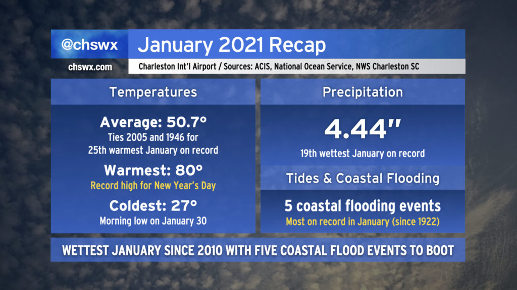
January 2021 has come to an end. It was an interesting month in many ways, but as far as weather goes, the month was on the warm and wet side of what passes for normal around here, but wasn’t too out of bounds.
We will begin February much as we spent about half of January: Chilly, cloudy, with occasional showers in the area. Fortunately, showers will depart for mid-week, as chilly high pressure runs the show through Thursday. Watch for some frosty and freezing temperatures mid-week before a warming trend commences Thursday afternoon. By Friday, we’re scraping 70° again as we return to the warm sector ahead of our next storm system, with showers becoming possible late in the day. Timing of our next front is somewhat suspect, so you’ll want to keep an eye on the forecasts for the weekend in anticipation of adjustments to rain chances and temperatures.