Tuesday: Temperatures taking another shot at the century mark
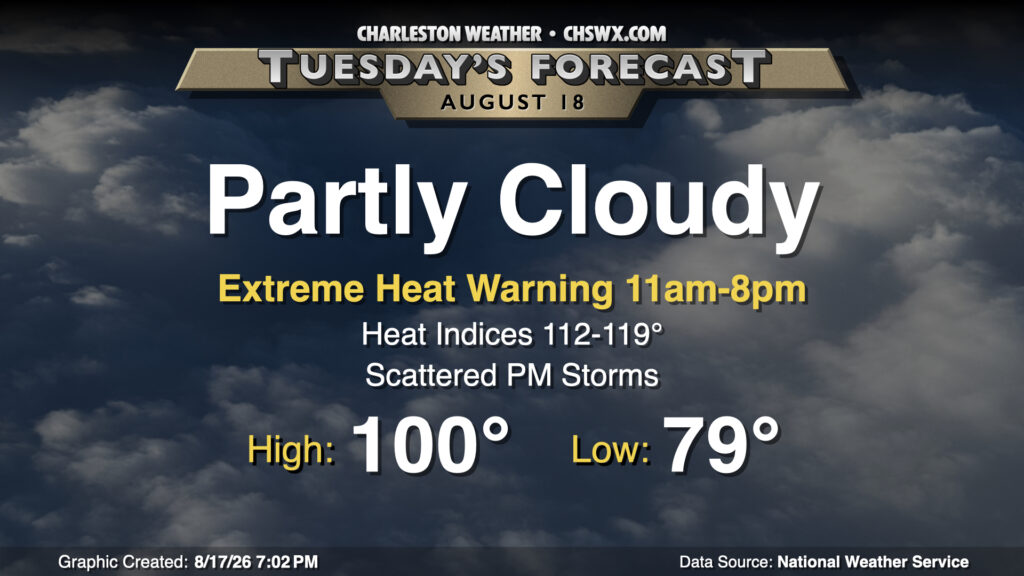
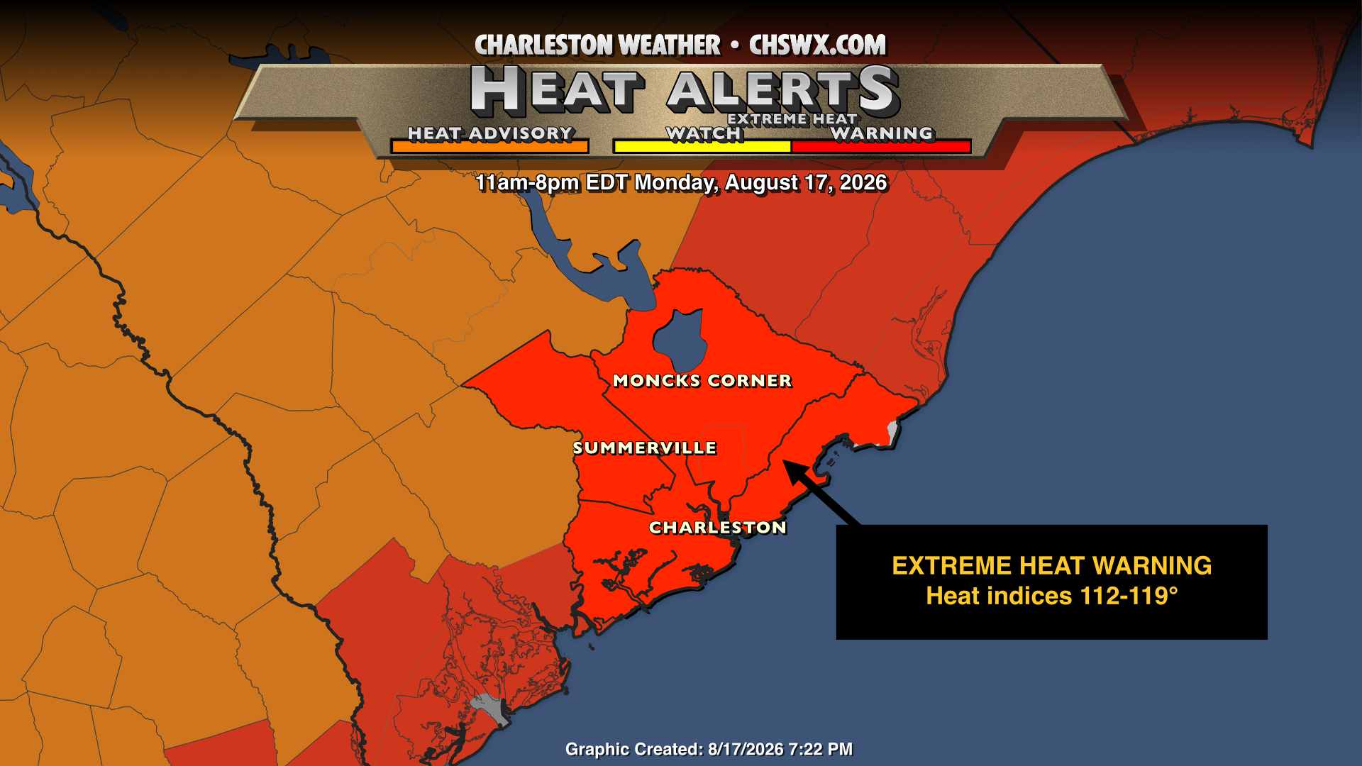
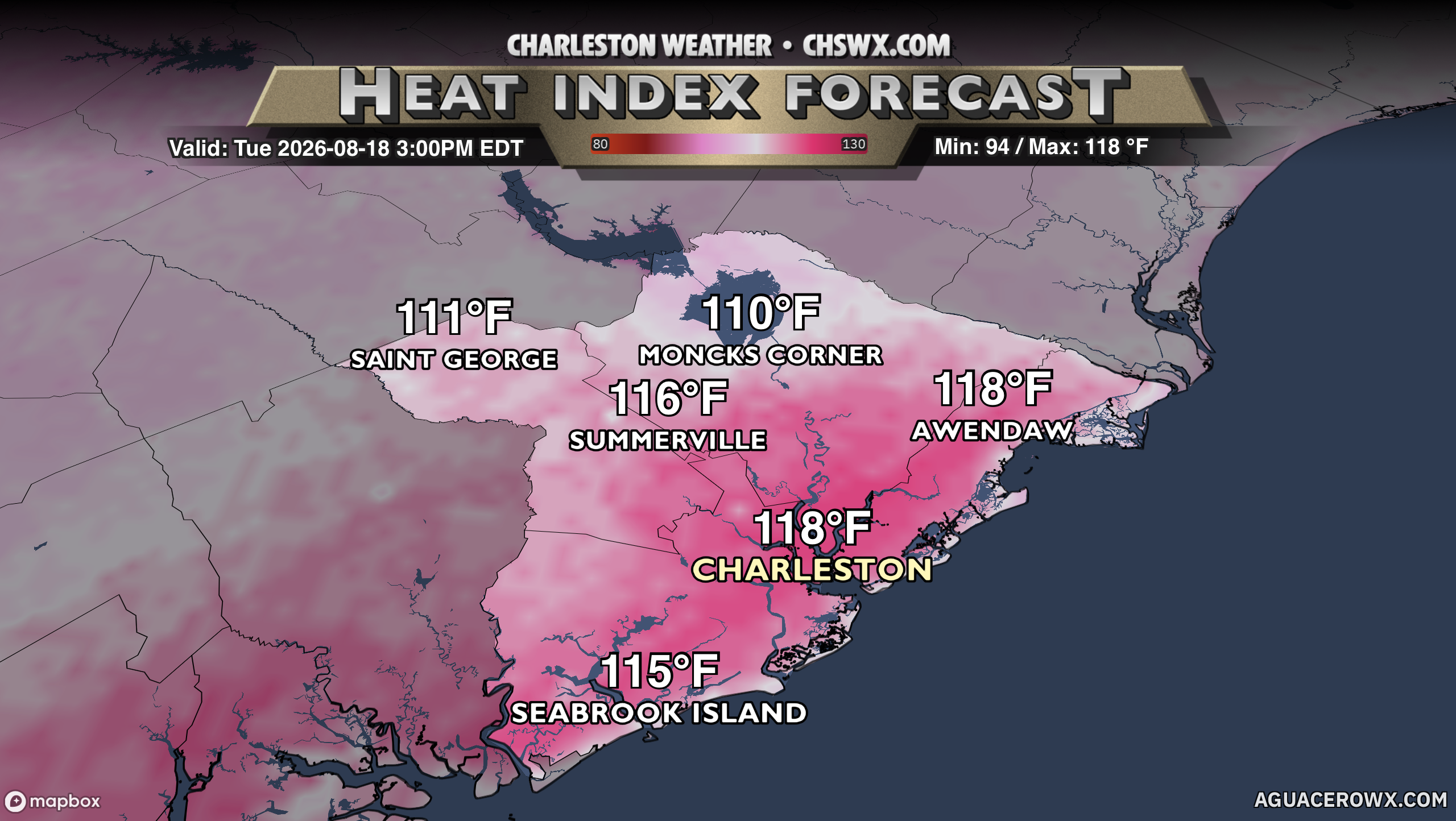
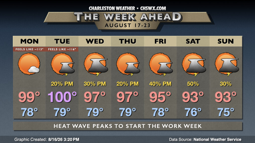
Another extremely hot day is on tap for Tuesday as temperatures take what should be one last shot at the 100° mark before sanity begins a slow return to the forecast. We’ll start the day near 80° inland of the coast, and we’re almost assuredly not getting below 80° at the coast and in downtown Charleston. From there, temperatures will soar into the upper 90s to near 100°, with the best risk of reaching the 100° mark inland of Highway 17. And then there are the dewpoints running in the mid-to-upper 70s, which will propel heat indices well into the mid-110s for many of us, with a few readings getting uncomfortably close to 120° in more rural spots. For the first time in this heat wave, an Extreme Heat Warning is in effect for the entire Tri-County, including Dorchester; to this point, we’ve only seen those warnings come out for Berkeley and Charleston. Continue to heed precautions for extreme heat: air conditioning if at all possible, but frequent breaks in the shade with water if you must be outdoors.
There will be a slightly better chance of thunderstorms Tuesday afternoon than we saw on Monday, which will cool some of us off. The price for this, though, is an elevated risk for strong and potentially damaging wind gusts, excessive lightning, and very heavy — perhaps flooding — rain in a few spots. Instability will be running on the high end of what we usually see around these parts, so any storm that can take advantage could take off like a rocket. The good news is that without much shear, storms will generally pop, rain for a while, and then collapse.
Read more »