The week ahead: Heat wave peaks
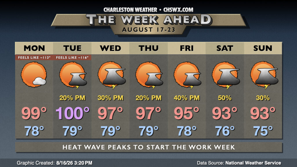
We have a few more days to go in the most dangerous part of this heat wave before the pattern finally begins to dislodge, allowing temperatures to trend back toward — but remain above — normal for mid-August.
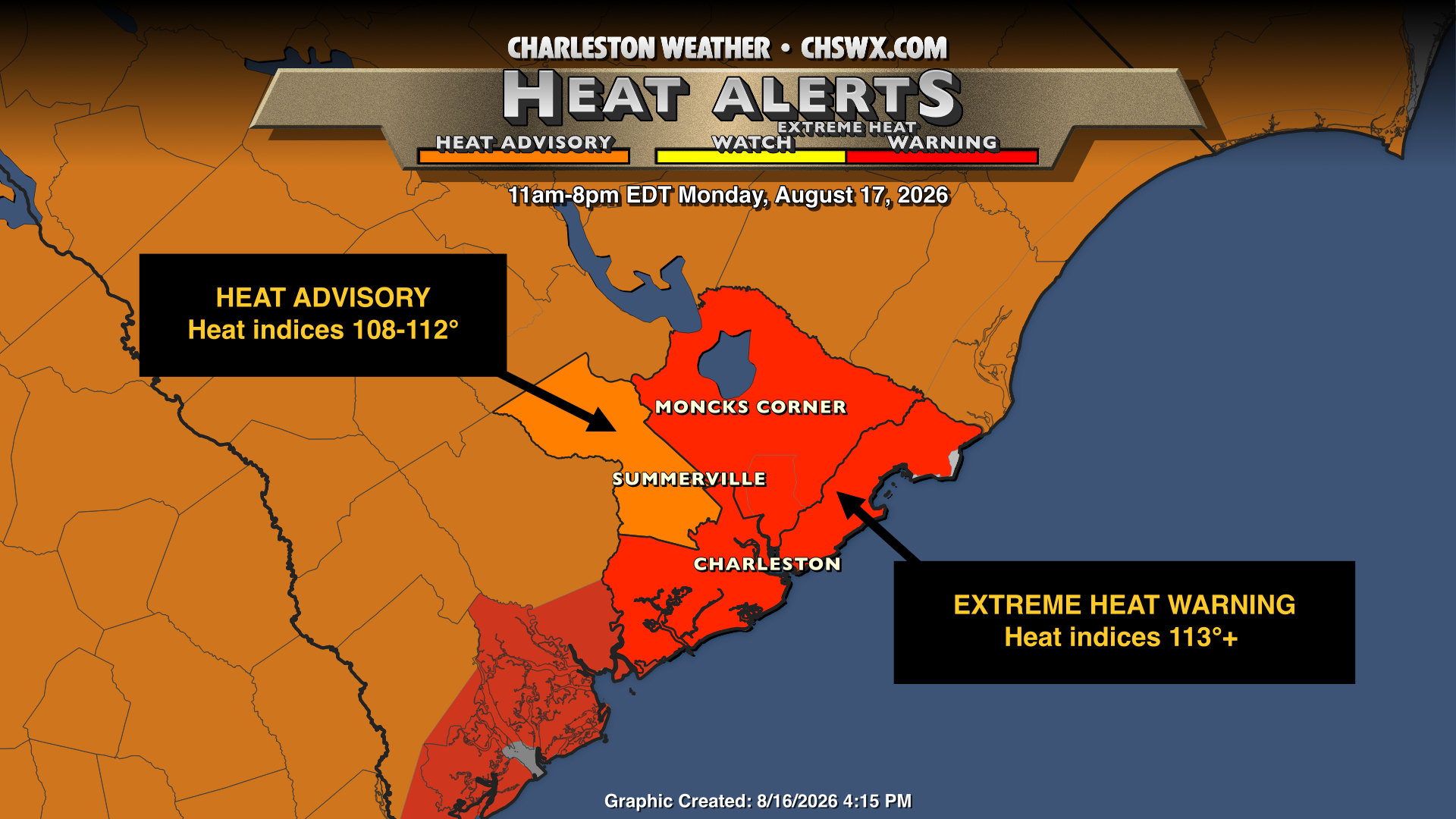
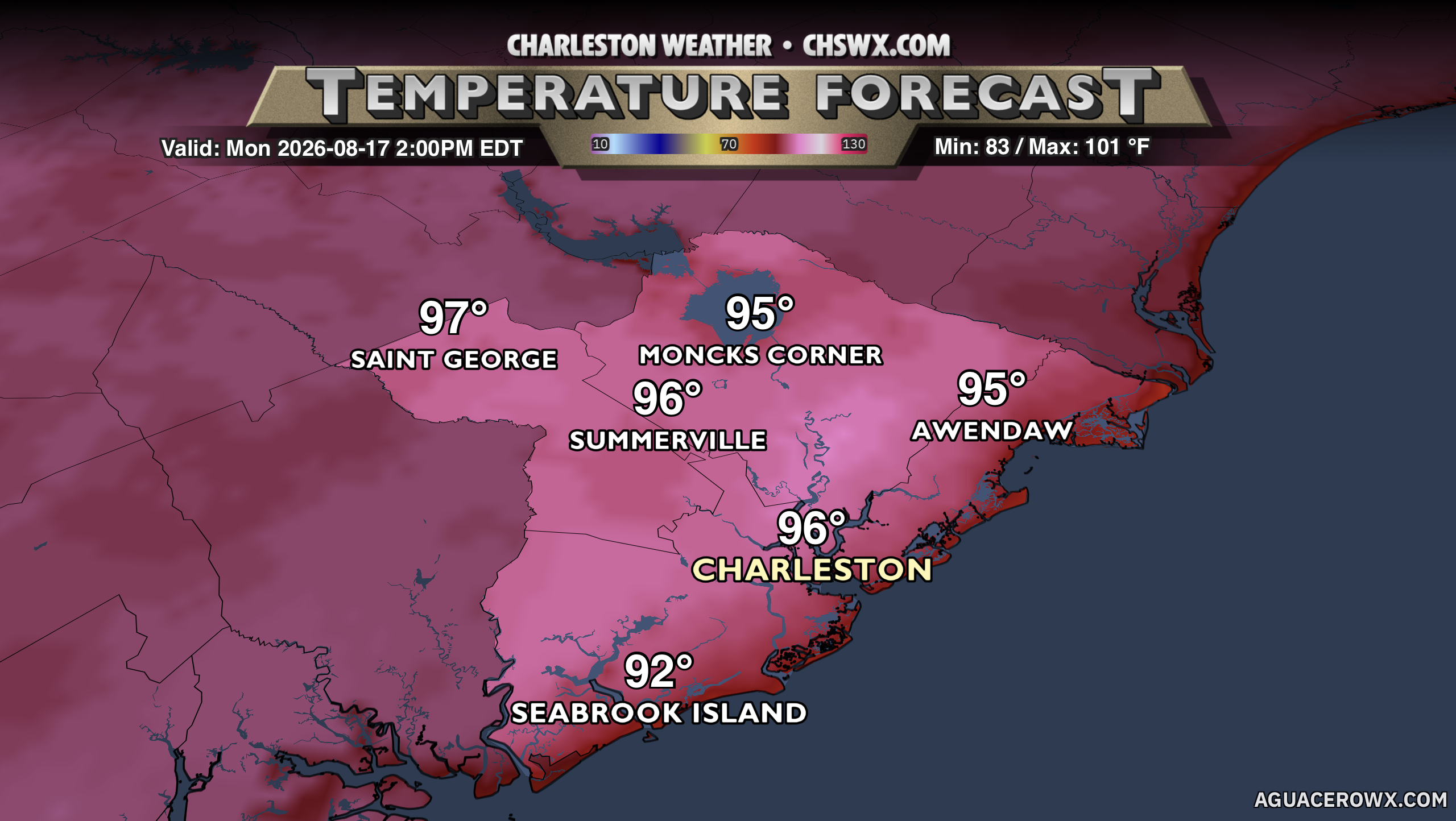
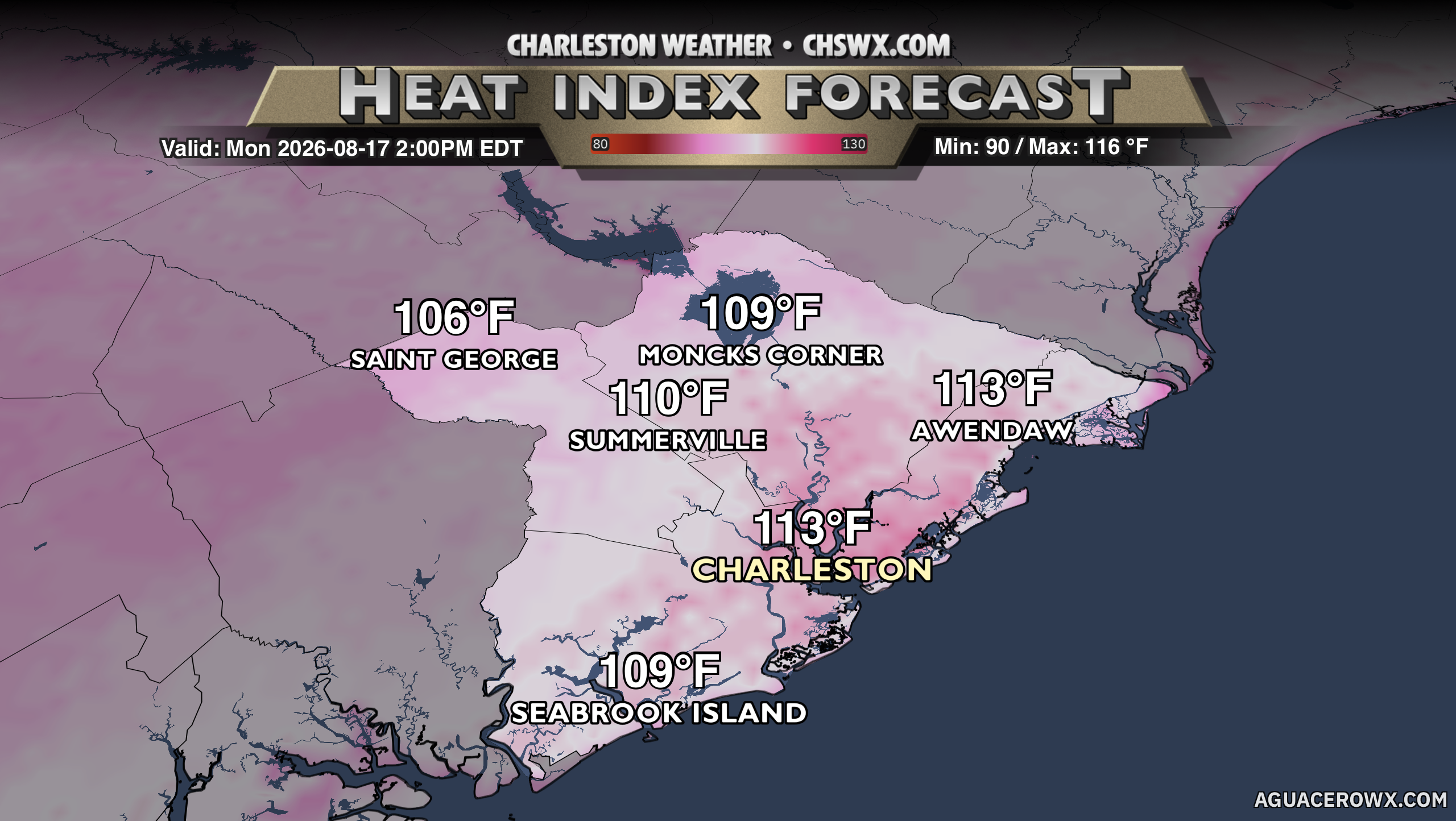
The heat wave re-escalates Monday as winds aloft throughout the atmospheric column come from the northwest. This keeps the seabreeze pinned to the coast until later in the day, which will allow air temperatures to soar well into the upper 90s, perhaps flirting with the century mark away from the coast. The combination of humid air and the heat will drive heat indices back into the 110s in many spots. A Heat Advisory is out for Dorchester County, where heat indices should peak around 108-112° primarily in the wake of the seabreeze, while an Extreme Heat Warning is in effect for Berkeley and Charleston counties for heat indices exceeding 113°. It’s less likely that thunderstorms will be in play on Monday, too, as the air above us turns a little drier given the northwest flow. We can never totally rule out a popup this time of year, but the chances look rather small.
We will take one last run at the 100° mark on Tuesday before the ridge finally starts to weaken a little bit for the second half of the week. While heat advisory conditions will continue, it is at least an off-ramp back to more standard summertime shower and thunderstorm activity to cool some of us off in the afternoons. By the weekend, a trough begins to dig across the eastern half of the country, which turns things more in the unsettled direction as we get into the last full week of August. (Hard to believe…)
Tropics: Calming back down a bit for now
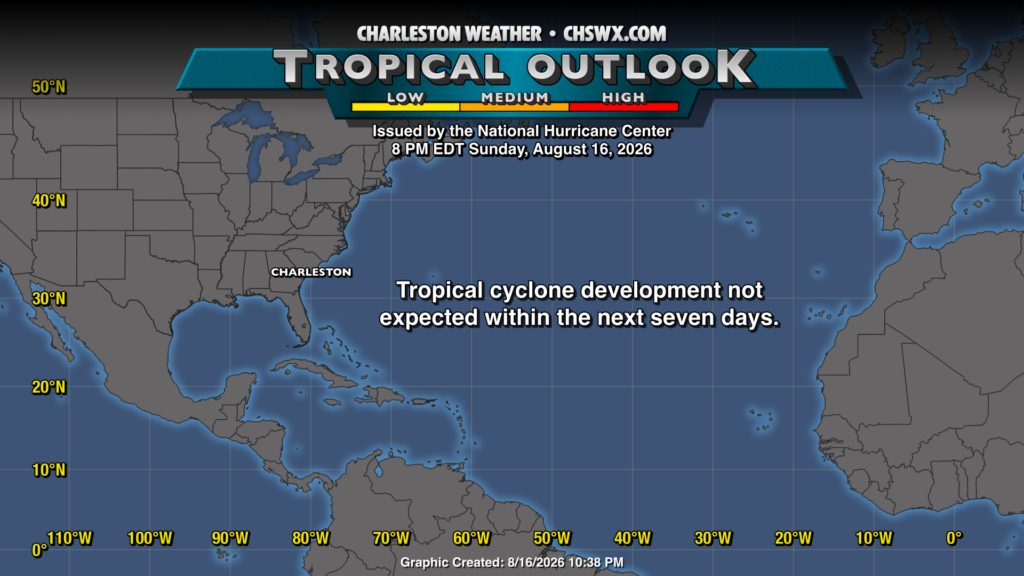
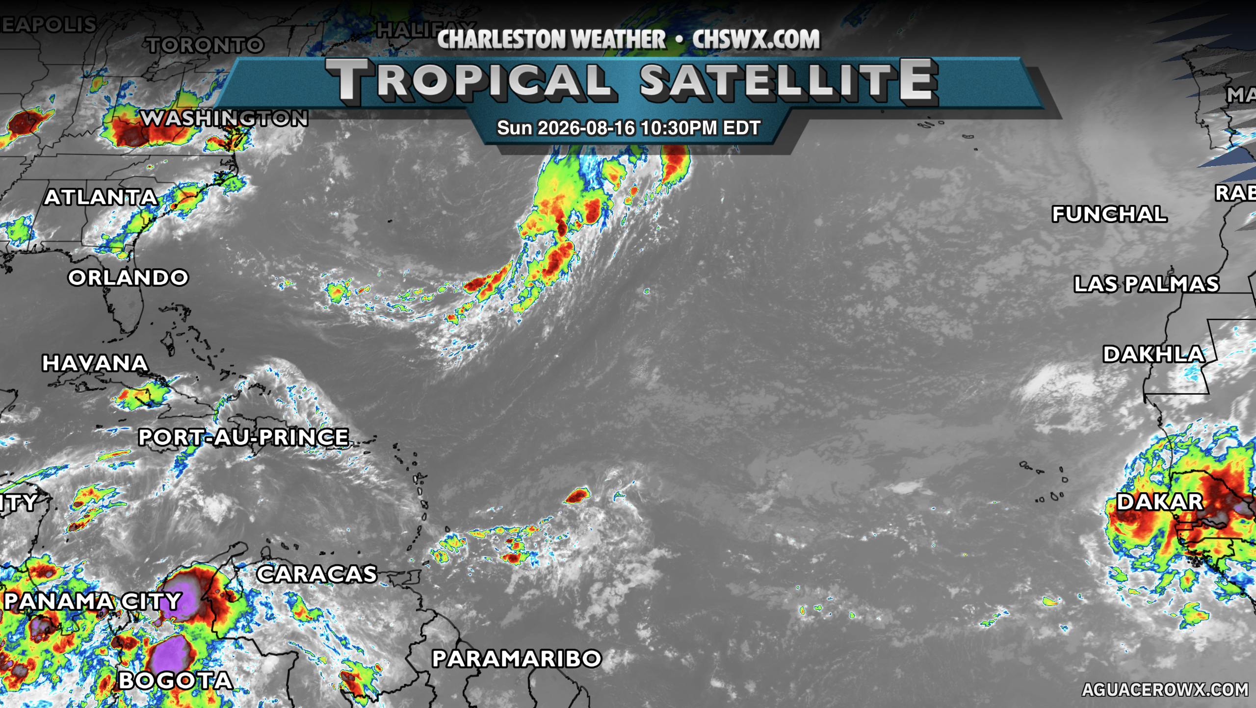
Finally, after a brief flareup of activity last week, the tropics have once again turned largely dormant for the moment — not wholly unexpected when dealing with an El Niño of this magnitude. We did, for 24 hours, have Cristobal racing eastward across the North Atlantic, but it didn’t get too far beyond a minimal tropical storm before the shear got to it. The two areas of interest that had been approaching the Caribbean did not develop, once again owing to the hostile conditions in place thus far. We will keep watch, of course, as we get closer to the climatological peak of the season in September — as we all know, the season can still turn on a dime and get busy on us, so it’s important to stay vigilant and prepared.
Follow my Charleston Weather updates on Mastodon, Bluesky, Instagram, Facebook, or directly in a feed reader. Do you like what you see here? Please consider supporting my independent, hype-averse weather journalism and become a supporter on Patreon for a broader look at all things #chswx!