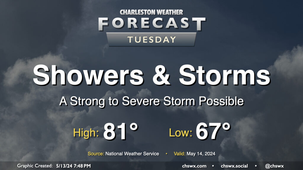
Tuesday figures to be a fairly active weather day with a couple rounds of storms expected. The first one will be ongoing as we wake up and commute; periods of heavy rain will be possible within thunderstorms, so be ready for delays in the morning. One other twist will be in the form of a warm front that will lift north across the area as we get into mid-morning; this could enhance low-level shear enough where the environment might support a brief tornado (though this risk is fairly low all things considered). The first round of showers and thunderstorms should get offshore roughly around midday, and many of us will catch a break from the rain early Tuesday afternoon. Heading into mid-to-late afternoon, expect additional scattered showers and thunderstorms to fire across the area. There will be a damaging wind risk within the strongest storms, so you’ll want to keep an ear out for possible weather warnings. Storms will be possible well into the evening before chances head back down around midnight or so.
Temperatures Tuesday start on the warm and muggy side in the mid-to-upper 60s. Expect highs to top out in the low 80s given the expected showers, thunderstorms, and overall cloud cover.
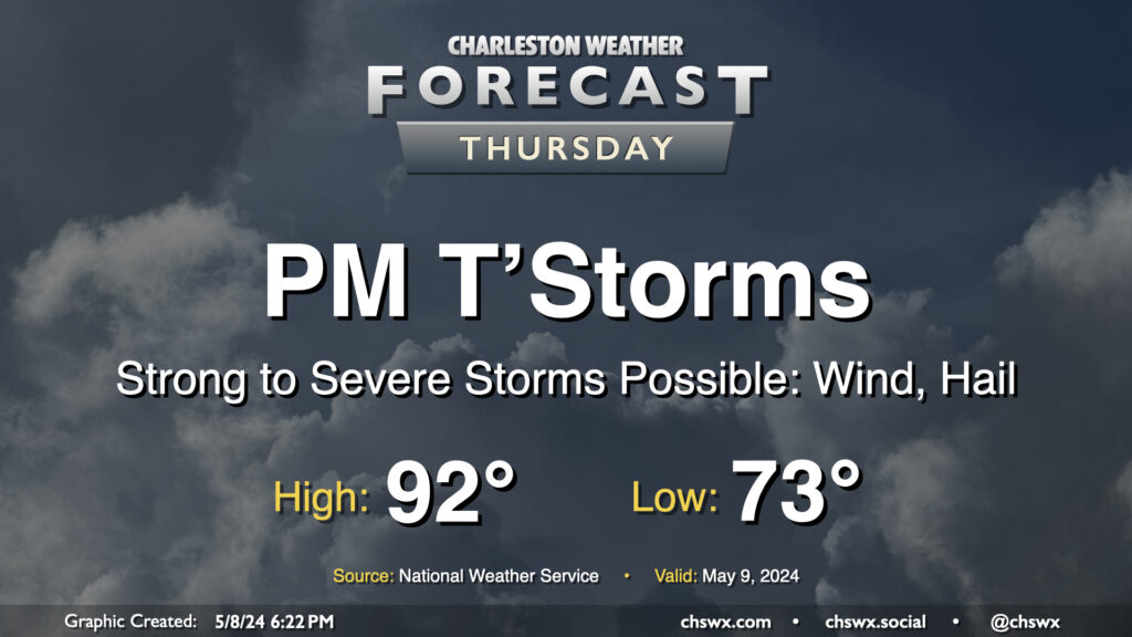
We get off to a warm start on Thursday — expect lows to only bottom out in the low to perhaps mid-70s with highs topping out in the low 90s and humidity making it feel closer to the upper 90s. The main weather story, though, will be the risk for some strong to severe thunderstorms moving through Thursday afternoon and into the evening. These could pack strong and potentially damaging wind gusts along with large hail. Exact timing is still unclear, but there is a risk these could coincide with the commute, so we’ll want to watch them closely. Stay close to reliable weather sources throughout the day for updates.
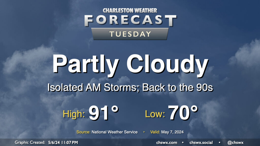
We may contend with a storm or two in the morning, but the weather story for Tuesday will be the return of the 90s in the afternoon. It’ll be a warm start with lows around 70°, but as the ridge aloft builds in, highs top out in the low 90s. If there’s one bit of good news here, it’s that it’s not summer-humid just yet, and dewpoints should run in the mid-60s, keeping heat indices reasonably in check. Cloud cover will be diminishing throughout the day as well, so expect plenty of sunshine as we get into the afternoon and evening hours.
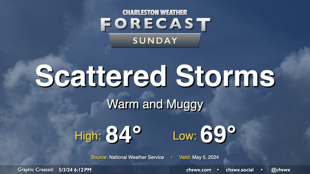
Expect another round of scattered showers and storms on Sunday. Most of us could see rain at any point in the day. The best chances start closer to the coast in the morning and migrate inland during the afternoon, much as we saw on Saturday. It’ll be muggy, too: lows will barely get below 70°, while highs top out in the mid-80s as dewpoints continue generally in the mid-60s.
Once again, Sunday is not a washout threat, especially as you get closer to the coast. However, you’ll want to make sure your outdoor plans have a solid indoor backup. Remember: When thunder roars, go indoors!
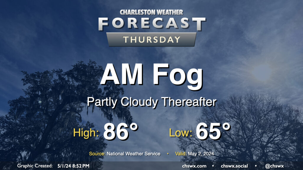
We’ll wake up to some fog in the area on Thursday morning, with some patches of dense fog not out of the question. This might have some commute impacts, to be ready to allow a little extra time to get where you are going tomorrow morning. Be sure to use low beams in fog, even if the sun is out — you want to be seen — but avoid the high beams as they may act to blind you.
Fog looks to scour out around 9-10am or so, and we should be in for a partly cloudy to mostly sunny day across the Lowcountry with temperatures rising to the mid-80s in the afternoon. Aside from the fog, there are no other weather concerns of note.
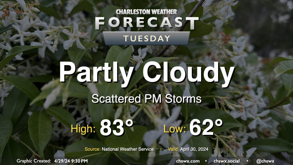
Our next chance of wet weather arrives later Tuesday as a disturbance aloft moves into the area. We start the day on a dry note, though, and not everyone will see rain all the time heading into Tuesday afternoon and evening. Expect generally partly cloudy skies away from the scattering of storms. Lows will run in the low 60s, yielding to low-to-mid-80s in the afternoon.
Showers and thunderstorms will be possible overnight Tuesday into Wednesday morning, which may have some relatively minor commute impacts depending on how quickly the disturbance can depart. Stay tuned.
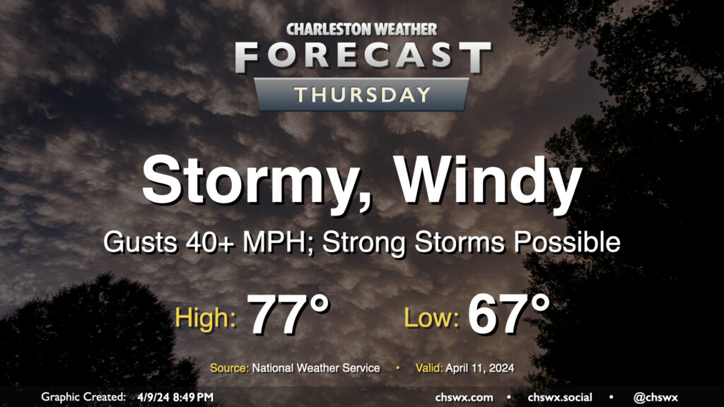
Thursday will be a busy weather day as showers and thunderstorms move across the area in association with a cold front. It’ll be a breezy day — expect gusts approaching, if not exceeding, 40 MPH at times especially on bridges and overpasses. We’ll have a Wind Advisory in effect starting at 8am as a result.
Rain will likely greet us in the morning and should be around for much of the day. Embedded thunderstorms will be possible as well, and if enough instability can be realized, a few damaging wind gusts will be possible. The better risk for severe weather will stay to our south, though, where more quality moisture will be available. Still, even without severe storms, wet soils may allow for some tree damage at lower wind speeds. Sporadic power outages could be an issue, so be ready just in case. Before it’s over, we can generally expect an inch to an inch and a half of rain in most spots, with locally heavier amounts possible.
Temperatures will be quite mild and muggy; expect to start the day in the upper 60s with highs peaking in the mid-to-upper 70s, tempered by rainfall.
Showers and thunderstorms should exit by evening, and the weather will continue to improve from there, with a nice stretch of sunny and increasingly warm weather for Friday and the weekend.
Tuesday will turn a little warmer as winds continue to blow southerly on the backside of high pressure. We start the day in the mid-50s, warming to around 80° in the afternoon as clouds mix in more prominently into the sky character. No rain, though we will likely see some evening coastal flooding once again with high tide around 9:34 PM thanks to the recent new moon and continued onshore flow.
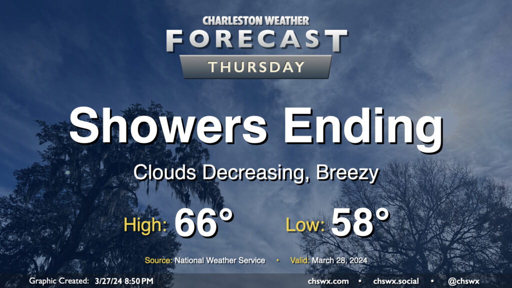
Showers will be coming to an end Thursday morning, yielding a quiet and increasingly warm period for Good Friday and Easter weekend. We should see the rain exit the area by midday, and from there, cloud cover will diminish. It’ll be a cool day in the wake of a cold front; expect highs to only top out in the mid-60s in the afternoon. The breeze will kick up at times as cooler air moves into the area behind the front as well, but it shouldn’t be too terribly gusty, either.
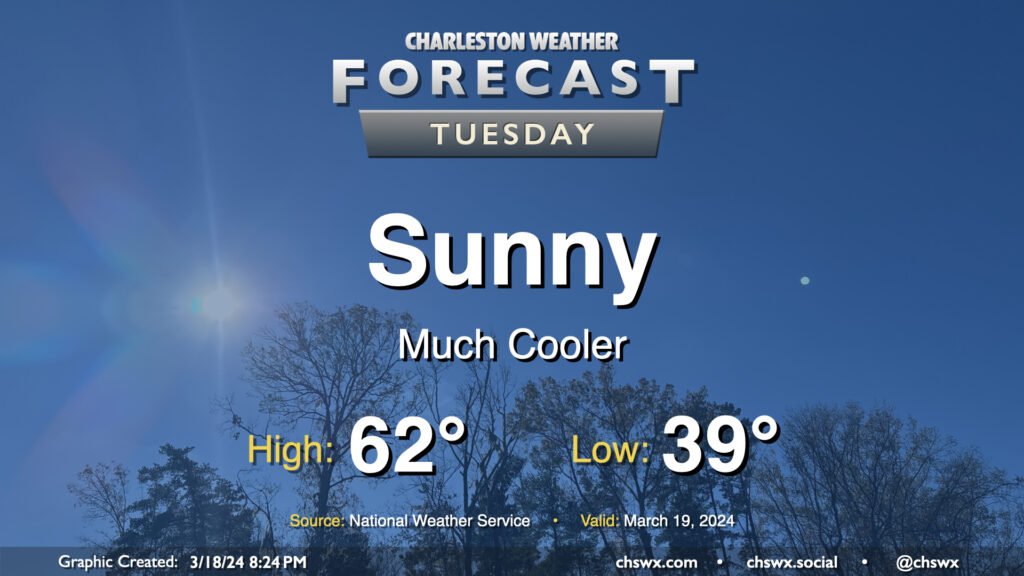
After the past couple weeks of warmth, Tuesday might come as a bit of a shock as lows dip into the upper 30s across a good bit of the metro to start the day as cool high pressure builds in throughout the day. Temperatures will only get into the low 60s, far below normal for mid-March (the normal high for March 19 is 71°). At least the sun will be out, and the March sun angle should make these cooler-than-normal temperatures feel pretty decent.