Our run of above-normal temperatures is just beginning, and will continue through Tuesday and the rest of the work week. Expect lows to bottom out in the upper 40s to around 50° on Tuesday morning, with temperatures warming into the upper 60s to low 70s in the afternoon under a mix of sun and clouds.
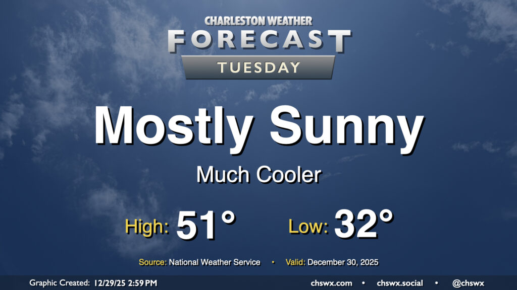
A cold front getting through the area Monday afternoon will usher in much cooler air for Tuesday. We’ll start the day around freezing away from the coast, with wind chills bottoming out in the mid-to-upper 20s in the morning thanks to northwesterly winds around 5-10 MPH. This breeze continues for much of the day. Despite full sunshine, the ongoing influx of cold air will keep highs pinned to the low 50s across the metro.
We’ll continue to put Monday’s cold snap in the rear view on Wednesday as temperatures continue to trend warmer with high pressure moving eastward. Temperatures will fall to the mid-30s overnight, but increasing cloud cover should keep a lid on further radiational cooling and keep us above freezing. From there, we’ll warm into the low-to-mid-60s as the cloud deck continues to thicken courtesy of a coastal trough taking shape offshore.
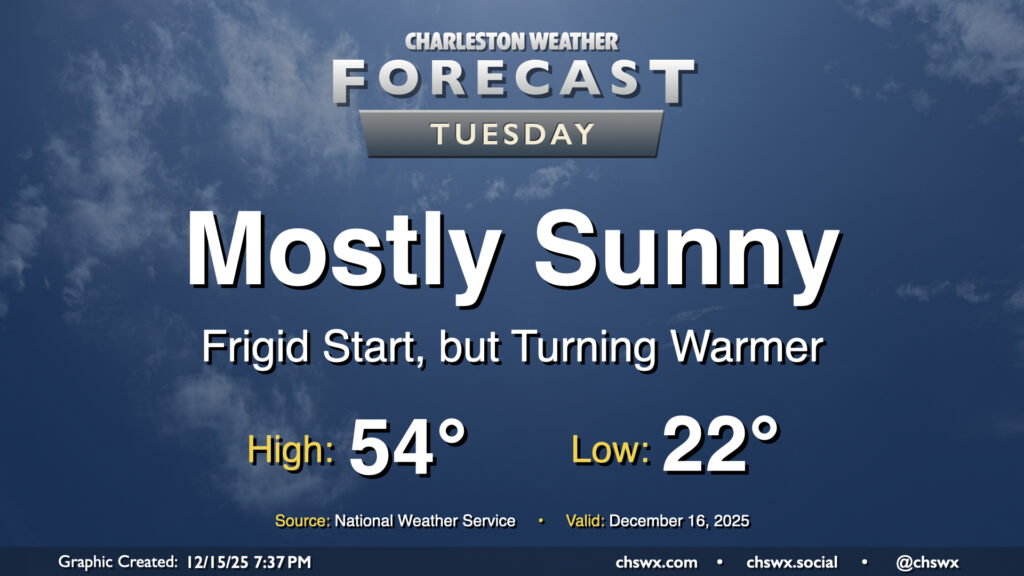
While it won’t be as windy as it was on Monday morning, we still have quite a frigid start queued up for Tuesday as lows drop back to the low 20s in the morning, with some upper teens possible closer to and west of I-95. However, with high pressure beginning to slip to the east, we’ll start to see temperatures begin to moderate in the afternoon as mostly sunny skies prevail. While the forecast high of 54° remains well below normal for this point in December, it will feel tropical in comparison to Monday’s high of 39° at the airport (which ties the record cold high temperature first set in 1942).
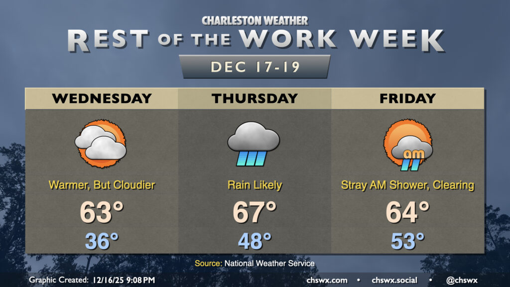
After another cold start on Wednesday, we’ll see temperatures climb a bit, though it’ll still be on the chilly side of normal, especially Thursday as a reinforcing front kicks up the cloud cover a bit.
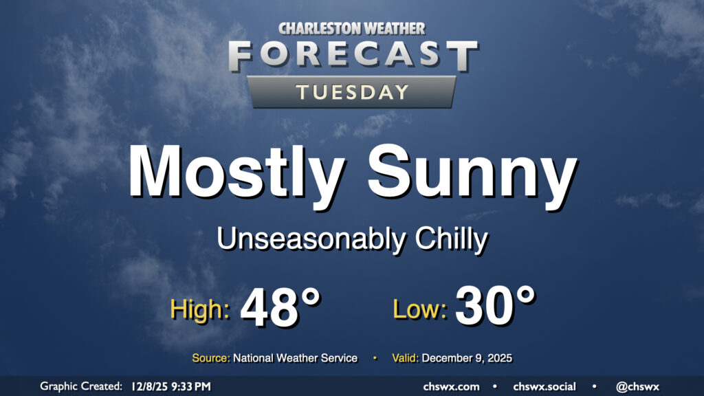
We’ll finally shed the cloud cover that’s punctuated the last several days on Tuesday as high pressure builds in from the northwest. The aforementioned high pressure will drive even cooler and drier air into the area, and we’ll wake up below freezing as a result away from the coast. The northerly breeze will help drive wind chills down into the low to mid-20s during the morning, so be sure to add a layer or two as you head out for the day. The feed of cooler and drier air continues throughout the day, so even with plenty of sunshine, highs will likely not climb out of the upper 40s.
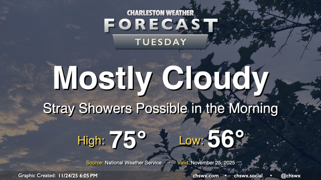
High pressure to our north will be shifting offshore as Tuesday goes on ahead of a storm system moving through the Ohio Valley, allowing a warm front to push northward into the area during the day. Some of us may see a few showers as this warm front moves northward, especially later in the morning and closer to the coast. They’ll be relatively short-lived, clearing the area during the afternoon, and won’t amount to too terribly much rain for those who see any of it at all. It’ll be a mild day once again, with lows in the mid-50s warming to the mid-70s in the afternoon in the wake of the warm front.
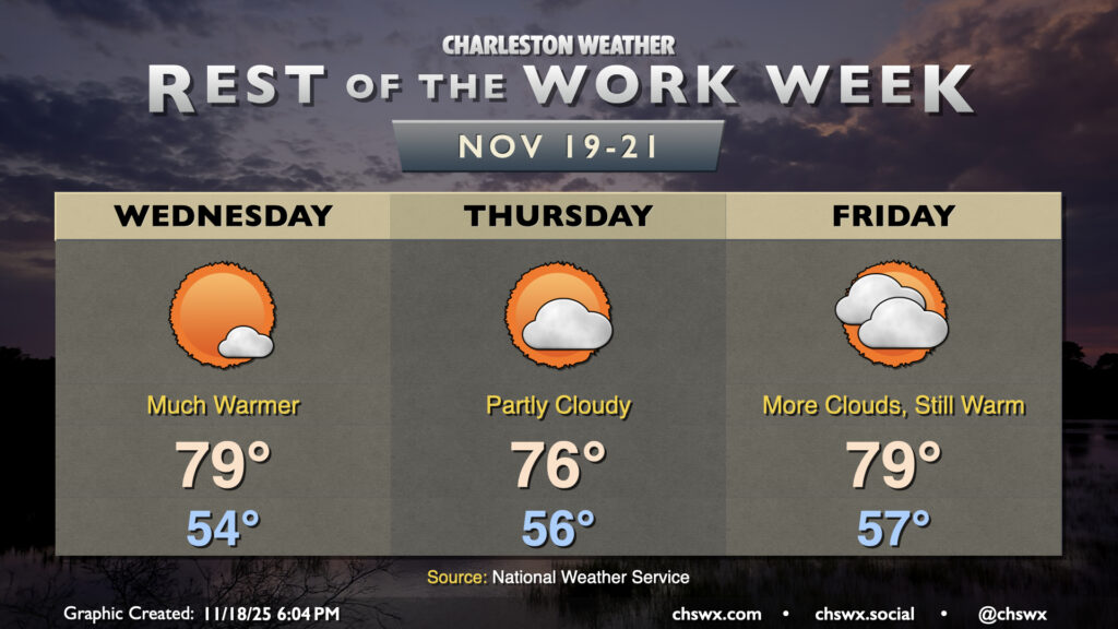
The main weather story for the rest of the work week will be unseasonable warmth courtesy of a ridge building in aloft. Temperatures will run well above normal, with highs approaching 80° particularly Wednesday and Friday (and maybe Thursday, depending on the position of a cold front to the north).
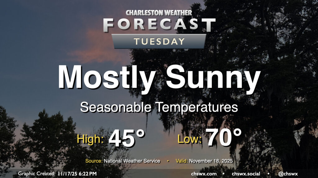
After a near-normal day of temperatures on Monday, we’ll look for a similar performance on Tuesday. Temperatures will start in the mid-40s across much of the area (a little warmer near the coast, a little cooler further inland), and highs will peak around 70° in the afternoon with mostly sunny skies remaining the rule. Winds will be going more southerly during the day as surface high pressure begins to shift offshore. This will set us up for a few days of rather warm temperatures starting Wednesday.