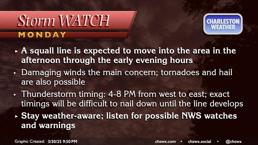
March will conclude on an unsettled and stormy note as a front moves through the area late Monday, bringing with it the risk for strong to severe thunderstorms as a squall line moves by in the late afternoon/early evening hours. It’ll be a very warm end to March, with highs peaking in the low 80s after a start in the low to mid-60s. There should be some breaks in the clouds, and with that, decent instability should develop. The shear is not off the charts, but with the instability and some pockets of drier air aloft, enough is there to support a scattered severe threat with damaging winds the primary concern. A tornado or two on the leading edge of the line can’t be totally ruled out, nor can some hail as well. Timing for thunderstorms is generally in the 4-8PM range from west to east across the metro, so be alert for potential issues during the commute. (The school day should be fine, though after-school stuff might get iffy if storms move a little faster than forecast.)
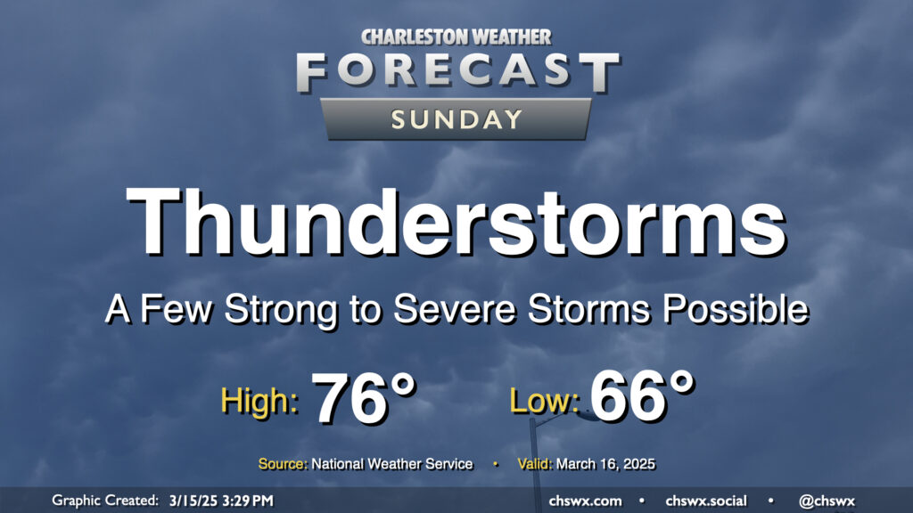
The main weather story for Sunday will be the risk for strong to severe thunderstorms in association with a squall line moving through the area generally from the mid-morning through mid-afternoon hours. Damaging wind gusts will be the overriding concern, but a tornado or two cannot be discounted, nor can some sporadic hail reports be discounted as well.
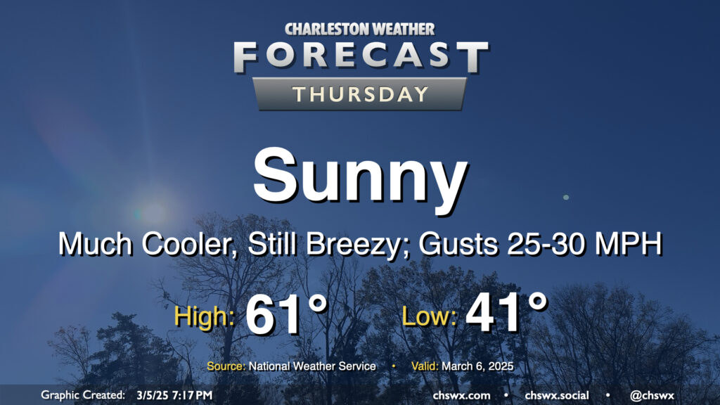
After a windy and occasionally rainy Wednesday that, thankfully, didn’t result in any severe weather, we will turn much cooler and sunnier for Thursday. Temperatures start in the low 40s, warming to just the low 60s in the afternoon with breezy conditions featuring gusts 25-30 MPH at times, particularly in the morning through the early afternoon as high pressure builds in. We’ll see that high pressure settle in a little more later Thursday night, and that will help winds go a little calmer and start to cool us off for potential frost and freeze issues inland for Thursday overnight into Friday morning.
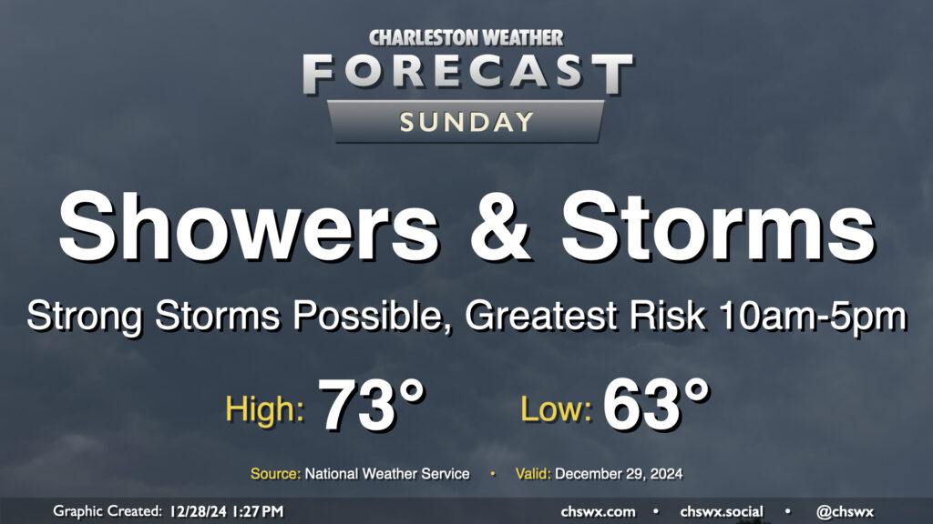
Sunday looks to be an active weather day as a cold front approaches the area. Expect at least scattered to numerous showers and thunderstorms to develop throughout the day, with a possible squall line moving by sometime in the early to mid-afternoon hours.
Category 4 Hurricane Helene continues to push toward a landfall in Florida this evening, intensifying rapidly as it does so. Here at home in the Lowcountry, we have been dealing with a fair bit of rain for much of the day, though the severe weather to this point has avoided the Tri-County. That may run out soon, though, as more rain bands develop and move ashore as we get into tonight and the overnight hours.
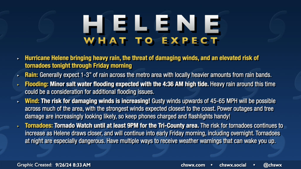
A potentially busy weather day awaits as Hurricane Helene strengthens again on approach to landfall late tonight on the Big Bend of Florida. A Tornado Watch is now in effect until at least 9PM, though I expect this to be extended overnight, as conditions continue to improve for the development of tornadoes. There has already been one tornado warning this morning in Beaufort County, likely with more to come. Tornadoes are the main concern with Helene, though heavy rain and gusty winds could still cause flooding and power outage issues.
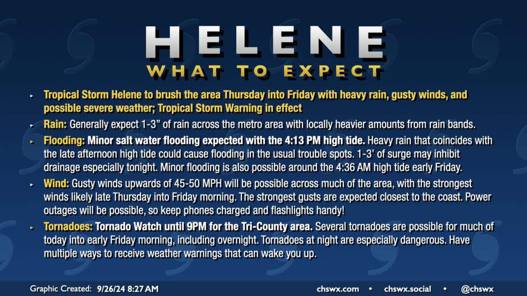
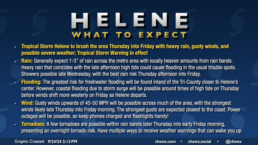
Hurricane Helene’s outer fringes will begin to affect the area on Thursday, with impacts peaking Thursday afternoon through Friday morning. Gusty winds, heavy rain, and a risk for tornadoes are the main concerns. A Tropical Storm Warning is in effect for the Lowcountry, including the entirety of the Charleston Tri-County area.
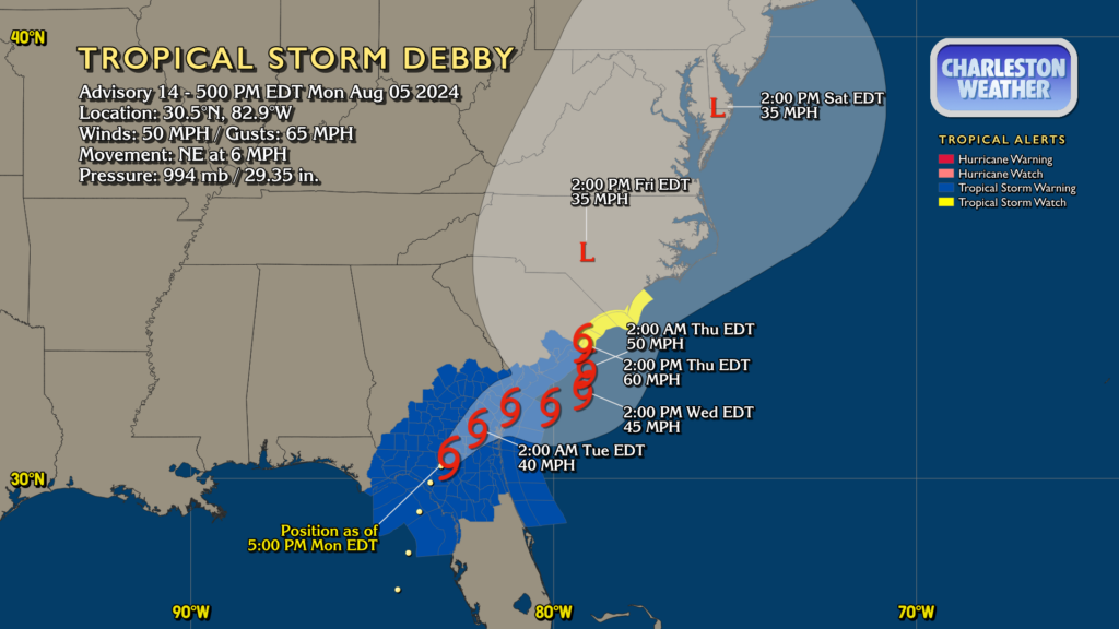
Debby made landfall this morning along the Big Bend of Florida as a Category 1 hurricane. It’s since fallen back to being a tropical storm with max winds now at 50 MPH, but its forward speed has been slowing as steering currents collapse around it. This is setting the stage for the well-advertised prolonged deluge and flash flood threat that will unfold particularly over the next couple days.
We will get the first week of July off to a very soggy start as a front stalls in the area, bringing a risk for numerous showers and thunderstorms on Monday evening (more on that shortly). While rain chances back off a little bit Tuesday and Wednesday as the front meanders and weakens, we will get at least a brief break from the advisory-level heat that punctuated the end of June. Rain will keep highs to the upper 80s on Monday, while onshore flow Tuesday helps to keep highs tamped down to the mid-80s. Warming begins again Wednesday, though, with upper 80s yielding to mid-90s on the Fourth of July. We’re in the upper 90s for Friday and the weekend with standard afternoon and evening shower and thunderstorm chances expected.