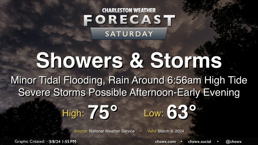
After one round of thunderstorms moved through Wednesday, a second round of unsettled weather, featuring potentially flooding rains in the morning and severe thunderstorms in the afternoon, lies ahead on Saturday.
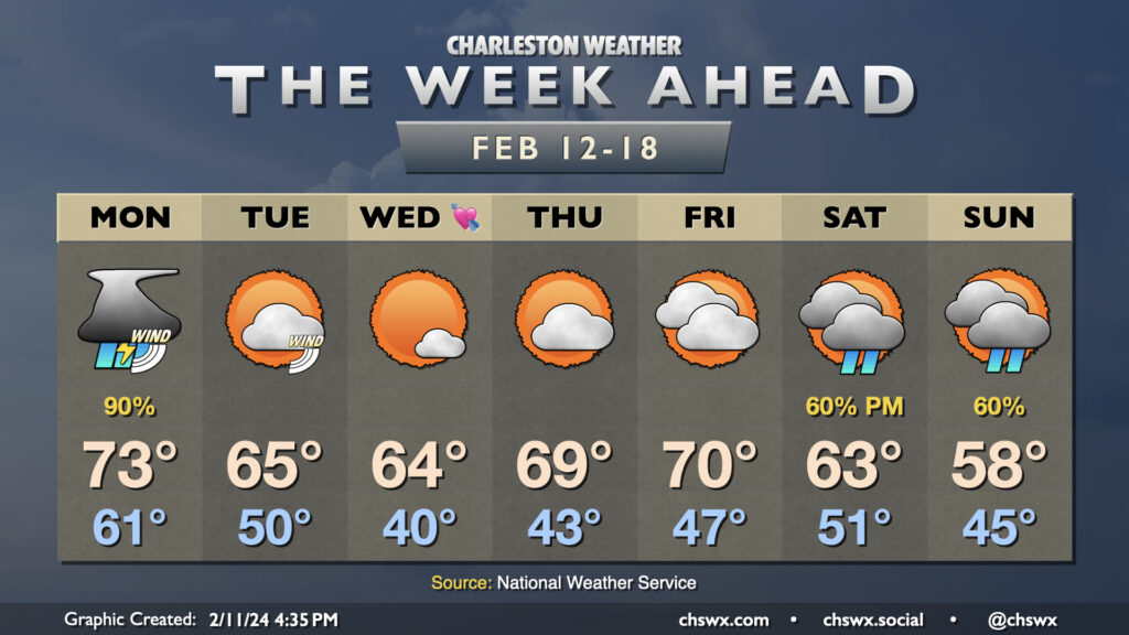
The upcoming week will get off to a fairly stormy start on Monday, but we’ll see things calm down and cool off a little bit for a few days before another storm system affects the area over the weekend.
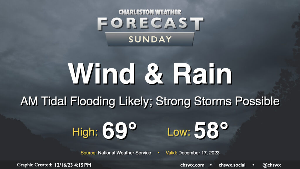
A fairly lousy and potentially high-impact weather day lies ahead for Sunday as a strengthening nor’easter moves along the coast. Wind and rain will begin to pick up early Sunday morning, with gusts near 45 MPH at times (and potentially even higher on bridges and overpasses). Rainfall could turn out to be quite significant, especially within any thunderstorms that can fire; before it’s over, many of us could see 3-5″ of rain with even higher amounts in some spots. Flooding is increasingly a concern as a result, especially with the potential for an 8′ water level around the 11:17am high tide coinciding with continued heavy rain. Finally, if surface-based instability can develop, a severe thunderstorm or two with locally damaging wind gusts and maybe even a tornado could be possible. All this to say that Sunday’s a good “stay inside” day.
Standard July warmth and mugginess will continue on Sunday. We’ll start the day in the mid-70s under partly cloudy skies, and we should get the first part of the day in rain-free. From there, we’ll start to see showers and thunderstorms develop by mid-afternoon and make their way into the area from the west and southwest throughout the rest of the evening. The strongest storms could produce strong wind gusts, while heavy rain and frequent lightning will be more widespread concerns. Be ready to bring outdoor activities inside if thunderstorms approach.
We open the week with the risk of a few strong to severe thunderstorms, and get much warmer thereafter as we say goodbye to June and welcome in July, with the first heat advisories of the season possible by the weekend.
Sunday will be a much more traditional warm and somewhat muggy June day across the Lowcountry than we’ve felt for much of the month, really. We start the day in the low 70s before temperatures warm into the low 90s under mostly sunny skies. Kick in some humidity and it’ll feel closer to 95° in the afternoon at peak heating. It looks quite unlikely that a shower or storm will develop, though it can never be totally ruled out in the summertime. Suspect it’ll be another day full of Instagram stories from the beach. Use that sunscreen as the UV index will be a solid 10.
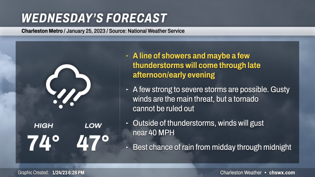
Wednesday could be a busy weather day here in the Lowcountry as a very dynamic storm system moves into the eastern half of the continental US, dragging a cold front through the Southeast throughout the day with showers and thunderstorms ahead of it.
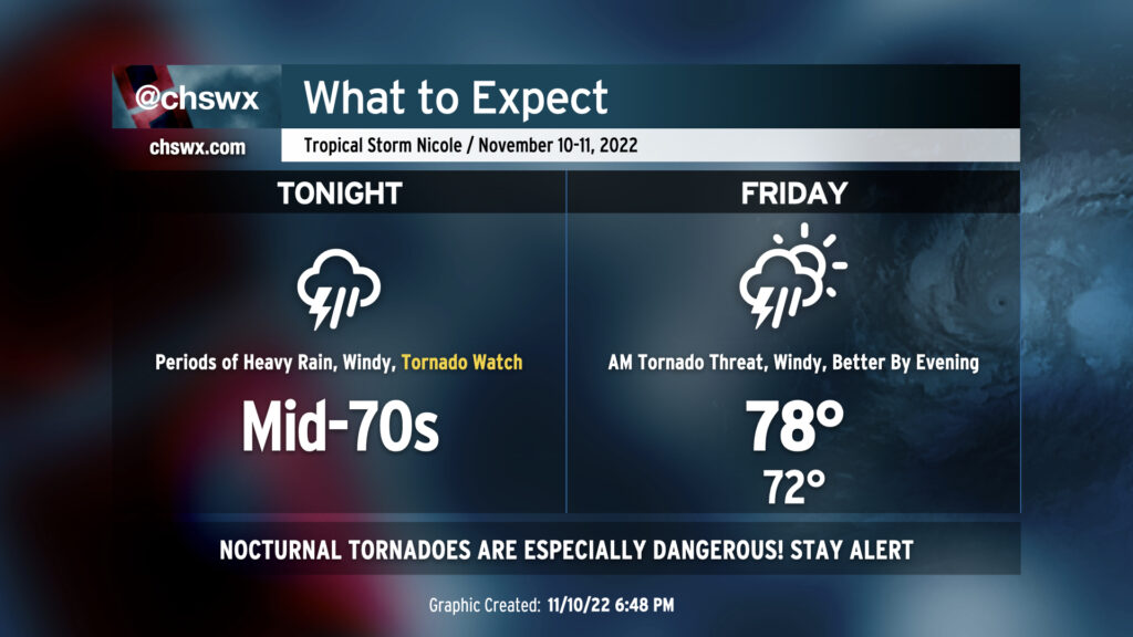
We have a potentially very busy 18-24 hours of weather ahead as Tropical Storm Nicole makes the turn to the north and the northeast overnight into Friday, keeping us on the “dirty” side of the storm. The main concern is overwhelmingly the threat for tornadoes overnight. A Tornado Watch is in effect until 1am, and it wouldn’t be surprising to see it extend even beyond that. Secondary to this will be the continued risk for heavy and potentially flooding rain at times, with gusty winds also a concern.
Nicole’s roughest weather arrives tomorrow and will last through Friday afternoon before improvement sets in just in time for the weekend. Heavy rain, gusty winds, tidal flooding, and a few tornadoes are all on the table with this event. Here’s what to expect.
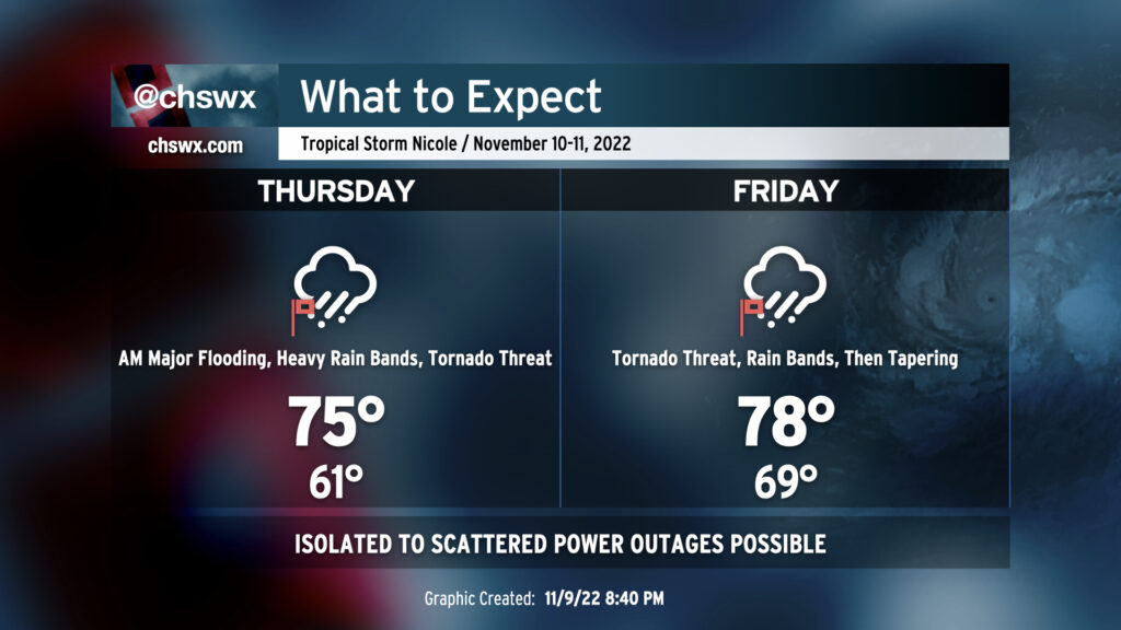
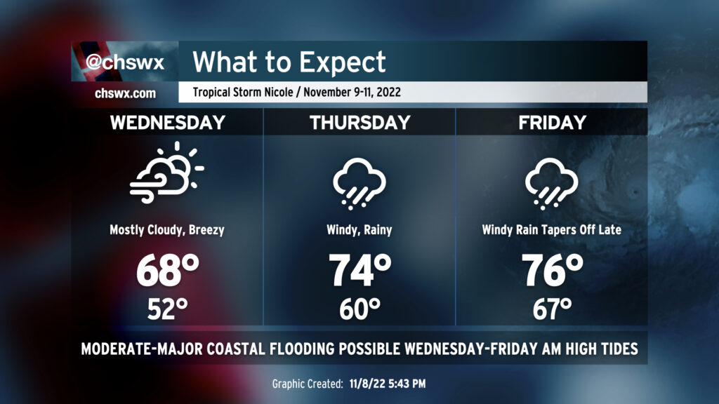
We have a busy few days of weather ahead of us as Tropical Storm Nicole makes landfall on Florida, perhaps as a hurricane, and then turns north and northeast to strafe the Carolinas with heavy rain, wind, and maybe even some severe weather.