Rest of the week: 2020 offers a stormy transition to 2021

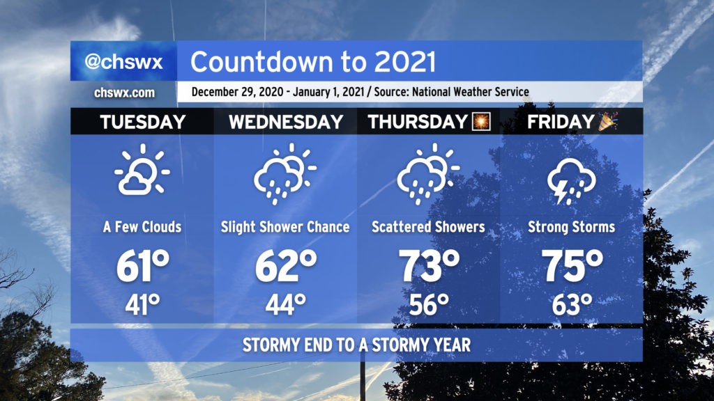
2020 looks to hand off to 2021 in the fashion we would expect from this year — a bit on the warm and stormy side — as a cold front approaches the area from the west.
The last few days of the year will get progressively warmer, with 70s back in the picture for New Year’s Eve. Rain chances also return beginning Wednesday, with a shower or two possible as a coastal trough moves inland in response to high pressure to the northeast breaking down and moving out. Rain chances improve for Thursday along with a noticeable jump in temperatures (70s!) as warm and moist air overspreads the area ahead of our next storm system.
Overall, if you’ve got things to do outdoors, Tuesday’s your best day to for-sure avoid rainfall. As for New Year’s Eve, I’m not expecting a washout for fireworks displays as of now, but the devil is in the details. Stay tuned.
Read more »