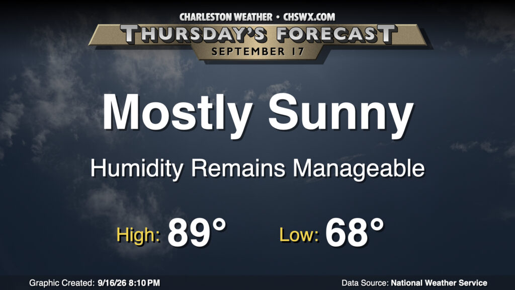
Another warm mid-September day lies ahead for Thursday as high pressure remains the dominant weather feature at the surface and aloft. We’ll get off to another pleasant start with lows in the upper 60s warming to the upper 80s in the afternoon with dewpoints in the mid-to-upper 60s away from the coast, where dewpoints will settle in the 70-72° range. Dry air in the atmospheric column will make for mostly sunny skies, with just a few passing clouds expected.
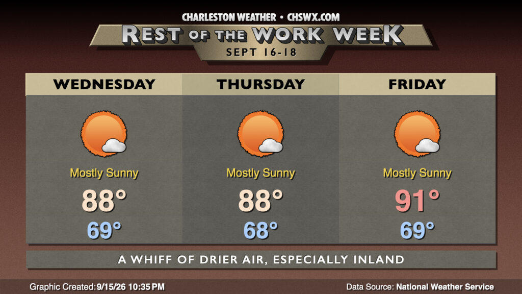
Drier air courtesy of high pressure wedging southwestward across the area will characterize the rest of the work week, bringing slightly more comfortable dewpoints to the area and seasonable temperatures for mid-September.
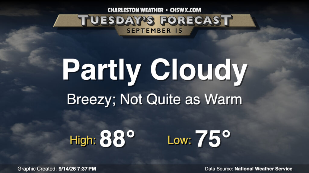
A front coming through on Tuesday will knock temperatures back from the record levels of the past two days, bringing some breezy conditions and maybe some coastal flooding in the process. We start the day in similar fashion to the past couple days, with lows in the mid-70s expected. High pressure building south will swing winds around to the east and northeast in the morning, turning things gusty in the process (especially at the coast). This wind may also help drive tidal departures higher, perhaps causing some minor coastal flooding with the midday high tide. Widespread flooding issues are not expected, though. We will see dewpoints begin to drop during the afternoon with highs peaking just in the upper 80s, right around mid-September normals.
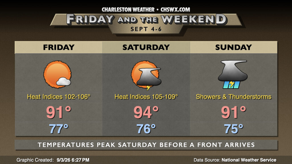
A cold front will stall out to our north, keeping warm and muggy conditions in place with disturbances bringing about showers and thunderstorms each day, especially Saturday.
Summer won’t loosen its grip just yet, especially as we head into Friday and Saturday as a front approaches the area, sending air temperatures back to the mid-90s and heat indices close to heat advisory territory.
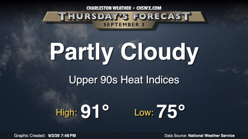
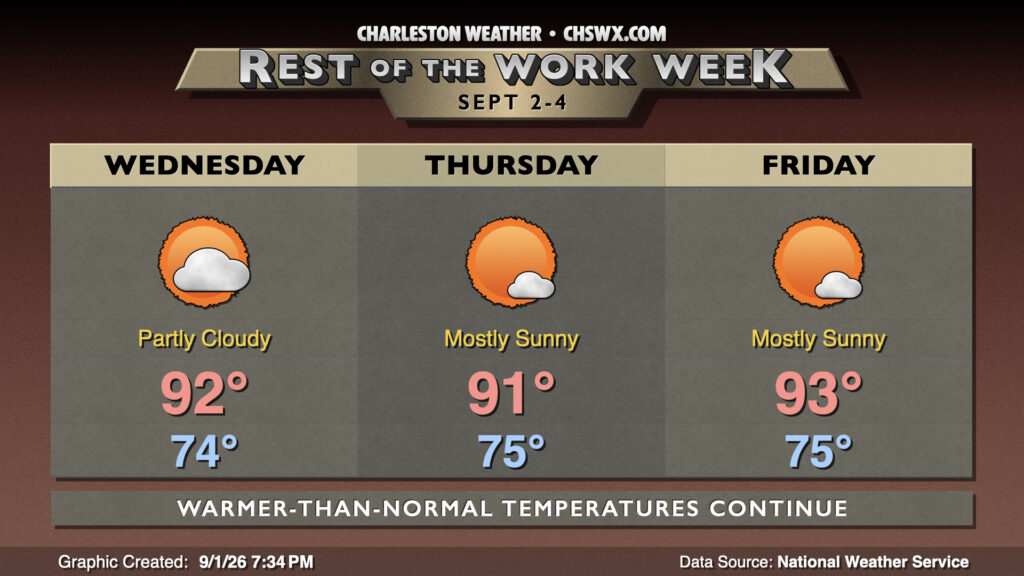
Thursday looks to generally be a repeat of Wednesday (weather-wise, anyway). We’ll start the day in the mid-70s once again, warming to the low 90s in the afternoon. Mid-70s dewpoints will help drive the heat index into the upper 90s to around 100° — not quite August, but getting long in the tooth. The day should be primarily quiet with partly cloudy skies expected, though like we saw roll through Moncks Corner on Wednesday, a stray shower can’t be totally ruled out.
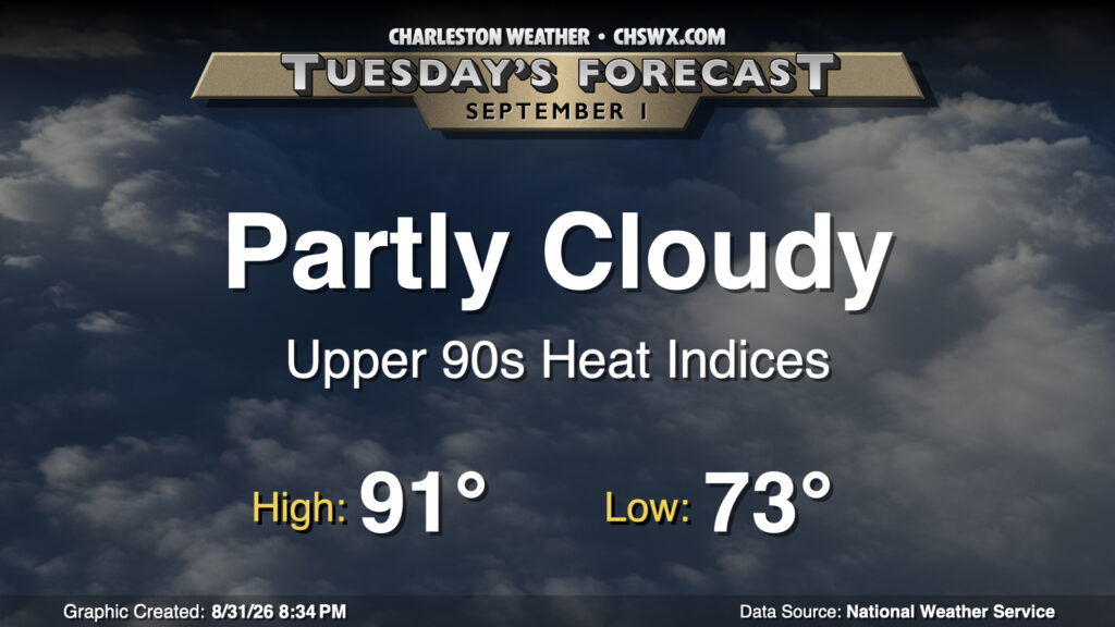
The first day of September marks the beginning of climatological fall, but it certainly won’t feel that way with a stretch of 90s coming up. Tuesday starts this streak, with highs expected in the low 90s after a low-to-mid-70s start. Ridging aloft will continue to build over the area, and that should suppress much in the way of shower and thunderstorm development in the afternoon, though a stray popup isn’t out of the question.
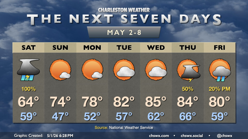
We’re taking a look at the next seven days tonight as I’ll be taking a bit of a break over the next few days. A more regular posting schedule resumes Friday!
A rain-cooled day is on tap for Saturday — not quite peak air show weather, that’s for sure — as we may challenge a record cool high temperature. The coolest high temperature on record for May 2 is 63°, set in 1978; the NWS forecast for the airport currently calls for highs to reach about 64°. It’s gonna be close! As mentioned, some much needed rain will be falling throughout the day, with some rumbles of thunder possible with some elevated instability. No severe weather is anticipated, though. It’ll be generally on and off through late afternoon before tapering off in the evening. Many of us should see an additional inch to inch and a half of rain before it’s over — quite a nice sight given the ongoing severe drought.
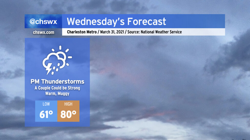
A cold front will approach the area from the west throughout the day Wednesday, with shower and thunderstorm chances increasing later in the day as the front gets closer. A couple showers or storms can’t be ruled out in the afternoon well ahead of it, but the best rain chances will start early in the evening through the overnight. One or two storms could turn strong with gusty winds and hail, especially for those of you who are further inland. However, widespread severe weather is not expected.
We’ll be at the apex of this week’s temperature rollercoaster with highs topping out around 80° in the afternoon. Afterward, it’s a much different story…