Here comes the heat wave

High pressure is aligning at the surface and aloft to bring us quite the early-season heat wave starting tomorrow, featuring a run at the all-time warmest May day on record and little to no rain for many of us.
Read more »High pressure is aligning at the surface and aloft to bring us quite the early-season heat wave starting tomorrow, featuring a run at the all-time warmest May day on record and little to no rain for many of us.
Read more »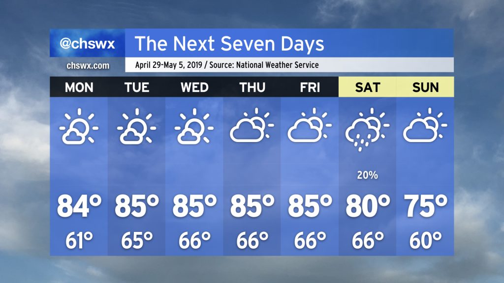
Since the Good Friday severe weather event, weather has been largely quiet in the Charleston metro area. Even a front that swung through this past Friday wasn’t able to eke out any rain across the Lowcountry. As a ridge of upper-level high pressure continues to be in control, we have more warm, dry days ahead.
Read more »
Spring has come into full swing here in the Lowcountry. After what was a fortunate severe weather non-event on Sunday, we had a much cooler and less humid Monday with highs topping out around 74° under plenty of sunshine. We get a repeat of that today as high pressure maintains control over our weather today through Thursday. Our next storm threat comes Friday, and may bring some strong winds to the area. Let’s dive in…
Read more »
The warmest day of #FakeSpring is upon us, with highs expected to top out in the low 80s away from the beaches, which will remain much cooler under the influence of water temperatures in the 50s. The NWS forecast high of 81° would be a new record for the date.
Read more »