A quiet stretch of weather continues
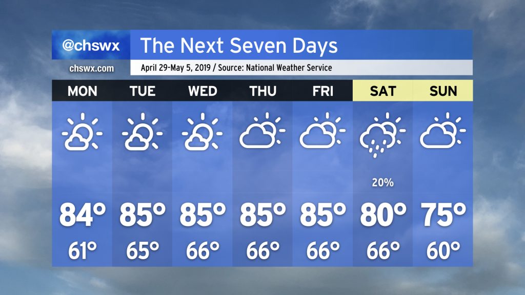
Since the Good Friday severe weather event, weather has been largely quiet in the Charleston metro area. Even a front that swung through this past Friday wasn’t able to eke out any rain across the Lowcountry. As a ridge of upper-level high pressure continues to be in control, we have more warm, dry days ahead.

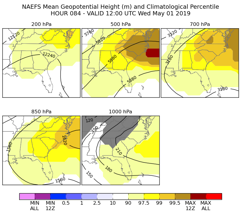
This ridge aloft is a strong one and is going to work against any sort of seabreeze convergence over the next few days. Looking at charts from the North American Ensemble Forecast System (NAEFS, a familiar term for those of you who read a lot of Area Forecast Discussions from NWS offices), the deep layered high pressure will become much stronger than the climatological norm for this time of year, particularly on Wednesday.
All in all, this means that prolonged dry conditions look to continue over much of the area for the rest of the work week. While many of us celebrate this as a time to get outdoors, this isn’t great news for those of you trying to tend to a garden or much more urgent agricultural needs.

Moderate drought continues over the Tri-County area, with rainfall deficits running 6-7″ below where we should be for this time of year. While we have had storms at times, they just have not produced enough rainfall to really make a difference, and with eight days (and counting) since measurable rainfall has fallen at the airport, this drought could continue to worsen as we begin May.
Changes coming?
The deep-layered ridge remains intact through Thursday before a trough begins to move in from the west during the day Friday. This will weaken the grip of high pressure over the area, and perhaps allow the seabreeze to become a little more active as temperatures remain well into the 80s in the afternoon.
Some pretty significant differences in the model guidance then show themselves for Saturday. The current NWS forecast calls for a cold front to swing through the area late Friday into Saturday. Model output for those days shows paltry precipitation, though.
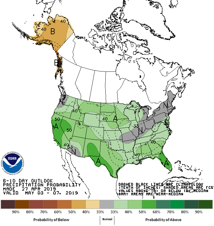
The Climate Prediction Center does indicate that there is around a 40%-50% chance of above-normal precipitation in the first full week of May. Perhaps there is some relief for your water bills on the horizon yet. As you may recall, we spent much of last winter and spring in a drought before the floodgates opened up in May. Hopefully we don’t get it all at once, but a few soaking days would be awfully nice.
I’ll keep an eye on all this for you. In the meantime, go enjoy this nice stretch of weather!
Follow my Charleston Weather updates on Mastodon, Bluesky, Instagram, Facebook, or directly in a feed reader. Do you like what you see here? Please consider supporting my independent, hype-averse weather journalism and become a supporter on Patreon for a broader look at all things #chswx!