The week ahead: Cold returns, but will be short-lived
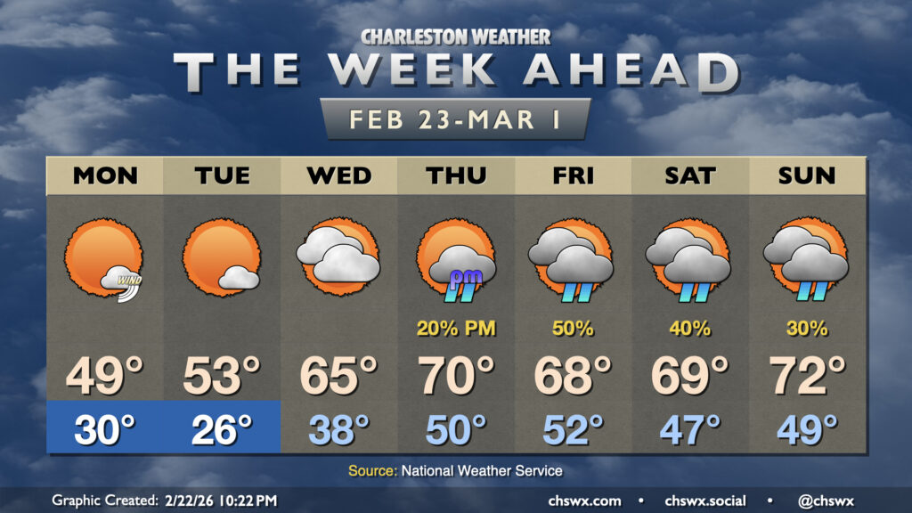
Winter makes a brief return to the Lowcountry to start the final week of February, but temperatures look to rebound for the second half of the week, albeit with some shower chances.
Read more »Winter makes a brief return to the Lowcountry to start the final week of February, but temperatures look to rebound for the second half of the week, albeit with some shower chances.
Read more »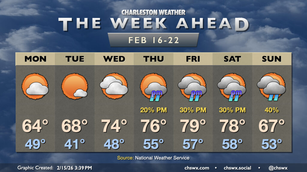
After some much-needed rain on Sunday, sunshine and warmth return for the new work week as high pressure remains the main weather driver for a few days before shower chances return to the picture later in the week.
Read more »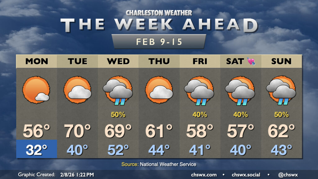
While we do have some rain chances in store this week, what we will be lacking (after Monday morning, anyway) is subfreezing cold. It’s been a very chilly start to February so far — in fact, this first week of February (Feb 1-7) ties 1951 for ninth coldest on record at the airport with an average temperature of 42.2°. We will thankfully break the cold snap this week as the upper-air pattern changes a bit, favoring a ridge trying to nudge in from the south that’ll keep the colder air bottled up to the north.
Read more »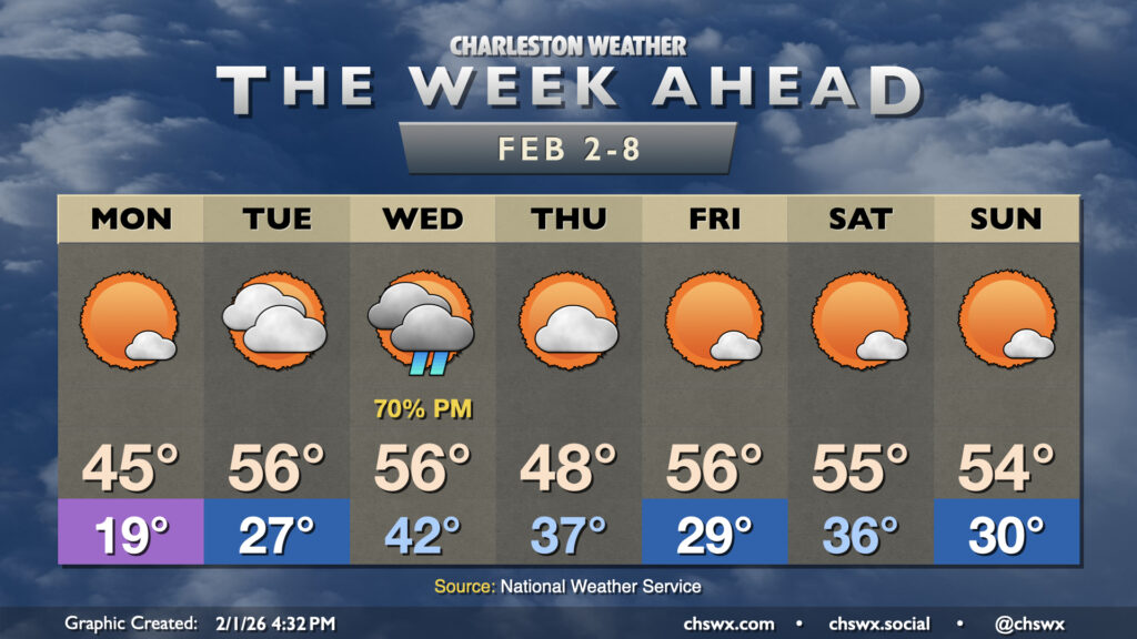
Our run of cooler than normal temperatures that closed January will continue for the first week of February, but a repeat of the past couple weekends of wintry intrigue, mercifully, is not expected.
Read more »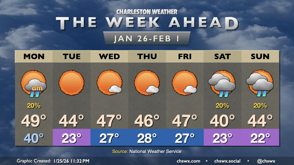
A cold front coming through on Monday will usher in much colder and drier air, keeping temperatures well below normal as we bid adieu to January.
Read more »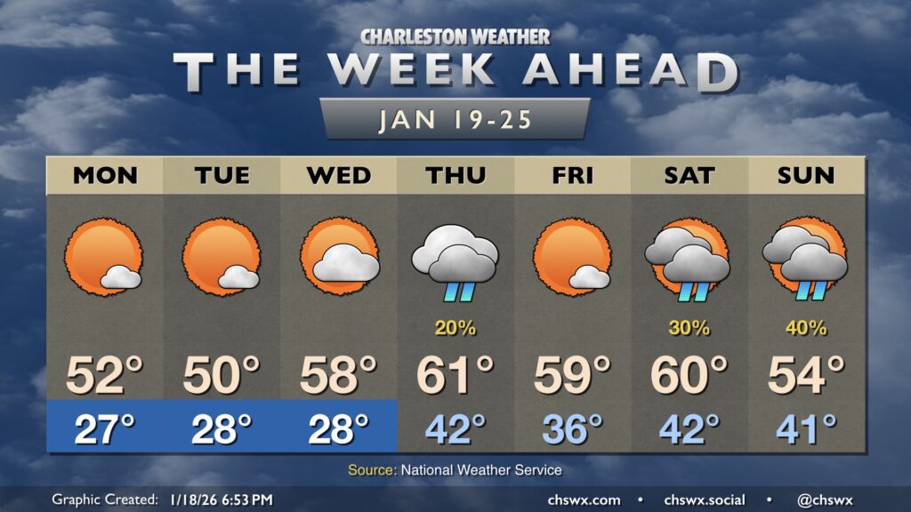
After some much-needed rain on Sunday, we get into a stretch of a few quiet but chilly days beginning on Monday. We’ll start Martin Luther King, Jr. Day in the mid-to-upper 20s across much of the metro away from the immediate coastline. There’s a slight chance for a little black ice in more sheltered and rural areas in the morning, but the vast majority of us will be okay as drier air with elevated winds should evaporate much, if not all, of today’s rain before things freeze. Temperatures will head into the low 50s with plenty of sunshine.
Read more »
This week will have a much different (and more seasonally-appropriate) feel than last week did as multiple shots of cold air are queued up for our neck of the woods.
Read more »
A quiet and warm week of weather lies ahead as we go back to work and school for the first time in 2026. Temperatures this week will climb some 10-15° above normal at times, but we should stay just short of any record highs.
Read more »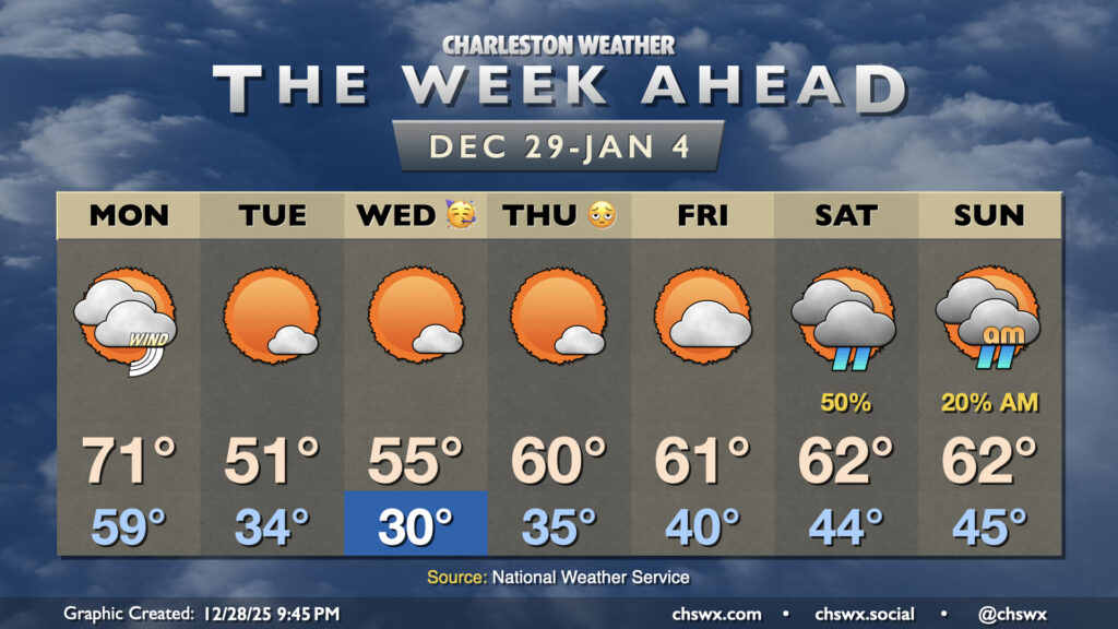
One more unseasonably warm day is on tap for Monday before the airmass flips, which will help us usher in 2026 on a cooler and more seasonable note.
Read more »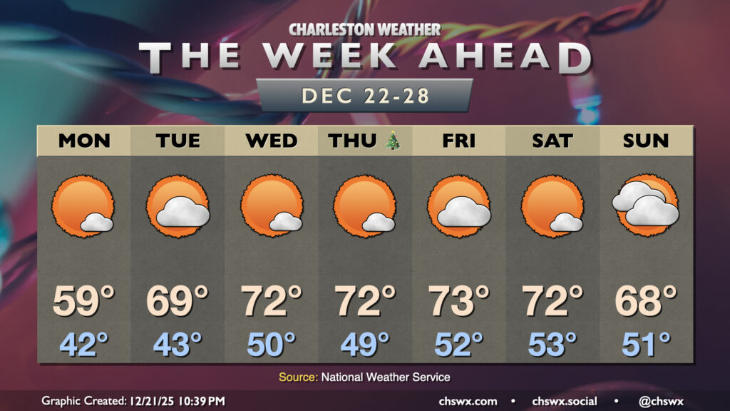
The main weather story for the week ahead — including Christmas Day — will be much warmer-than-normal temperatures as high pressure aloft will remain the dominant weather feature across a good bit of the continental US.
Read more »