High pressure takes the wheel and turns up the heat

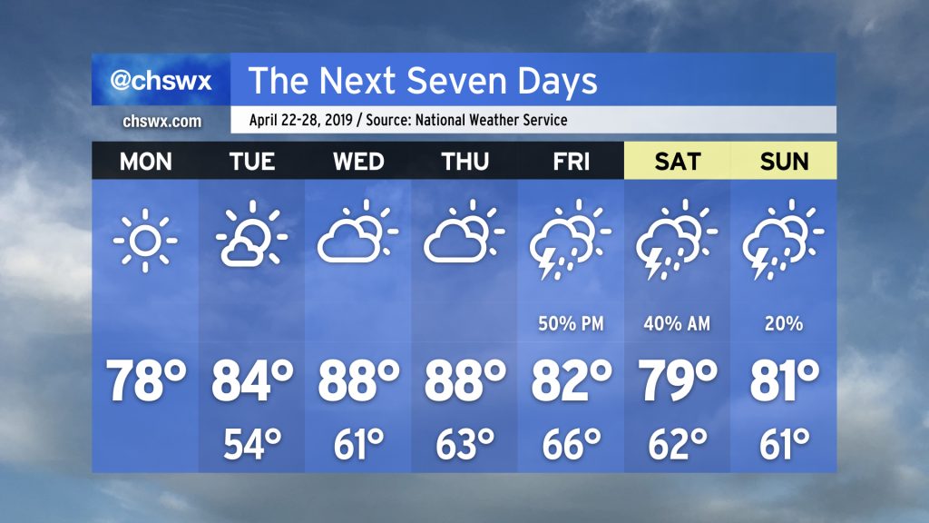
High pressure remains in control of the forecast through Thursday, yielding several quiet weather days. (That sound you hear is the collective sigh of lots of Charleston-area meteorologists who spent much of Friday doing battle with spin-up tornadoes.)
We’ll maintain seasonable conditions through Tuesday as high pressure gradually slips offshore. Southerly flow around the back side of the high turns on the heat pump for Wednesday and Thursday, with highs expected to top out in the upper 80s for the first time this year. A cold front will then approach on Friday, bringing a chance for showers and thunderstorms to the area. Some chance of rain lingers through the weekend, but it’s nothing to toss your plans over.