Tropical update: Keeping tabs on Dorian

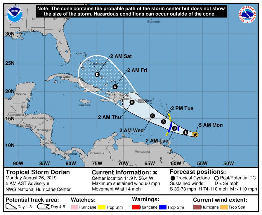
Tropical Storm Dorian formed over the weekend, fighting dry air as it approaches the Lesser Antilles. It has a highly uncertain road ahead of it, but it may be something to watch as we get into next week.

The National Hurricane Center forecast has Dorian maintaining tropical storm strength, continuing to fight off dry air in its environment, as it approaches Puerto Rico and the Dominican Republic. Based on the current forecast, it may briefly intensify to become a hurricane later Wednesday or early Thursday before land interaction weakens it to a depression. From there, it is forecast to continue its trek through the Bahamas. After that, model solutions diverge between a recurvature into the Atlantic and Dorian working its way into the Gulf with a wide variety of potential intensities. We’re very far out, and there’s not going to be much confidence in Dorian’s forecast beyond Thursday given the uncertainty of potential land interaction. So, it’ll continue to be watched.
Bottom line: It’s very premature to get into any details regarding potential US impacts. It’s nothing to panic over; just keep an eye on it for now.
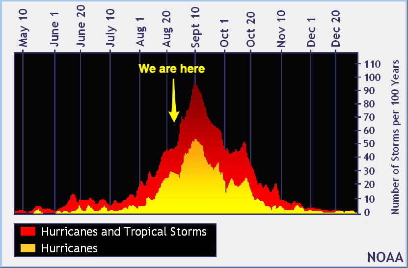
Entering the peak of the season

The climatological peak of hurricane season is coming up on September 10. It’s expected that things would become a little more active around this time of year. It doesn’t necessarily mean that we are going to be harassed by every storm that forms, either.
Now is a good time to check your hurricane plan and make sure it’s up to date. Hopefully you won’t need it — but if you do, you’ll be glad you had it!
Follow my Charleston Weather updates on Mastodon, Bluesky, Instagram, Facebook, or directly in a feed reader. Do you like what you see here? Please consider supporting my independent, hype-averse weather journalism and become a supporter on Patreon for a broader look at all things #chswx!