Tropical update: Jerry’s recurvature is likely, but more waves to watch

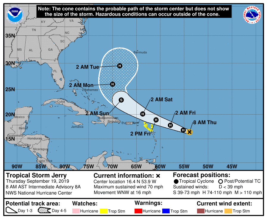
So let’s start with the good stuff: Model agreement has continued to improve regarding Tropical Storm Jerry’s future path, and that path is toward recurvature way from the US East Coast this weekend. (Bermuda, which just took a pretty good whooping from Humberto, will want to watch Jerry with wary eyes.) But, for Charleston, Jerry increasingly looks like a storm about nothing. It is forecast to become a hurricane later today, but will encounter hostile upper-air conditions that will limit its further development, according to the Hurricane Center. This should preclude the stronger solutions and a more southerly track as seen in a few of the global guidance members that we discussed yesterday.

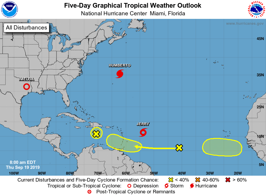
There are more waves to watch, though. One wave, south of Hispaniola, is going to have a hard time getting going thanks to its expected interaction with the island as it moves northwest. NHC gives it 10% odds to develop in the next five days.
A second wave well southeast of Jerry has a chance to develop as it takes a more southerly track into the Windward Islands over the next few days. NHC has this at 30% odds to develop in the next five days. The latitude of this wave will indicate a system for us to watch if it does indeed develop.
A third wave, which has yet to come off the coast of Africa, has a 20% chance of development in the next five days as it hits the waters. Plenty of time to watch, but its expected latitude, between 5 and 10° N, also means it’s something to keep an eye on for now.
Bottom line
- There are currently no imminent tropical threats to the Lowcountry.
- Jerry looks very likely to recurve well away from the East Coast of the United States sometime Sunday.
- There are a couple waves to watch, but we have a lot of time to do so.
- Enjoy this beautiful fall preview!
Follow my Charleston Weather updates on Mastodon, Bluesky, Instagram, Facebook, or directly in a feed reader. Do you like what you see here? Please consider supporting my independent, hype-averse weather journalism and become a supporter on Patreon for a broader look at all things #chswx!