Warmer for much of the week, but more cool weather to come

After a very refreshing weekend of below-normal temperatures, we will be headed back into the 70s for a few days starting Monday. (For what it’s worth, highs in the 70s are normal for early November.) However, another round of unseasonably cool weather is on tap for the weekend.
Warmer air returns as high pressure slips offshore
After another chilly start on Monday — lows in the mid-40s will be common away from the beaches — we will start to see a little bit of a warmup as high pressure heads offshore and winds go a little more southerly. Expect a high right around 70° with an uptick in cloud cover.
Our next rain chance arrives overnight Monday into early Tuesday as a coastal trough develops and gets near the coast. This rain chance will depart by midday Tuesday as a weak cold front approaches the area. By Wednesday, expect a small downturn in temperatures, but we will still be in the low 70s in the afternoon.
The next rain chance this week tentatively arrives overnight Thursday into much of Friday as a stronger cold front approaches the area. You will definitely notice this front — read on.
Chilly air builds back in for the weekend — and beyond

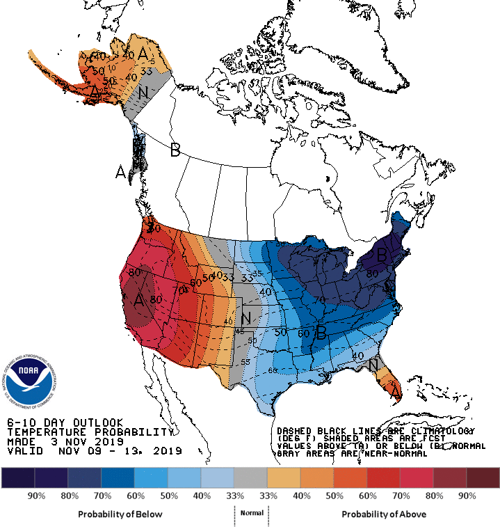
After Thursday and Friday’s cold front, we’ll get a shot of cold air that will send temperatures closer to January normals once more. We’ll want to keep an eye on this one over the weekend as some inland spots might actually see a little frost; some of the guidance wants to dip into the upper 30s. A lot of details to work out still, though. Just keep the sweaters on standby.
The pattern largely favors cooler air remaining in place over the next week or two, as a trough in the east continues to hold tight. (Ridging in the west will keep conditions warm, dry, and favorable for more fires.)
Tides

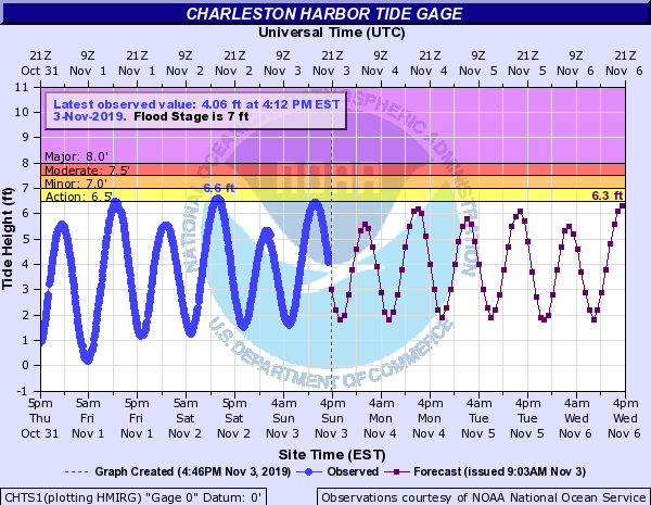
Tides look to stay in check for the next several days. We may see an uptick in water levels getting into Wednesday and Thursday as winds turn a little more northeast, but no coastal flooding is expected for the next few days.
Tropical update

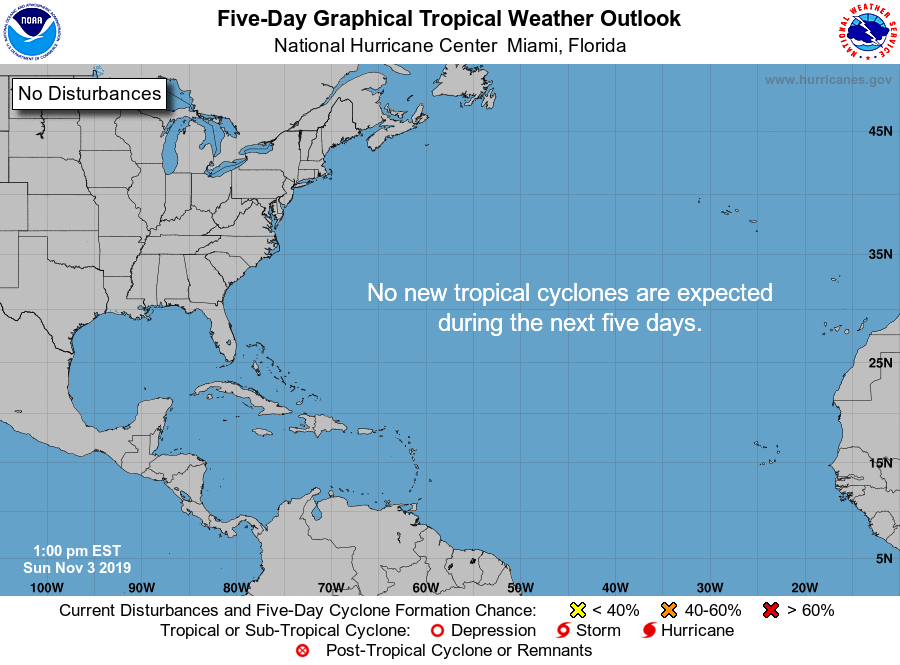
After a brief appearance from Subtropical Storm Rebekah this past week, we’re down to four names: Sebastien, Tanya, Van, and Wendy.
Looks like we’re going to stay quiet, though, at least for the next few days.

November is often a quiet final month of the tropical season. We in #chswx will keep an eye on it, but we are most assuredly turning our attention more toward our sweaters than our hurricane go-bags at this point.
Follow my Charleston Weather updates on Mastodon, Bluesky, Instagram, Facebook, or directly in a feed reader. Do you like what you see here? Please consider supporting my independent, hype-averse weather journalism and become a supporter on Patreon for a broader look at all things #chswx!