Heavy rain overnight into Wednesday; 2-4″ forecast in spots through Friday
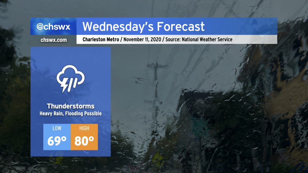
Periods of heavy rain look to continue for the next few days as moisture from Tropical Storm Eta in the Gulf continues to overspread the area with a stalling cold front to our west. For Wednesday, showers and thunderstorms continue to overspread the area throughout the day. It’ll be muggy, with highs once again topping out around 80° after starting out near 70°, which may threaten record high minimum temperatures once again.
As always, when heavy rainfall is in the forecast, we need to watch around times of high tide for particularly acute flooding in downtown Charleston. High tides will be at 3:55am and 4:13pm on Wednesday. Given continued onshore flow, the Wednesday afternoon high tide could tip briefly into coastal flood stage as well, so that will be something to watch carefully.
Models coming around on Eta
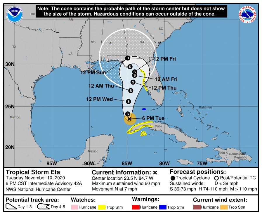
The 4PM update from the National Hurricane Center on Tropical Storm Eta continues to bring it slowly northward into the Florida Gulf Coast this weekend as it slowly weakens. Recent model guidance, however, is once again starting to hit on Eta accelerating across northern Florida ahead of a cold front over the weekend. The tropical model consensus seems to agree with keeping Eta just offshore as it accelerates northeast this weekend, eventually dissipating, though the Euro keeps it heading north into the Panhandle. The UKMET brings it along I-95, which wouldn’t be great as it would spread even heavier rain across the area. This shift in the guidance suggests that there will be additional track revisions with the 10pm forecast update from NHC.
While no direct impacts from Eta are currently in the forecast, its moisture will continue to keep elevated rain chances in place into at least Thursday, with additional heavy rainfall and possible flooding in the cards. Guidance suggests a period of very heavy rain setting up along the coast on Thursday, which would substantially increase the flooding threat if this verifies. Stay tuned.
Follow my Charleston Weather updates on Mastodon, Bluesky, Instagram, Facebook, or directly in a feed reader. Do you like what you see here? Please consider supporting my independent, hype-averse weather journalism and become a supporter on Patreon for a broader look at all things #chswx!