Soggy Thursday coming with the potential for flooding
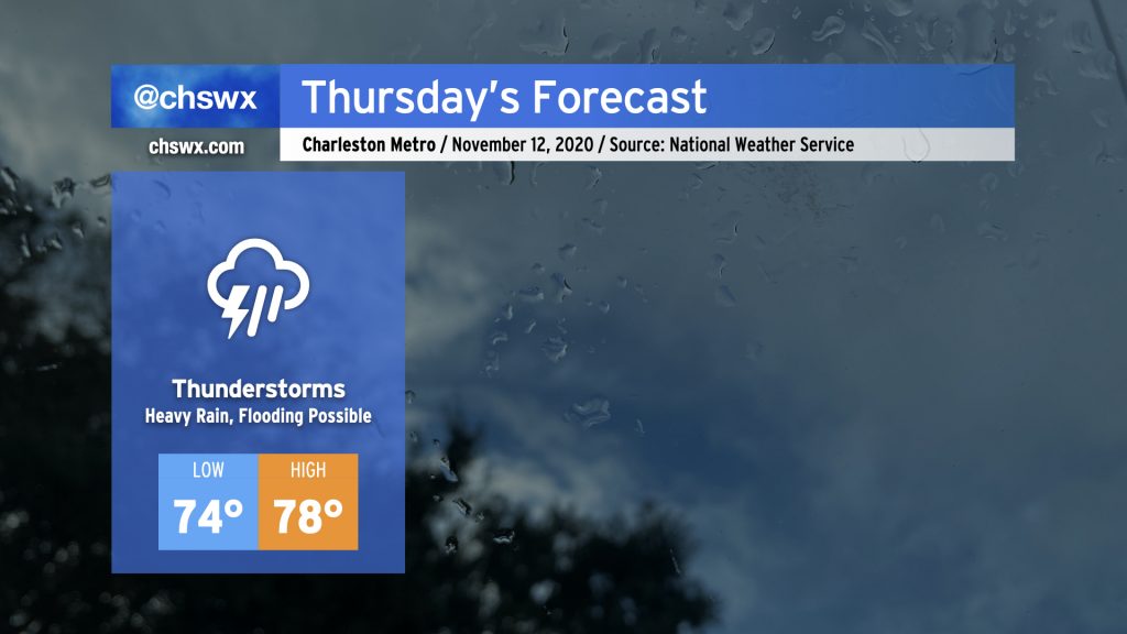
Some pretty heavy rain for any time of year, much less November, is in store for Thursday. Deep tropical moisture will continue to blanket the area ahead of a cold front. At the same time, Tropical Storm Eta will move across northern Florida and into the Atlantic, weakening while undergoing a post-tropical transition. Be ready for the potential for flooding due to heavy rain, especially around times of high tide (4:54am, 5:10pm). Some tidal flooding cannot be ruled out, either.
Temperatures are just not going to move much tomorrow with rain expected to be in place for a fair bit of the day. Highs will top out in the upper 70s after a low in the mid-70s, which would absolutely destroy the record high minimum temperature of 68° set in 1975. Our lows have been rewriting the record books for the last few days due to such abnormal warmth. (A normal November low based on 1981-2010 climatology is 48°!) Fortunately, there is some relief in sight with the cold front.
Eta approaching Florida; will be off our coast late Thursday/early Friday
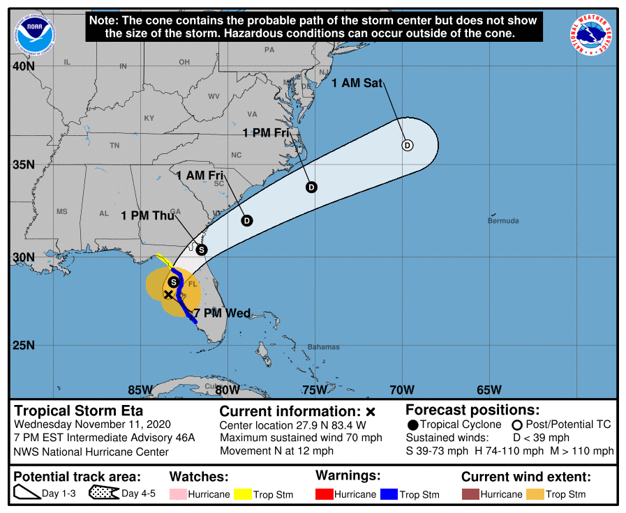
After a very nebulous week or so of guidance, Eta’s evolution is much more certain. It will make landfall as a tropical storm tonight along the western Gulf Coast of Florida, and then begin to accelerate northeastward as we get into Thursday. Around midday, expect Eta to re-emerge around Jacksonville, FL and continue to move northeast, parallel to the Carolina coast, weakening as it goes. Aside from the significant rainfall we are poised to see Thursday, Eta is not expected to have any direct impacts on the Lowcountry.
Coastal flooding risk ramps up for Friday into the weekend
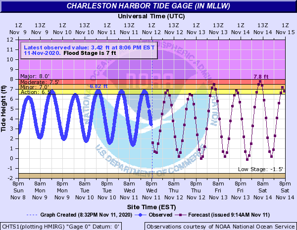
Once the cold front clears the area Friday, we’ll see temperatures moderate a little bit (but still run well above normal) and winds come around to the northeast as high pressure moves into New England, wedging down the Appalachians. As this happens, winds will go northeast (read: onshore). With the approaching new moon on Sunday, astronomical and meteorological conditions will be favorable for another round of king tides. These could be significant, with moderate coastal flooding possible with morning and midday high tides through the weekend. Probabilistic guidance is also suggesting the potential for major coastal flooding with the midday Sunday high tide. If Downtown is in your plans this weekend, be ready to find alternate routes to avoid driving through salt water.
Fall will be back
While Friday’s cold front is going to knock temperatures a bit more down to earth, we’ll get a reinforcing shot of cooler air coming through overnight Sunday into Monday. This front will be accompanied by a few showers followed by cool high pressure, which will knock temperatures back down to mid-November normals by Tuesday. Hang in there, fall fans!
Follow my Charleston Weather updates on Mastodon, Bluesky, Instagram, Facebook, or directly in a feed reader. Do you like what you see here? Please consider supporting my independent, hype-averse weather journalism and become a supporter on Patreon for a broader look at all things #chswx!