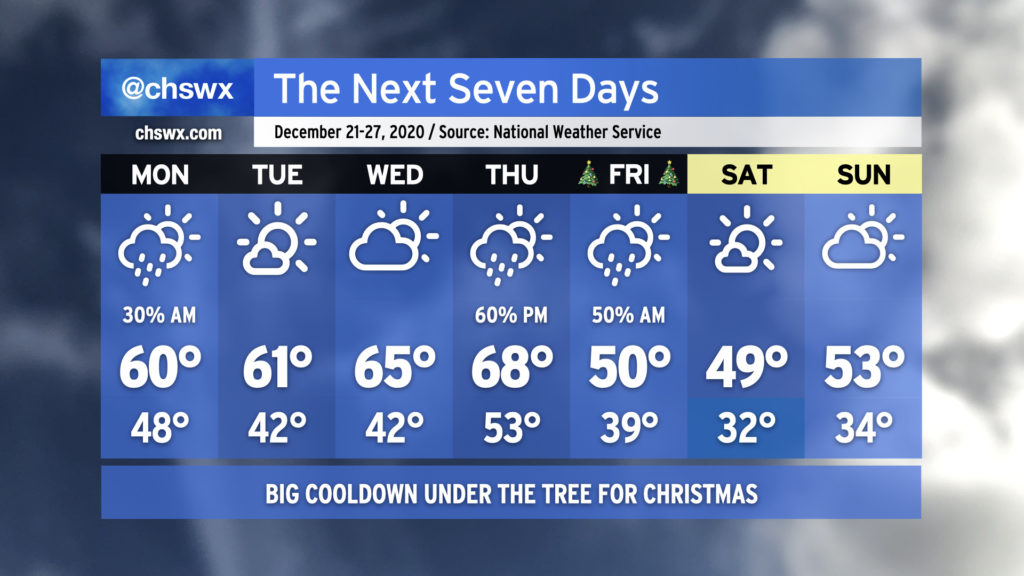
The week ahead: A little warm before a lump of cold under the tree

We’ll start the last few days before Christmas a little warmer than we have been of late, but Santa has cold high pressure for us for Christmas and beyond as we get into the holiday weekend.
Rain clears out Monday, setting up a warm few days
As low pressure develops and skirts the coast, we’ll gradually see rainfall subside throughout the day, followed by cloud cover eventually breaking up during the day Monday. Temperatures will rebound a bit to around 60°, which is as warm as we’ve been in the past five days — a very 2020 way to welcome the winter solstice. We’ll stay warm with a good bit of sun as we get through Tuesday and Wednesday, with temperatures gradually warming into the mid-60s.
Next front arrives for Christmas
The warmest day of the set will be Thursday (Christmas Eve — no, I can’t believe it either), with upper 60s in the forecast as a cold front approaches the area. Shower chances will head up as the day goes on, with the best chances in the evening and early overnight hours. It may make for some tricky sleigh aviation at times, but nothing too hazardous! Once the front is through, cooler and drier air will be rushing in for Christmas as high pressure builds in from the west. The strong cold advection regime will keep temperatures limited to 50° or so in the afternoon despite decreasing cloud cover.
We stay cold into next weekend, with partly cloudy skies expected Saturday and Sunday and high temperatures in the upper 40s to low 50s. We should see a freeze overnight Friday into Saturday as well. We’ll see if any precipitation comes into the picture on Sunday as another storm system is modeled to approach the area; timing, position, and intensity of that storm system are all very much details that the models are in disagreement on. Will keep an eye on it.
Follow my Charleston Weather updates on Mastodon, Bluesky, Instagram, Facebook, or directly in a feed reader. Do you like what you see here? Please consider supporting my independent, hype-averse weather journalism and become a supporter on Patreon for a broader look at all things #chswx!