Great-looking Tuesday ahead
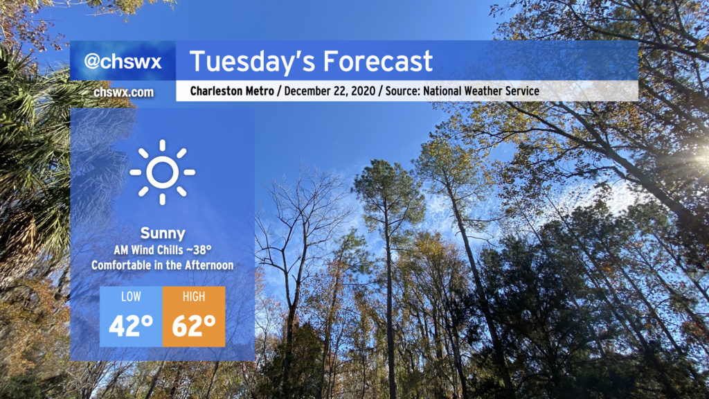
We have a rather gorgeous Tuesday ahead as high pressure moves along to our northeast. Downslope flow will continue, allowing temperatures to warm back into the low 60s for the afternoon after starting out in the low 40s under full sunshine.
Latest on the Christmastime forecast
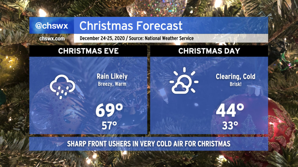
We in #chswx continue to watch model trends for our Christmas Eve cold front, which is going to bring in quite a cold airmass in its wake for Christmas Day.
Christmas Eve looks rainy and warm ahead of the front. The main band of rain should swing through in the afternoon to evening hours, with a half-inch to around an inch of rain a decent bet for many of us. Temperatures should head into the upper 60s to around 70° in many spots as warm air advection from the southwest overspreads the area ahead of the front.
Based on current guidance trends, precipitation should come to an end around midnight, with rapid clearing to follow as the cold rushes in. We’ll wake up to temperatures in the mid-30s in the Charleston metro area proper, with freezing temperatures likely inland. Winds will make it feel even colder, with wind chills in the mid-20s a decent bet as we wake up Christmas morning. Cold advection will stay firmly in place during the day, limiting highs to the mid-40s — very wintry for sure, and well below normal for Christmas in Charleston. (The average high on Christmas Day at the airport is 60°.) The chill lingers into the weekend, with temperatures moderating into the 50s on Sunday.
Follow my Charleston Weather updates on Mastodon, Bluesky, Instagram, Facebook, or directly in a feed reader. Do you like what you see here? Please consider supporting my independent, hype-averse weather journalism and become a supporter on Patreon for a broader look at all things #chswx!